 |
|
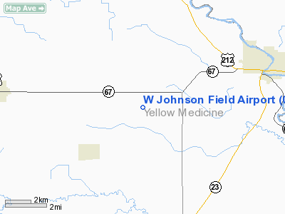
Location & QuickFacts
| FAA Information Effective: | 2008-09-25 |
| Airport Identifier: | 09MN |
| Airport Status: | Operational |
| Longitude/Latitude: | 095-39-49.0820W/44-46-47.8460N
-95.663634/44.779957 (Estimated) |
| Elevation: | 1060 ft / 323.09 m (Estimated) |
| Land: | 0 acres |
| From nearest city: | 3 nautical miles SW of Hazel Run, MN |
| Location: | Yellow Medicine County, MN |
| Magnetic Variation: | 05E (1985) |
Owner & Manager
| Ownership: | Privately owned |
| Owner: | Willis L Johnson |
| Address: | R R 1
Hazel Run, MN 56247 |
| Manager: | Willis L Johnson |
| Address: | R R 1
Hazel Run, MN 56247 |
| Phone number: | 612-564-3203 |
Airport Operations and Facilities
| Airport Use: | Private |
| Wind indicator: | Yes |
| Segmented Circle: | No |
| Control Tower: | No |
| Sectional chart: | Twin Cities |
| Region: | AGL - Great Lakes |
| Boundary ARTCC: | ZMP - Minneapolis |
| Tie-in FSS: | PNM - Princeton |
| FSS on Airport: | No |
| FSS Toll Free: | 1-800-WX-BRIEF |
Runway Information
Runway N/S
| Dimension: | 2680 x 100 ft / 816.9 x 30.5 m |
| Surface: | TURF, |
| |
Runway N |
Runway S |
| Traffic Pattern: | Left | Left |
|
Radio Navigation Aids
| ID |
Type |
Name |
Ch |
Freq |
Var |
Dist |
| DXX | NDB | Dawson/madison | | 341.00 | 06E | 25.2 nm |
| AQP | NDB | Appleton | | 356.00 | 05E | 30.7 nm |
| BBB | NDB | Benson | | 239.00 | 05E | 32.9 nm |
| VVV | NDB | Ortonville | | 332.00 | 05E | 44.9 nm |
| MVE | VOR/DME | Montevideo | 053X | 111.60 | 05E | 11.8 nm |
| MML | VOR/DME | Marshall | 047X | 111.00 | 05E | 21.1 nm |
| RWF | VOR/DME | Redwood Falls | 080X | 113.30 | 07E | 29.6 nm |
| BDH | VOR/DME | Willmar | 84X | 113.70 | 04E | 30.5 nm |
| ILL | VOR/DME | Willmar | 084X | 113.70 | 04E | 31.7 nm |
| MOX | VOR/DME | Morris | 033X | 109.60 | 05E | 49.0 nm |
Remarks
- FOR RECORD PURPOSES ONLY.
Images and information placed above are from
http://www.airport-data.com/airport/09MN/
We thank them for the data!
| General Info
|
| Country |
United States
|
| State |
MINNESOTA
|
| FAA ID |
09MN
|
| Latitude |
44-46-47.846N
|
| Longitude |
095-39-49.082W
|
| Elevation |
1060 feet
|
| Near City |
HAZEL RUN
|
We don't guarantee the information is fresh and accurate. The data may
be wrong or outdated.
For more up-to-date information please refer to other sources.
|
|


