 |
|
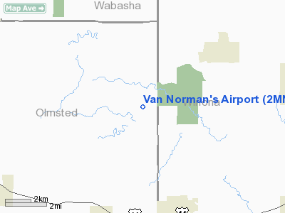
Location & QuickFacts
| FAA Information Effective: | 2008-09-25 |
| Airport Identifier: | 2MN6 |
| Airport Status: | Operational |
| Longitude/Latitude: | 092-05-34.5840W/44-02-49.8690N
-92.092940/44.047186 (Estimated) |
| Elevation: | 1100 ft / 335.28 m (Estimated) |
| Land: | 0 acres |
| From nearest city: | 4 nautical miles N of St Charles, MN |
| Location: | Olmsted County, MN |
| Magnetic Variation: | 02E (1985) |
Owner & Manager
| Ownership: | Privately owned |
| Owner: | Willis R. Van Norman |
| Address: | 19230 26th St Ne
St Charles, MN 55972 |
| Phone number: | 507-932-3513 |
| Manager: | Willis R. Van Norman |
| Address: | 19230 26th St Ne
St Charles, MN 55972 |
| Phone number: | 507-932-3513 |
Airport Operations and Facilities
| Airport Use: | Private
PERSONAL USE. |
| Wind indicator: | Yes |
| Segmented Circle: | No |
| Control Tower: | No |
| Landing fee charge: | No |
| Sectional chart: | Green Bay |
| Region: | AGL - Great Lakes |
| Boundary ARTCC: | ZMP - Minneapolis |
| Tie-in FSS: | PNM - Princeton |
| FSS on Airport: | No |
| FSS Toll Free: | 1-800-WX-BRIEF |
Runway Information
Runway 17/35
| Dimension: | 1600 x 80 ft / 487.7 x 24.4 m |
| Surface: | TURF, |
| |
Runway 17 |
Runway 35 |
| Traffic Pattern: | Left | Left |
| Obstruction: | 5 ft fence, 100.0 ft from runway | 10 ft trees, 600.0 ft from runway |
|
Radio Navigation Aids
| ID |
Type |
Name |
Ch |
Freq |
Var |
Dist |
| CHU | NDB | Caledonia | | 209.00 | 03E | 38.1 nm |
| CJJ | NDB | Cresco | | 293.00 | 02E | 41.0 nm |
| DEH | NDB | Decorah | | 236.00 | 01E | 48.9 nm |
| ONA | VOR/DME | Winona | 051X | 111.40 | 01E | 16.8 nm |
| RST | VOR/DME | Rochester | 057X | 112.00 | 05E | 27.0 nm |
| LSE | VOR/DME | La Crosse | 021X | 108.40 | 02E | 37.6 nm |
| JAY | VOR/DME | Austin | 019X | 108.20 | 03E | 45.7 nm |
| ODI | VORTAC | Nodine | 126X | 117.90 | 01E | 28.2 nm |
Remarks
- 30' ANTENNA ON HOUSE 300' FROM THR ON APCH TO RWY 35.
Images and information placed above are from
http://www.airport-data.com/airport/2MN6/
We thank them for the data!
| General Info
|
| Country |
United States
|
| State |
MINNESOTA
|
| FAA ID |
2MN6
|
| Latitude |
44-02-49.869N
|
| Longitude |
092-05-34.584W
|
| Elevation |
1100 feet
|
| Near City |
ST CHARLES
|
We don't guarantee the information is fresh and accurate. The data may
be wrong or outdated.
For more up-to-date information please refer to other sources.
|
|


