 |
|
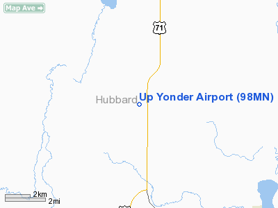
Location & QuickFacts
| FAA Information Effective: | 2008-09-25 |
| Airport Identifier: | 98MN |
| Airport Status: | Operational |
| Longitude/Latitude: | 094-53-05.0300W/47-17-47.1200N
-94.884731/47.296422 (Estimated) |
| Elevation: | 1446 ft / 440.74 m (Estimated) |
| Land: | 50 acres |
| From nearest city: | 12 nautical miles S of Bemidji, MN |
| Location: | Hubbard County, MN |
| Magnetic Variation: | () |
Owner & Manager
| Ownership: | Privately owned |
| Owner: | Gary Shadrick |
| Address: | 12794 Oak Point Rd Nw
Cass Lake, MN 56633 |
| Phone number: | 218-335-8435 |
| Manager: | Gary Shadrick |
| Address: | 12794 Oak Point Rd Nw
Cass Lake, MN 56633 |
| Phone number: | 218-335-8435 |
Airport Operations and Facilities
| Airport Use: | Private |
| Wind indicator: | Yes |
| Control Tower: | No |
| Sectional chart: | Twin Cities |
| Region: | AGL - Great Lakes |
| Boundary ARTCC: | ZMP - Minneapolis |
| Tie-in FSS: | PNM - Princeton |
| FSS Toll Free: | 1-800-WX-BRIEF |
Runway Information
Runway 18/36
| Dimension: | 1400 x 100 ft / 426.7 x 30.5 m |
| Surface: | TURF, |
| |
Runway 18 |
Runway 36 |
| Traffic Pattern: | Left | Left |
|
Radio Navigation Aids
| ID |
Type |
Name |
Ch |
Freq |
Var |
Dist |
| PK | NDB | Spida | | 269.00 | 04E | 28.0 nm |
| XVG | NDB | Longville | | 392.00 | 04E | 33.1 nm |
| PWC | NDB | Pine River | | 330.00 | 03E | 39.9 nm |
| FSE | NDB | Fosston | | 224.00 | 05E | 40.1 nm |
| PKD | VOR/DME | Park Rapids | 043X | 110.60 | 04E | 25.1 nm |
| DTL | VOR/DME | Detroit Lakes | 049X | 111.20 | 05E | 49.9 nm |
| BJI | VORTAC | Bemidji | 023X | 108.60 | 04E | 17.7 nm |
Remarks
- PRVDD CLEAR 20:1 APCHS, CLEAR OBSTACLE FREE ZONE, AND CLEAR RY SAFETY AREA.
Images and information placed above are from
http://www.airport-data.com/airport/98MN/
We thank them for the data!
We don't guarantee the information is fresh and accurate. The data may
be wrong or outdated.
For more up-to-date information please refer to other sources.
|
|


