 |
|
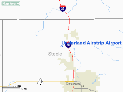
Underland Airstrip Airport |
Location & QuickFacts
| FAA Information Effective: | 2008-09-25 |
| Airport Identifier: | 6MN8 |
| Airport Status: | Operational |
| Longitude/Latitude: | 093-16-20.7680W/44-09-09.8670N
-93.272436/44.152741 (Estimated) |
| Elevation: | 1145 ft / 349.00 m (Estimated) |
| Land: | 0 acres |
| From nearest city: | 2 nautical miles SW of Medford, MN |
| Location: | Steele County, MN |
| Magnetic Variation: | 03E (1985) |
Owner & Manager
| Ownership: | Privately owned |
| Owner: | Gary Underland |
| Address: | 3796 Nw 50th St.
Medford, MN 55049 |
| Phone number: | 507-451-4653 |
| Manager: | Gary Underland |
| Address: | 3796 Nw 50th St.
Medford, MN 55049 |
| Phone number: | 507-451-4653 |
Airport Operations and Facilities
| Airport Use: | Private
PERSONAL USE. |
| Wind indicator: | Yes |
| Segmented Circle: | No |
| Control Tower: | No |
| Landing fee charge: | No |
| Sectional chart: | Omaha |
| Region: | AGL - Great Lakes |
| Boundary ARTCC: | ZMP - Minneapolis |
| Tie-in FSS: | PNM - Princeton |
| FSS on Airport: | No |
| FSS Toll Free: | 1-800-WX-BRIEF |
Runway Information
Runway N/S
| Dimension: | 2600 x 150 ft / 792.5 x 45.7 m |
| Surface: | TURF, |
| |
Runway N |
Runway S |
| Traffic Pattern: | Left | Left |
| Obstruction: | 25 ft pline, 50.0 ft from runway | |
|
Radio Navigation Aids
| ID |
Type |
Name |
Ch |
Freq |
Var |
Dist |
| ACQ | NDB | Waseca | | 371.00 | 02E | 13.1 nm |
| MS | NDB | Narco | | 266.00 | 02E | 41.2 nm |
| PPI | NDB | Hopey | | 400.00 | 03E | 45.6 nm |
| SBU | NDB | Blue Earth | | 332.00 | 04E | 48.9 nm |
| FOW | VOR/DME | Halfway | 049X | 111.20 | 02E | 5.2 nm |
| MKT | VOR/DME | Mankato | 045X | 110.80 | 07E | 27.9 nm |
| AEL | VOR/DME | Albert Lea | 035X | 109.80 | 05E | 28.6 nm |
| RST | VOR/DME | Rochester | 057X | 112.00 | 05E | 36.7 nm |
| JAY | VOR/DME | Austin | 019X | 108.20 | 03E | 37.9 nm |
| FCM | VOR/DME | Flying Cloud | 055X | 111.80 | 06E | 41.2 nm |
| MSP | VOR/DME | Minneapolis | 100X | 115.30 | 02E | 44.7 nm |
| FGT | VORTAC | Farmington | 104X | 115.70 | 06E | 29.0 nm |
| MSP | VOT | Minneapolis St Paul | | 111.00 | | 44.0 nm |
| STP | VOT | St Paul | | 114.40 | | 48.2 nm |
Remarks
- OPERATION OF THIS APT WILL ADVERSELY AFFECT THE SAFE & EFFICIENT USE OF AIRSPACE BY ACFT.
Images and information placed above are from
http://www.airport-data.com/airport/6MN8/
We thank them for the data!
| General Info
|
| Country |
United States
|
| State |
MINNESOTA
|
| FAA ID |
6MN8
|
| Latitude |
44-09-09.867N
|
| Longitude |
093-16-20.768W
|
| Elevation |
1145 feet
|
| Near City |
MEDFORD
|
We don't guarantee the information is fresh and accurate. The data may
be wrong or outdated.
For more up-to-date information please refer to other sources.
|
|


