 |
|
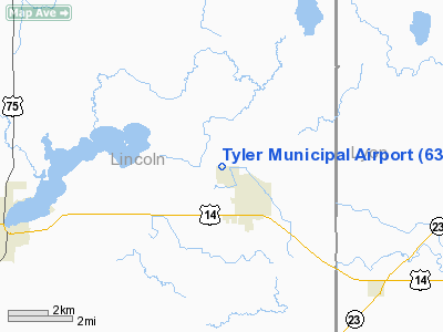
Location & QuickFacts
| FAA Information Effective: | 2008-09-25 |
| Airport Identifier: | 63Y |
| Airport Status: | Operational |
| Longitude/Latitude: | 096-09-01.1210W/44-17-29.8780N
-96.150311/44.291633 (Estimated) |
| Elevation: | 1742 ft / 530.96 m (Estimated) |
| Land: | 134 acres |
| From nearest city: | 1 nautical miles NW of Tyler, MN |
| Location: | Lincoln County, MN |
| Magnetic Variation: | 06E (1985) |
Owner & Manager
| Ownership: | Publicly owned |
| Owner: | City Of Tyler |
| Address: | 230 N Tyler St
Tyler, MN 56178 |
| Phone number: | 507-247-5556 |
| Manager: | Kristi Luger |
| Address: | 230 N Tyler St.
Tyler, MN 56178 |
| Phone number: | 507-247-5556 |
Airport Operations and Facilities
| Airport Use: | Open to public |
| Wind indicator: | Yes |
| Segmented Circle: | No |
| Control Tower: | No |
| Lighting Schedule: | DUSK-DAWN |
| Beacon Color: | Clear-Green (lighted land airport) |
| Landing fee charge: | No |
| Sectional chart: | Omaha |
| Region: | AGL - Great Lakes |
| Boundary ARTCC: | ZMP - Minneapolis |
| Tie-in FSS: | PNM - Princeton |
| FSS on Airport: | No |
| FSS Toll Free: | 1-800-WX-BRIEF |
| NOTAMs Facility: | PNM (NOTAM-d service avaliable) |
Airport Communications
Airport Services
| Airframe Repair: | NONE |
| Power Plant Repair: | NONE |
| Bottled Oxygen: | NONE |
| Bulk Oxygen: | NONE |
Runway Information
Runway 14/32
| Dimension: | 2600 x 160 ft / 792.5 x 48.8 m |
| Surface: | TURF, Good Condition |
| Edge Lights: | Low |
| |
Runway 14 |
Runway 32 |
| Longitude: | 096-09-13.2600W | 096-08-55.9800W |
| Latitude: | 44-17-29.0500N | 44-17-07.7000N |
| Elevation: | 1742.00 ft | 1742.00 ft |
| Traffic Pattern: | Left | Left |
| Markings: | None,
RY 14/32 MKD WITH YELLOW CONES. | None, |
| Runway End Identifier: | No | No |
| Centerline Lights: | No | No |
| Touchdown Lights: | No | No |
| Obstruction: | , 50:1 slope to clear | 18 ft road, 471.0 ft from runway, 120 ft left of centerline, 26:1 slope to clear |
|
Radio Navigation Aids
| ID |
Type |
Name |
Ch |
Freq |
Var |
Dist |
| DXX | NDB | Dawson/madison | | 341.00 | 06E | 41.6 nm |
| MDS | NDB | Wentworth | | 400.00 | 05E | 43.8 nm |
| PQN | NDB/DME | Pipestone | 028X | 284.00 | 06E | 19.4 nm |
| MML | VOR/DME | Marshall | 047X | 111.00 | 05E | 16.9 nm |
| BKX | VOR/DME | Brookings | 025X | 108.80 | 06E | 28.6 nm |
| MVE | VOR/DME | Montevideo | 053X | 111.60 | 05E | 45.0 nm |
| RWF | VOR/DME | Redwood Falls | 080X | 113.30 | 07E | 45.2 nm |
| OTG | VOR/DME | Worthington | 043X | 110.60 | 08E | 45.9 nm |
| FSD | VORTAC | Sioux Falls | 097X | 115.00 | 09E | 47.3 nm |
Remarks
- CFM SNOW REMOVAL & WINTER CONDS WITH AMGR FM 0800-1700 CALL 504-247-5556.
- CONSTR PRIOR TO 1959
Images and information placed above are from
http://www.airport-data.com/airport/63Y/
We thank them for the data!
| General Info
|
| Country |
United States
|
| State |
MINNESOTA
|
| FAA ID |
63Y
|
| Latitude |
44-17-29.878N
|
| Longitude |
096-09-01.121W
|
| Elevation |
1742 feet
|
| Near City |
TYLER
|
We don't guarantee the information is fresh and accurate. The data may
be wrong or outdated.
For more up-to-date information please refer to other sources.
|
|


