 |
|
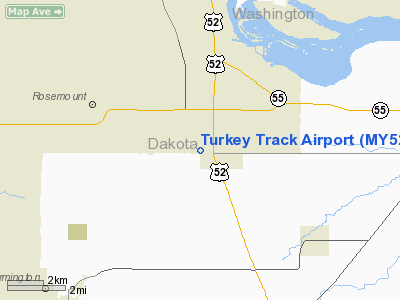
Location & QuickFacts
| FAA Information Effective: | 2008-09-25 |
| Airport Identifier: | MY52 |
| Airport Status: | Operational |
| Longitude/Latitude: | 093-02-38.7680W/44-43-06.8790N
-93.044102/44.718577 (Estimated) |
| Elevation: | 923 ft / 281.33 m (Estimated) |
| Land: | 0 acres |
| From nearest city: | 1 nautical miles W of Coates, MN |
| Location: | Dakota County, MN |
| Magnetic Variation: | 03E (1985) |
Owner & Manager
| Ownership: | Privately owned |
| Owner: | Arlaine Franzmeier |
| Address: | 3033 160th St East
Rosemount, MN 55068 |
| Phone number: | 612-423-2377 |
| Manager: | Craig Franzmeier |
| Address: | 7729- 165th Street East
Hastings, MN 55033 |
| Phone number: | 651-437-1075 |
Airport Operations and Facilities
| Airport Use: | Private
PERSONAL USE. |
| Segmented Circle: | No |
| Control Tower: | No |
| Sectional chart: | Twin Cities |
| Region: | AGL - Great Lakes |
| Boundary ARTCC: | ZMP - Minneapolis |
| Tie-in FSS: | PNM - Princeton |
| FSS Toll Free: | 1-800-WX-BRIEF |
Runway Information
Runway 18/36
| Dimension: | 2000 x 150 ft / 609.6 x 45.7 m |
| Surface: | TURF, |
| |
Runway 18 |
Runway 36 |
| Traffic Pattern: | Left | Left |
|
Radio Navigation Aids
| ID |
Type |
Name |
Ch |
Freq |
Var |
Dist |
| MS | NDB | Narco | | 266.00 | 02E | 6.7 nm |
| PPI | NDB | Hopey | | 400.00 | 03E | 10.3 nm |
| RNH | NDB | New Richmond | | 257.00 | 02E | 33.7 nm |
| OEO | NDB | Osceola | | 233.00 | 01E | 38.7 nm |
| AHH | NDB | Ameron | | 278.00 | 01E | 44.3 nm |
| GYL | NDB | Glencoe | | 407.00 | 03E | 44.5 nm |
| ACQ | NDB | Waseca | | 371.00 | 02E | 44.7 nm |
| MSP | VOR/DME | Minneapolis | 100X | 115.30 | 02E | 13.5 nm |
| FCM | VOR/DME | Flying Cloud | 055X | 111.80 | 06E | 18.7 nm |
| FOW | VOR/DME | Halfway | 049X | 111.20 | 02E | 33.9 nm |
| MKT | VOR/DME | Mankato | 045X | 110.80 | 07E | 47.8 nm |
| FGT | VORTAC | Farmington | 104X | 115.70 | 06E | 7.9 nm |
| GEP | VORTAC | Gopher | 120X | 117.30 | 06E | 29.2 nm |
| MSP | VOT | Minneapolis St Paul | | 111.00 | | 12.3 nm |
| STP | VOT | St Paul | | 114.40 | | 13.4 nm |
Images and information placed above are from
http://www.airport-data.com/airport/MY52/
We thank them for the data!
| General Info
|
| Country |
United States
|
| State |
MINNESOTA
|
| FAA ID |
MY52
|
| Latitude |
44-43-06.879N
|
| Longitude |
093-02-38.768W
|
| Elevation |
923 feet
|
| Near City |
COATES
|
We don't guarantee the information is fresh and accurate. The data may
be wrong or outdated.
For more up-to-date information please refer to other sources.
|
|


