 |
|
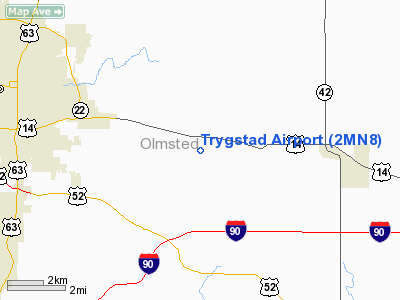
Location & QuickFacts
| FAA Information Effective: | 2008-09-25 |
| Airport Identifier: | 2MN8 |
| Airport Status: | Operational |
| Longitude/Latitude: | 092-20-08.6110W/43-59-45.8700N
-92.335725/43.996075 (Estimated) |
| Elevation: | 1227 ft / 373.99 m (Surveyed) |
| Land: | 20 acres |
| From nearest city: | 6 nautical miles W of Rochester, MN |
| Location: | Olmsted County, MN |
| Magnetic Variation: | 02E (1985) |
Owner & Manager
| Ownership: | Privately owned |
| Owner: | David J. Trygstad |
| Address: | 1772 Chester Road Se
Rochester, MN 55904 |
| Phone number: | 507-281-3545 |
| Manager: | David J. Trygstad |
| Address: | 1772 Chester Road Se
Rochester, MN 55904 |
| Phone number: | 507-281-3545 |
Airport Operations and Facilities
| Airport Use: | Private |
| Wind indicator: | Yes |
| Segmented Circle: | No |
| Control Tower: | No |
| Landing fee charge: | No |
| Sectional chart: | Chicago |
| Region: | AGL - Great Lakes |
| Boundary ARTCC: | ZMP - Minneapolis |
| Tie-in FSS: | PNM - Princeton |
| FSS on Airport: | No |
| FSS Toll Free: | 1-800-WX-BRIEF |
Airport Services
| Bottled Oxygen: | NONE |
| Bulk Oxygen: | NONE |
Runway Information
Runway 09/27
| Dimension: | 2500 x 40 ft / 762.0 x 12.2 m |
| Surface: | ASPH-TURF, |
| |
Runway 09 |
Runway 27 |
| Traffic Pattern: | Left | Left |
| Markings: | Numbers only, Good Condition | Numbers only, Good Condition |
| Displaced threshold: | 370.00 ft | 0.00 ft |
| Runway End Identifier: | Yes
REIL ON RWY & REIL RWY 27 NSTD. | Yes |
| Centerline Lights: | No | No |
| Touchdown Lights: | No | No |
|
Radio Navigation Aids
| ID |
Type |
Name |
Ch |
Freq |
Var |
Dist |
| CJJ | NDB | Cresco | | 293.00 | 02E | 38.9 nm |
| CHU | NDB | Caledonia | | 209.00 | 03E | 44.2 nm |
| RST | VOR/DME | Rochester | 057X | 112.00 | 05E | 17.1 nm |
| ONA | VOR/DME | Winona | 051X | 111.40 | 01E | 27.6 nm |
| JAY | VOR/DME | Austin | 019X | 108.20 | 03E | 35.8 nm |
| FOW | VOR/DME | Halfway | 049X | 111.20 | 02E | 46.4 nm |
| LSE | VOR/DME | La Crosse | 021X | 108.40 | 02E | 47.3 nm |
| AEL | VOR/DME | Albert Lea | 035X | 109.80 | 05E | 48.7 nm |
| ODI | VORTAC | Nodine | 126X | 117.90 | 01E | 37.9 nm |
Images and information placed above are from
http://www.airport-data.com/airport/2MN8/
We thank them for the data!
| General Info
|
| Country |
United States
|
| State |
MINNESOTA
|
| FAA ID |
2MN8
|
| Latitude |
43-59-45.870N
|
| Longitude |
092-20-08.611W
|
| Elevation |
1227 feet
|
| Near City |
ROCHESTER
|
We don't guarantee the information is fresh and accurate. The data may
be wrong or outdated.
For more up-to-date information please refer to other sources.
|
|


