 |
|
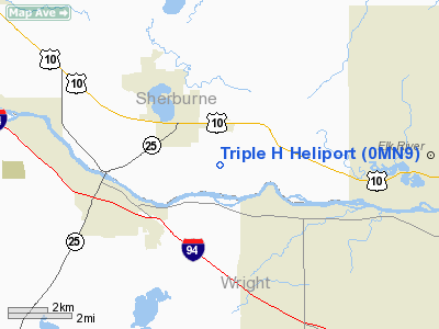
Location & QuickFacts
| FAA Information Effective: | 2008-09-25 |
| Airport Identifier: | 0MN9 |
| Airport Status: | Operational |
| Longitude/Latitude: | 093-43-03.3830W/45-18-47.7230N
-93.717606/45.313256 (Estimated) |
| Elevation: | 980 ft / 298.70 m (Estimated) |
| Land: | 0 acres |
| From nearest city: | 3 nautical miles SE of Big Lake, MN |
| Location: | Sherburne County, MN |
| Magnetic Variation: | 03E (1995) |
Owner & Manager
| Ownership: | Privately owned |
| Owner: | George Hook |
| Address: | 17674 County Rd 14
Big Lake, MN 55309 |
| Phone number: | 612-263-6161 |
| Manager: | Triple H Aviation Inc |
| Address: | 17674 County Rd 14
Big Lake, MN 55309 |
| Phone number: | 612-263-6161 |
Airport Operations and Facilities
| Airport Use: | Private |
| Wind indicator: | Yes |
| Segmented Circle: | No |
| Control Tower: | No |
| Lighting Schedule: | PHONE REQ
FOR FLOOD LGTS CALL 612-263-6161. |
| Sectional chart: | Twin Cities |
| Region: | AGL - Great Lakes |
| Boundary ARTCC: | ZMP - Minneapolis |
| Tie-in FSS: | PNM - Princeton |
| FSS Toll Free: | 1-800-WX-BRIEF |
Runway Information
Helipad H1
| Dimension: | 50 x 50 ft / 15.2 x 15.2 m |
| Surface: | CONC, |
| |
Runway H1 |
Runway |
| Traffic Pattern: | Left | Left |
|
Radio Navigation Aids
| ID |
Type |
Name |
Ch |
Freq |
Var |
Dist |
| PNM | NDB | Princeton | | 368.00 | 03E | 15.8 nm |
| CBG | NDB | Cambridge | | 350.00 | 03E | 24.2 nm |
| GYL | NDB | Glencoe | | 407.00 | 03E | 36.7 nm |
| HCD | NDB | Hutchinson | | 209.00 | 04E | 39.4 nm |
| JMR | NDB | Mora | | 327.00 | 03E | 39.5 nm |
| ROS | NDB | Rush City | | 282.00 | 02E | 39.5 nm |
| MS | NDB | Narco | | 266.00 | 02E | 39.6 nm |
| PPI | NDB | Hopey | | 400.00 | 03E | 42.2 nm |
| OEO | NDB | Osceola | | 233.00 | 01E | 43.5 nm |
| LXL | NDB | Little Falls | | 359.00 | 03E | 46.4 nm |
| STC | VOR/DME | St Cloud | 058X | 112.10 | 03E | 20.2 nm |
| FCM | VOR/DME | Flying Cloud | 055X | 111.80 | 06E | 31.3 nm |
| MSP | VOR/DME | Minneapolis | 100X | 115.30 | 02E | 32.3 nm |
| GEP | VORTAC | Gopher | 120X | 117.30 | 06E | 17.7 nm |
| DWN | VORTAC | Darwin | 027X | 109.00 | 07E | 34.0 nm |
| FGT | VORTAC | Farmington | 104X | 115.70 | 06E | 46.9 nm |
| MSP | VOT | Minneapolis St Paul | | 111.00 | | 33.5 nm |
| STP | VOT | St Paul | | 114.40 | | 35.8 nm |
Remarks
- PRVDD ALL APCH/DEP FROM 324-328, AREA IS MARKED, WIND INDICATOR IS MAINTAINED & COMPLY WITH FAR PART 91.126(B)(2)>
Images and information placed above are from
http://www.airport-data.com/airport/0MN9/
We thank them for the data!
| General Info
|
| Country |
United States
|
| State |
MINNESOTA
|
| FAA ID |
0MN9
|
| Latitude |
45-18-47.723N
|
| Longitude |
093-43-03.383W
|
| Elevation |
980 feet
|
| Near City |
BIG LAKE
|
We don't guarantee the information is fresh and accurate. The data may
be wrong or outdated.
For more up-to-date information please refer to other sources.
|
|


