 |
|
Location & QuickFacts
| FAA Information Effective: | 2008-09-25 |
| Airport Identifier: | MN26 |
| Airport Status: | Operational |
| Longitude/Latitude: | 095-07-59.0980W/46-26-47.8610N
-95.133083/46.446628 (Estimated) |
| Elevation: | 1350 ft / 411.48 m (Estimated) |
| Land: | 0 acres |
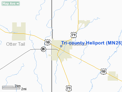
| From nearest city: | 2 nautical miles E of Wadena, MN |
| Location: | Wadena County, MN |
| Magnetic Variation: | 05E (1985) |
Owner & Manager
| Ownership: | Privately owned |
| Owner: | Tri-county Hospital |
| Address: | 415 N. Jefferson
Wadena, MN 56482 |
| Phone number: | 218-631-3510 |
| Manager: | Dennis Miley, Administrator
LEO 218-631-3510 |
| Address: | 415n Jefferson
Wadena, MN 56482 |
| Phone number: | 218-631-3510 |
Airport Operations and Facilities
| Airport Use: | Private |
| Wind indicator: | Yes |
| Segmented Circle: | No |
| Control Tower: | No |
| Lighting Schedule: | RDO-CTL
ACTVT PERIMETER LGTS - 123.05 |
| Beacon Color: | Clear-Green-Yellow (heliport) |
| Sectional chart: | Twin Cities |
| Region: | AGL - Great Lakes |
| Boundary ARTCC: | ZMP - Minneapolis |
| Tie-in FSS: | PNM - Princeton |
| FSS Toll Free: | 1-800-WX-BRIEF |
Runway Information
Helipad H1
| Dimension: | 50 x 50 ft / 15.2 x 15.2 m |
| Surface: | CONC, |
| |
Runway H1 |
Runway |
| Traffic Pattern: | Left | Left |
|
Radio Navigation Aids
| ID |
Type |
Name |
Ch |
Freq |
Var |
Dist |
| SAZ | NDB | Staples | | 257.00 | 04E | 14.1 nm |
| PK | NDB | Spida | | 269.00 | 04E | 24.2 nm |
| PWC | NDB | Pine River | | 330.00 | 03E | 35.2 nm |
| XCR | NDB | Ripley | | 404.00 | 03E | 39.6 nm |
| EE | NDB | Tamie | | 374.00 | 04E | 40.0 nm |
| LXL | NDB | Little Falls | | 359.00 | 03E | 44.4 nm |
| GHW | NDB | Glenwood | | 346.00 | 03E | 48.8 nm |
| RYM | TACAN | Camp Ripley | 048X | | 03E | 38.8 nm |
| PKD | VOR/DME | Park Rapids | 043X | 110.60 | 04E | 27.3 nm |
| AXN | VOR/DME | Alexandria | 075X | 112.80 | 07E | 29.6 nm |
| DTL | VOR/DME | Detroit Lakes | 049X | 111.20 | 05E | 38.6 nm |
| FFM | VOR/DME | Fergus Falls | 041X | 110.40 | 05E | 43.5 nm |
| BRD | VORTAC | Brainerd | 116X | 116.90 | 03E | 46.3 nm |
Remarks
- APCH FROM NE, SE, OR NW.
- PROVIDED APCH/DEP OPERATIONS ARE CONDUCTED FROM 55 DEG TO 85 DEG AND FROM 315 DEG TO 330 DEG; AREA IS MARKED; WIND INDICATOR IS MAINTAINED.
Images and information placed above are from
http://www.airport-data.com/airport/MN26/
We thank them for the data!
| General Info
|
| Country |
United States
|
| State |
MINNESOTA
|
| FAA ID |
MN26
|
| Latitude |
46-26-47.861N
|
| Longitude |
095-07-59.098W
|
| Elevation |
1350 feet
|
| Near City |
WADENA
|
We don't guarantee the information is fresh and accurate. The data may
be wrong or outdated.
For more up-to-date information please refer to other sources.
|
|


