 |
|
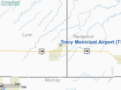
Location & QuickFacts
| FAA Information Effective: | 2008-09-25 |
| Airport Identifier: | TKC |
| Airport Status: | Operational |
| Longitude/Latitude: | 095-36-26.1350W/44-14-56.8110N
-95.607260/44.249114 (Estimated) |
| Elevation: | 1340 ft / 408.43 m (Surveyed) |
| Land: | 440 acres |
| From nearest city: | 1 nautical miles NE of Tracy, MN |
| Location: | Lyon County, MN |
| Magnetic Variation: | 05E (1985) |
Owner & Manager
| Ownership: | Publicly owned |
| Owner: | City Of Tracy |
| Address: | 336 Morgan St
Tracy, MN 56175 |
| Phone number: | 507-629-5528 |
| Manager: | Homer Dobson |
| Address: | 249 5th St., P.o. Box 1218
Tracy, MN 56175 |
| Phone number: | 507-629-3833 |
Airport Operations and Facilities
| Airport Use: | Open to public |
| Wind indicator: | Yes |
| Segmented Circle: | No |
| Control Tower: | No |
| Lighting Schedule: | DUSK-DAWN |
| Beacon Color: | Clear-Green (lighted land airport) |
| Landing fee charge: | No |
| Sectional chart: | Omaha |
| Region: | AGL - Great Lakes |
| Boundary ARTCC: | ZMP - Minneapolis |
| Tie-in FSS: | PNM - Princeton |
| FSS on Airport: | No |
| FSS Toll Free: | 1-800-WX-BRIEF |
| NOTAMs Facility: | TKC (NOTAM-d service avaliable) |
| Federal Agreements: | N1 |
Airport Communications
Airport Services
| Fuel available: | 100LL
FOR SVC CALL ARPT MGR 507-629-3833/829-9310. |
| Airframe Repair: | NONE |
| Power Plant Repair: | NONE |
| Bottled Oxygen: | NONE |
| Bulk Oxygen: | NONE |
Runway Information
Runway 06/24
| Dimension: | 2590 x 200 ft / 789.4 x 61.0 m |
| Surface: | TURF, Good Condition |
| |
Runway 06 |
Runway 24 |
| Longitude: | 095-36-41.0000W | 095-36-14.0340W |
| Latitude: | 44-14-52.0000N | 44-15-07.5460N |
| Elevation: | 1340.00 ft | 1330.00 ft |
| Alignment: | 52 | 127 |
| Traffic Pattern: | Left | Left |
| Obstruction: | 20 ft road, 400.0 ft from runway, 100 ft left of centerline, 20:1 slope to clear | 4 ft fence, 105.0 ft from runway, 26:1 slope to clear |
|
Runway 11/29
| Dimension: | 3100 x 75 ft / 944.9 x 22.9 m |
| Surface: | ASPH, Good Condition |
| Edge Lights: | Medium |
| |
Runway 11 |
Runway 29 |
| Longitude: | 095-36-40.8000W | 095-36-03.4000W |
| Latitude: | 44-15-02.9900N | 44-14-48.3000N |
| Elevation: | 1331.00 ft | 1336.00 ft |
| Alignment: | 118 | 127 |
| Traffic Pattern: | Left | Left |
| Markings: | Non-precision instrument, Good Condition | Non-precision instrument, Good Condition |
| Obstruction: | 21 ft road, 580.0 ft from runway, 288 ft right of centerline, 18:1 slope to clear | , 50:1 slope to clear
RWY 29+5 FT FENCE 0-50 FT FM RY END. |
|
Runway 17/35
| Dimension: | 1825 x 200 ft / 556.3 x 61.0 m |
| Surface: | TURF, Good Condition |
| |
Runway 17 |
Runway 35 |
| Longitude: | 095-36-30.0000W | 095-36-30.0000W |
| Latitude: | 44-15-04.0000N | 44-14-45.2000N |
| Elevation: | 1326.00 ft | 1336.00 ft |
| Alignment: | 127 | 0 |
| Traffic Pattern: | Left | Left |
| Obstruction: | 16 ft road, 350.0 ft from runway, 21:1 slope to clear | 23 ft trees, 477.0 ft from runway, 80 ft left of centerline, 20:1 slope to clear |
|
Radio Navigation Aids
| ID |
Type |
Name |
Ch |
Freq |
Var |
Dist |
| MWM | NDB | Windom | | 203.00 | 03E | 29.7 nm |
| MJQ | NDB | Jackson | | 353.00 | 04E | 45.1 nm |
| JYG | NDB | St James | | 260.00 | 04E | 48.2 nm |
| PQN | NDB/DME | Pipestone | 028X | 284.00 | 06E | 33.7 nm |
| ULM | NDB/DME | New Ulm | 050X | 272.00 | 04E | 47.9 nm |
| MML | VOR/DME | Marshall | 047X | 111.00 | 05E | 15.2 nm |
| RWF | VOR/DME | Redwood Falls | 080X | 113.30 | 07E | 24.4 nm |
| OTG | VOR/DME | Worthington | 043X | 110.60 | 08E | 36.2 nm |
| MVE | VOR/DME | Montevideo | 053X | 111.60 | 05E | 43.7 nm |
Remarks
- DUMP 400' EAST OF RWY 29 25' BELOW RWY SFC.
- RYS 06/24 & 17/35 NOT PLOWED WINTER MONTHS.
Images and information placed above are from
http://www.airport-data.com/airport/TKC/
We thank them for the data!
| General Info
|
| Country |
United States
|
| State |
MINNESOTA
|
| FAA ID |
TKC
|
| Latitude |
44-14-56.811N
|
| Longitude |
095-36-26.135W
|
| Elevation |
1340 feet
|
| Near City |
TRACY
|
We don't guarantee the information is fresh and accurate. The data may
be wrong or outdated.
For more up-to-date information please refer to other sources.
|
|


