 |
|
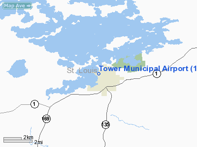
| Tower Municipal Airport |
| IATA: none – ICAO: none – FAA LID: 12D |
| Summary |
| Airport type |
Public |
| Owner |
City of Tower |
| Serves |
Tower, Minnesota |
| Elevation AMSL |
1,369 ft / 417 m |
| Coordinates |
47°49′06″N 092°17′30″W / 47.81833°N 92.29167°W / 47.81833; -92.29167 |
| Runways |
| Direction |
Length |
Surface |
| ft |
m |
| 8/26 |
3,400 |
1,036 |
Asphalt |
| 14W/32W |
5,000 |
1,524 |
Water |
| Statistics (2007) |
| Aircraft operations |
3,700 |
| Based aircraft |
23 |
| Source: Federal Aviation Administration |
Tower Municipal Airport (FAA LID: 12D) is a city-owned, public-use airport located one nautical mile (2 km) northwest of the central business district of Tower, a city in St. Louis County, Minnesota, United States. It is located on Lake Vermilion and is also known as Tower Municipal Airport & Seaplane Base.
Facilities and aircraft
Tower Municipal Airport covers an area of 100 acres (40 ha) at an elevation of 1,369 feet (417 m) above mean sea level. It has one runways designated 8/26 with a 3,400 x 75 ft (1,036 x 23 m) asphalt surface. It also has one seaplane landing area designated 14W/32W which measures 5,000 x 200 ft (1,524 x 61 m).
For the 12-month period ending April 30, 2007, the airport had 3,700 general aviation aircraft operations, an average of 10 per day. At that time there were 23 aircraft based at this airport: 96% single-engine and 4% ultralight.
The above content comes from Wikipedia and is published under free licenses – click here to read more.
Location & QuickFacts
| FAA Information Effective: | 2008-09-25 |
| Airport Identifier: | 12D |
| Airport Status: | Operational |
| Longitude/Latitude: | 092-17-30.0000W/47-49-06.0000N
-92.291667/47.818333 (Estimated) |
| Elevation: | 1369 ft / 417.27 m (Surveyed) |
| Land: | 100 acres |
| From nearest city: | 1 nautical miles NW of Tower, MN |
| Location: | St Louis County, MN |
| Magnetic Variation: | 02E (1985) |
Owner & Manager
| Ownership: | Publicly owned |
| Owner: | City Of Tower |
| Address: | Box 576, 602 Main St.
Tower, MN 55790 |
| Phone number: | 218-753-4070 |
| Manager: | Tim Kotzian |
| Address: | Box 576, 602 Main St.
Tower, MN 55790 |
| Phone number: | 218-753-3231 |
Airport Operations and Facilities
| Airport Use: | Open to public |
| Wind indicator: | Yes |
| Segmented Circle: | No |
| Control Tower: | No |
| Lighting Schedule: | DUSK-DAWN |
| Landing fee charge: | No |
| Sectional chart: | Green Bay |
| Region: | AGL - Great Lakes |
| Boundary ARTCC: | ZMP - Minneapolis |
| Tie-in FSS: | PNM - Princeton |
| FSS on Airport: | No |
| FSS Toll Free: | 1-800-WX-BRIEF |
| NOTAMs Facility: | PNM (NOTAM-d service avaliable) |
| Federal Agreements: | N |
Airport Communications
Airport Services
| Fuel available: | 100LL
SELF SERVICE FUEL AVBL 24 HRS WITH CREDIT CARD. |
Runway Information
Runway 08/26
| Dimension: | 3400 x 75 ft / 1036.3 x 22.9 m |
| Surface: | ASPH, Good Condition |
| Edge Lights: | Medium |
| |
Runway 08 |
Runway 26 |
| Longitude: | 092-17-40.1400W | 092-16-50.5800W |
| Latitude: | 47-49-02.3400N | 47-49-05.7100N |
| Elevation: | 1362.00 ft | 1362.00 ft |
| Traffic Pattern: | Left | Right |
| Markings: | Basic, Good Condition | Basic, Good Condition |
| Obstruction: | 5 ft trees, 201.0 ft from runway, 105 ft left of centerline
RY 08, +5 TREES, 100-200 FT FM END, 105L. | 45 ft trees, 525.0 ft from runway, 140 ft left of centerline, 7:1 slope to clear |
|
Runway 14W/32W
| Dimension: | 5000 x 200 ft / 1524.0 x 61.0 m |
| Surface: | WATER, |
| |
Runway 14W |
Runway 32W |
| Traffic Pattern: | Left | Left |
|
Radio Navigation Aids
| ID |
Type |
Name |
Ch |
Freq |
Var |
Dist |
| CQM | NDB | Cook | | 233.00 | 01E | 16.1 nm |
| ORB | NDB | Orr | | 341.00 | 02E | 25.9 nm |
| SCG | NDB | Scott | | 385.00 | 02E | 27.5 nm |
| BFW | NDB | Silver Bay | | 350.00 | 00E | 49.3 nm |
| ELO | VOR/DME | Ely | 033X | 109.60 | 00E | 18.6 nm |
| EVM | VOR/DME | Eveleth | 019X | 108.20 | 01E | 25.2 nm |
| HIB | VOR/DME | Hibbing | 045X | 110.80 | 02E | 35.3 nm |
Remarks
- +270' HILL 2500' SOUTHEAST OF ARPT.
- ULTRALIGHT TRAFFIC ON & INVOF ARPT.
Images and information placed above are from
http://www.airport-data.com/airport/12D/
We thank them for the data!
| General Info
|
| Country |
United States
|
| State |
MINNESOTA
|
| FAA ID |
12D
|
| Latitude |
47-49-06.000N
|
| Longitude |
092-17-30.000W
|
| Elevation |
1369 feet
|
| Near City |
TOWER
|
We don't guarantee the information is fresh and accurate. The data may
be wrong or outdated.
For more up-to-date information please refer to other sources.
|
|


