 |
|
Long Prairie Municipal Airport
Todd Field |
| IATA: none – ICAO: none – FAA LID: 14Y |
| Summary |
| Airport type |
Public |
| Owner |
Todd County / City of Long Prairie |
| Serves |
Long Prairie, Minnesota |
| Elevation AMSL |
1,333 ft / 406 m |
| Coordinates |
45°53′54″N 094°52′26″W / 45.89833°N 94.87389°W / 45.89833; -94.87389 |
| Runways |
| Direction |
Length |
Surface |
| ft |
m |
| 16/34 |
3,000 |
914 |
Asphalt |
| Statistics (2008) |
| Aircraft operations |
5,730 |
| Based aircraft |
15 |
| Sources: Minnesota DOT, FAA |
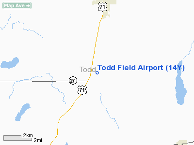
Long Prairie Municipal Airport (FAA LID: 14Y), also known as Todd Field or Todd Field Airport, is a public use airport located four nautical miles (7 km) south of the central business district of Long Prairie, a city in Todd County, Minnesota, United States. The airport is owned by Todd County and the City of Long Prairie.
Facilities and aircraft
Todd Field covers an area of 160 acres (65 ha) at an elevation of 1,333 feet (406 m) above mean sea level. It has one runway designated 16/34 with an asphalt surface measuring 3,000 by 75 feet (914 x 23 m).
For the 12-month period ending July 21, 2008, the airport had 5,730 aircraft operations, an average of 15 per day: 99.8% general aviation and 0.2% military. At that time there were 15 aircraft based at this airport: 93% single-engine and 7% ultralight.
The above content comes from Wikipedia and is published under free licenses – click here to read more.
Location & QuickFacts
| FAA Information Effective: | 2008-09-25 |
| Airport Identifier: | 14Y |
| Airport Status: | Operational |
| Longitude/Latitude: | 094-52-25.9100W/45-53-53.7250N
-94.873864/45.898257 (Estimated) |
| Elevation: | 1333 ft / 406.30 m (Estimated) |
| Land: | 160 acres |
| From nearest city: | 4 nautical miles S of Long Prairie, MN |
| Location: | Todd County, MN |
| Magnetic Variation: | 02E (2010) |
Owner & Manager
| Ownership: | Publicly owned |
| Owner: | Todd Co/city Of Long Prairie |
| Address: | 615 Long St. S
Long Prairie, MN 56347 |
| Phone number: | 612-732-2167 |
| Manager: | Chad Kuehne |
| Address: | 18794 Elm Dr.
Long Prairie, MN 56347 |
| Phone number: | 320-732-2167 |
Airport Operations and Facilities
| Airport Use: | Open to public |
| Wind indicator: | Yes |
| Segmented Circle: | No |
| Control Tower: | No |
| Lighting Schedule: | DUSK-DAWN |
| Beacon Color: | Clear-Green (lighted land airport) |
| Landing fee charge: | No |
| Sectional chart: | Twin Cities |
| Region: | AGL - Great Lakes |
| Boundary ARTCC: | ZMP - Minneapolis |
| Tie-in FSS: | PNM - Princeton |
| FSS on Airport: | No |
| FSS Toll Free: | 1-800-WX-BRIEF |
| NOTAMs Facility: | 14Y (NOTAM-d service avaliable) |
| Federal Agreements: | N |
Airport Communications
Airport Services
| Fuel available: | 100LL
FOR FUEL CALL 320-732-3827/766-4717. |
Runway Information
Runway 16/34
| Dimension: | 3000 x 75 ft / 914.4 x 22.9 m |
| Surface: | ASPH, Good Condition |
| Edge Lights: | Medium |
| |
Runway 16 |
Runway 34 |
| Longitude: | 094-52-31.1300W | 094-52-20.6900W |
| Latitude: | 45-54-08.0800N | 45-53-39.3700N |
| Elevation: | 1332.00 ft | 1328.00 ft |
| Alignment: | 127 | 127 |
| Traffic Pattern: | Left | Left |
| Markings: | Basic, Good Condition | Basic, Good Condition |
| Crossing Height: | 23.00 ft | 23.00 ft |
| VASI: | 4-light PAPI on left side | 4-light PAPI on left side |
| Visual Glide Angle: | 3.00° | 3.00° |
| Runway End Identifier: | Yes | Yes |
| Centerline Lights: | No | No |
| Touchdown Lights: | No | No |
|
Radio Navigation Aids
| ID |
Type |
Name |
Ch |
Freq |
Var |
Dist |
| EE | NDB | Tamie | | 374.00 | 04E | 19.2 nm |
| LXL | NDB | Little Falls | | 359.00 | 03E | 22.5 nm |
| GHW | NDB | Glenwood | | 346.00 | 03E | 24.1 nm |
| XCR | NDB | Ripley | | 404.00 | 03E | 24.7 nm |
| SAZ | NDB | Staples | | 257.00 | 04E | 29.2 nm |
| BBB | NDB | Benson | | 239.00 | 05E | 47.4 nm |
| RYM | TACAN | Camp Ripley | 048X | | 03E | 24.6 nm |
| AXN | VOR/DME | Alexandria | 075X | 112.80 | 07E | 15.4 nm |
| STC | VOR/DME | St Cloud | 058X | 112.10 | 03E | 40.1 nm |
| ILL | VOR/DME | Willmar | 084X | 113.70 | 04E | 47.8 nm |
| BDH | VOR/DME | Willmar | 84X | 113.70 | 04E | 48.1 nm |
| BRD | VORTAC | Brainerd | 116X | 116.90 | 03E | 44.5 nm |
Remarks
- ULTRALIGHTS ON & INVOF ARPT.
Images and information placed above are from
http://www.airport-data.com/airport/14Y/
We thank them for the data!
| General Info
|
| Country |
United States
|
| State |
MINNESOTA
|
| FAA ID |
14Y
|
| Latitude |
45-53-54.872N
|
| Longitude |
094-52-26.076W
|
| Elevation |
1333 feet
|
| Near City |
LONG PRAIRIE
|
We don't guarantee the information is fresh and accurate. The data may
be wrong or outdated.
For more up-to-date information please refer to other sources.
|
|


