 |
|
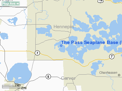
Location & QuickFacts
| FAA Information Effective: | 2008-09-25 |
| Airport Identifier: | MN80 |
| Airport Status: | Operational |
| Longitude/Latitude: | 093-41-18.7210W/44-54-51.7250N
-93.688534/44.914368 (Estimated) |
| Elevation: | 930 ft / 283.46 m (Estimated) |
| Land: | 0 acres |
| From nearest city: | 2 nautical miles S of Mound, MN |
| Location: | Hennepin County, MN |
| Magnetic Variation: | 03E (1990) |
Owner & Manager
| Ownership: | Privately owned |
| Owner: | Kurt Opheim |
| Address: | 3895 Co Rd 44
Minnetrista, MN 55364 |
| Phone number: | 612-472-3607 |
| Manager: | Kurt Opheim |
| Address: | 3895 Co Rd 44
Minnetrista, MN 55364 |
| Phone number: | 612-472-3607 |
Airport Operations and Facilities
| Airport Use: | Private |
| Wind indicator: | Yes |
| Segmented Circle: | No |
| Control Tower: | No |
| Sectional chart: | Twin Cities |
| Region: | AGL - Great Lakes |
| Boundary ARTCC: | ZMP - Minneapolis |
| Tie-in FSS: | PNM - Princeton |
| FSS Toll Free: | 1-800-WX-BRIEF |
Runway Information
Runway 06/24
| Dimension: | 5500 x 750 ft / 1676.4 x 228.6 m |
| Surface: | WATER, |
| |
Runway 06 |
Runway 24 |
| Traffic Pattern: | Left | Left |
|
Runway 16/34
| Dimension: | 7000 x 750 ft / 2133.6 x 228.6 m |
| Surface: | WATER, |
| |
Runway 16 |
Runway 34 |
| Traffic Pattern: | Left | Left |
| Obstruction: | 100 ft trees, 1070.0 ft from runway | 150 ft trees, 1070.0 ft from runway |
|
Radio Navigation Aids
| ID |
Type |
Name |
Ch |
Freq |
Var |
Dist |
| GYL | NDB | Glencoe | | 407.00 | 03E | 19.3 nm |
| MS | NDB | Narco | | 266.00 | 02E | 26.0 nm |
| HCD | NDB | Hutchinson | | 209.00 | 04E | 29.8 nm |
| PPI | NDB | Hopey | | 400.00 | 03E | 31.9 nm |
| PNM | NDB | Princeton | | 368.00 | 03E | 39.2 nm |
| CBG | NDB | Cambridge | | 350.00 | 03E | 42.7 nm |
| OEO | NDB | Osceola | | 233.00 | 01E | 48.7 nm |
| ULM | NDB/DME | New Ulm | 050X | 272.00 | 04E | 49.9 nm |
| FCM | VOR/DME | Flying Cloud | 055X | 111.80 | 06E | 11.2 nm |
| MSP | VOR/DME | Minneapolis | 100X | 115.30 | 02E | 19.3 nm |
| STC | VOR/DME | St Cloud | 058X | 112.10 | 03E | 41.3 nm |
| MKT | VOR/DME | Mankato | 045X | 110.80 | 07E | 42.8 nm |
| FOW | VOR/DME | Halfway | 049X | 111.20 | 02E | 44.8 nm |
| GEP | VORTAC | Gopher | 120X | 117.30 | 06E | 19.3 nm |
| FGT | VORTAC | Farmington | 104X | 115.70 | 06E | 27.5 nm |
| DWN | VORTAC | Darwin | 027X | 109.00 | 07E | 34.2 nm |
| MSP | VOT | Minneapolis St Paul | | 111.00 | | 20.2 nm |
| STP | VOT | St Paul | | 114.40 | | 26.8 nm |
Remarks
- SUBMIT SIGNED AGREEMENT BETWEEN OWNERS OF FLOBACKS SPB & SELF SHOWING COMPATABLE TFC PATTERNS WITHOUT OVERLAP.
Images and information placed above are from
http://www.airport-data.com/airport/MN80/
We thank them for the data!
| General Info
|
| Country |
United States
|
| State |
MINNESOTA
|
| FAA ID |
MN80
|
| Latitude |
44-54-51.725N
|
| Longitude |
093-41-18.721W
|
| Elevation |
930 feet
|
| Near City |
MOUND
|
We don't guarantee the information is fresh and accurate. The data may
be wrong or outdated.
For more up-to-date information please refer to other sources.
|
|


