 |
|
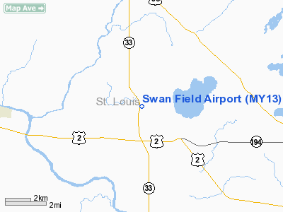
Location & QuickFacts
| FAA Information Effective: | 2008-09-25 |
| Airport Identifier: | MY13 |
| Airport Status: | Operational |
| Longitude/Latitude: | 092-27-25.5000W/46-52-09.3000N
-92.457083/46.869250 (Estimated) |
| Elevation: | 1345 ft / 409.96 m (Estimated) |
| Land: | 64 acres |
| From nearest city: | 1 nautical miles NW of Saginaw, MN |
| Location: | St Louis County, MN |
| Magnetic Variation: | () |
Owner & Manager
| Ownership: | Privately owned |
| Owner: | Robert & Sharon Swan |
| Address: | 4972 Hwy 33
Saginaw, MN 55779 |
| Phone number: | 218-729-7666 |
| Manager: | Robert & Sharon Swan |
| Address: | 4972 Hwy 33
Saginaw, MN 55779 |
| Phone number: | 218-729-7666 |
Airport Operations and Facilities
| Airport Use: | Private |
| Wind indicator: | Yes |
| Control Tower: | No |
| Sectional chart: | Great Falls |
| Region: | AGL - Great Lakes |
| Boundary ARTCC: | ZMP - Minneapolis |
| Tie-in FSS: | PNM - Princeton |
| FSS Toll Free: | 1-800-WX-BRIEF |
Runway Information
Runway 18/36
| Dimension: | 2000 x 150 ft / 609.6 x 45.7 m |
| Surface: | TURF, |
| |
Runway 18 |
Runway 36 |
| Traffic Pattern: | Left | Left |
|
Radio Navigation Aids
| ID |
Type |
Name |
Ch |
Freq |
Var |
Dist |
| DL | NDB | Pykla | | 379.00 | 02E | 4.4 nm |
| COQ | NDB | Cloquet | | 335.00 | 03E | 10.5 nm |
| SUW | NDB | Bong | | 260.00 | 01E | 18.1 nm |
| MZH | NDB | Moose Lake | | 362.00 | 02E | 30.8 nm |
| TWM | NDB | Two Harbors | | 243.00 | 01E | 31.2 nm |
| OLG | NDB | Solon Springs | | 388.00 | 01E | 42.5 nm |
| BFW | NDB | Silver Bay | | 350.00 | 00E | 48.5 nm |
| LKI | TACAN | Lakeside | 011X | | 05E | 11.3 nm |
| HIB | VOR/DME | Hibbing | 045X | 110.80 | 02E | 27.9 nm |
| EVM | VOR/DME | Eveleth | 019X | 108.20 | 01E | 33.3 nm |
| GPZ | VOR/DME | Grand Rapids | 051X | 111.40 | 06E | 45.8 nm |
| DLH | VORTAC | Duluth | 073X | 112.60 | 05E | 11.2 nm |
Remarks
- 22 FT PLINE 2200 FT N; 40 FT PLINE 2700 FT S; 289 FT TWR 3 NM NW & 60 FT TREES 125 FT EITHER SIDE OF RWY.
- PRVDD CLEAR 20:1 APCHS, CLEAR OBSTACLE FREE ZONE & CLEAR RWY SAFETY AREA.
Images and information placed above are from
http://www.airport-data.com/airport/MY13/
We thank them for the data!
We don't guarantee the information is fresh and accurate. The data may
be wrong or outdated.
For more up-to-date information please refer to other sources.
|
|


