 |
|
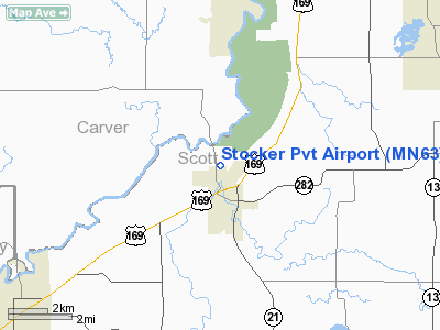
Location & QuickFacts
| FAA Information Effective: | 2008-09-25 |
| Airport Identifier: | MN63 |
| Airport Status: | Operational |
| Longitude/Latitude: | 093-38-12.8460W/44-40-59.8660N
-93.636902/44.683296 (Estimated) |
| Elevation: | 855 ft / 260.60 m (Estimated) |
| Land: | 0 acres |
| From nearest city: | 1 nautical miles N of Jordan, MN |
| Location: | Scott County, MN |
| Magnetic Variation: | 03E (1985) |
Owner & Manager
| Ownership: | Privately owned |
| Owner: | Eldred Stocker |
| Address: | 301 Sunset Dr
Jordan, MN 55352 |
| Phone number: | 612-492-6600 |
| Address: |
|
Airport Operations and Facilities
| Airport Use: | Private |
| Wind indicator: | Yes |
| Segmented Circle: | No |
| Control Tower: | No |
| Landing fee charge: | No |
| Sectional chart: | Twin Cities |
| Region: | AGL - Great Lakes |
| Boundary ARTCC: | ZMP - Minneapolis |
| Tie-in FSS: | PNM - Princeton |
| FSS on Airport: | No |
| FSS Toll Free: | 1-800-WX-BRIEF |
Airport Services
| Airframe Repair: | NONE |
| Power Plant Repair: | NONE |
Runway Information
Runway E/W
| Dimension: | 1400 x 100 ft / 426.7 x 30.5 m |
| Surface: | TURF, |
| |
Runway E |
Runway W |
| Traffic Pattern: | Left | Left |
|
Runway N/S
| Dimension: | 1400 x 100 ft / 426.7 x 30.5 m |
| Surface: | TURF, |
| |
Runway N |
Runway S |
| Traffic Pattern: | Left | Left |
|
Runway NE/SW
| Dimension: | 2000 x 100 ft / 609.6 x 30.5 m |
| Surface: | TURF, |
| |
Runway NE |
Runway SW |
| Traffic Pattern: | Left | Left |
|
Radio Navigation Aids
| ID |
Type |
Name |
Ch |
Freq |
Var |
Dist |
| GYL | NDB | Glencoe | | 407.00 | 03E | 19.7 nm |
| MS | NDB | Narco | | 266.00 | 02E | 24.8 nm |
| PPI | NDB | Hopey | | 400.00 | 03E | 31.8 nm |
| HCD | NDB | Hutchinson | | 209.00 | 04E | 33.5 nm |
| ACQ | NDB | Waseca | | 371.00 | 02E | 37.0 nm |
| ULM | NDB/DME | New Ulm | 050X | 272.00 | 04E | 43.0 nm |
| FCM | VOR/DME | Flying Cloud | 055X | 111.80 | 06E | 11.5 nm |
| MSP | VOR/DME | Minneapolis | 100X | 115.30 | 02E | 21.4 nm |
| MKT | VOR/DME | Mankato | 045X | 110.80 | 07E | 30.3 nm |
| FOW | VOR/DME | Halfway | 049X | 111.20 | 02E | 31.0 nm |
| FGT | VORTAC | Farmington | 104X | 115.70 | 06E | 19.7 nm |
| GEP | VORTAC | Gopher | 120X | 117.30 | 06E | 30.0 nm |
| DWN | VORTAC | Darwin | 027X | 109.00 | 07E | 42.4 nm |
| MSP | VOT | Minneapolis St Paul | | 111.00 | | 21.7 nm |
| STP | VOT | St Paul | | 114.40 | | 29.1 nm |
Remarks
- TAKEOFF TO SOUTH ON N/S RWY, RESTRICTED TO 20 KNOTS OR MORE WIND TO BE HIGH ABOVE HOUSING; LANDING TO SOUTH RESTRICTED TO 25 KNOT HEADWIND.
Images and information placed above are from
http://www.airport-data.com/airport/MN63/
We thank them for the data!
| General Info
|
| Country |
United States
|
| State |
MINNESOTA
|
| FAA ID |
MN63
|
| Latitude |
44-40-59.866N
|
| Longitude |
093-38-12.846W
|
| Elevation |
855 feet
|
| Near City |
JORDAN
|
We don't guarantee the information is fresh and accurate. The data may
be wrong or outdated.
For more up-to-date information please refer to other sources.
|
|


