 |
|
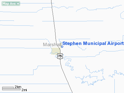
Stephen Municipal Airport |
Location & QuickFacts
| FAA Information Effective: | 2008-09-25 |
| Airport Identifier: | D41 |
| Airport Status: | Operational |
| Longitude/Latitude: | 096-51-46.2200W/48-27-29.9240N
-96.862839/48.458312 (Estimated) |
| Elevation: | 830 ft / 252.98 m (Estimated) |
| Land: | 80 acres |
| From nearest city: | 1 nautical miles NE of Stephen, MN |
| Location: | Marshall County, MN |
| Magnetic Variation: | 06E (1985) |
Owner & Manager
| Ownership: | Publicly owned |
| Owner: | City Of Stephen |
| Address: | 424 Fifth St., Po Box 630
Stephen, MN 56757 |
| Phone number: | 218-478-3614 |
| Manager: | Curtis Larson |
| Address: | Po Box 139
Stephen, MN 56757 |
| Phone number: | 218-478-2247 |
Airport Operations and Facilities
| Airport Use: | Open to public |
| Wind indicator: | Yes |
| Segmented Circle: | No |
| Control Tower: | No |
| Lighting Schedule: | DUSK-DAWN |
| Beacon Color: | Clear-Green (lighted land airport) |
| Landing fee charge: | No |
| Sectional chart: | Twin Cities |
| Region: | AGL - Great Lakes |
| Traffic Pattern Alt: | 800 ft |
| Boundary ARTCC: | ZMP - Minneapolis |
| Tie-in FSS: | PNM - Princeton |
| FSS on Airport: | No |
| FSS Toll Free: | 1-800-WX-BRIEF |
| NOTAMs Facility: | PNM (NOTAM-d service avaliable) |
Airport Communications
| CTAF: | 122.700 |
| Unicom: | 122.700 |
Airport Services
Runway Information
Runway 17/35
| Dimension: | 2700 x 60 ft / 823.0 x 18.3 m |
| Surface: | ASPH, Fair Condition
RUNWAY CRACKS. |
| Edge Lights: | Low |
| |
Runway 17 |
Runway 35 |
| Longitude: | 096-51-58.1900W | 096-51-55.2400W |
| Latitude: | 48-27-52.7000N | 48-27-26.1300N |
| Elevation: | 830.00 ft | 830.00 ft |
| Traffic Pattern: | Left | Left |
| Markings: | Basic, Good Condition | Basic, Good Condition |
| Runway End Identifier: | No | No |
| Centerline Lights: | No | No |
| Touchdown Lights: | No | No |
| Obstruction: | , 50:1 slope to clear | 17 ft road, 482.0 ft from runway, 16:1 slope to clear |
|
Radio Navigation Aids
| ID |
Type |
Name |
Ch |
Freq |
Var |
Dist |
| CKN | NDB | Crookston | | 400.00 | 07E | 38.5 nm |
| PFT | NDB | Piney Pinecreek | | 342.00 | 05E | 47.5 nm |
| RDR | TACAN | Red River | 111X | | 06E | 37.2 nm |
| GFK | VOR/DME | Grand Forks | 090X | 114.30 | 09E | 32.9 nm |
| TVF | VOR/DME | Thief River Falls | 021X | 108.40 | 08E | 35.8 nm |
| HML | VORTAC | Humboldt | 071X | 112.40 | 09E | 26.7 nm |
Remarks
- ULTRALIGHT TRAFFIC ON & INVOF ARPT.
- PRVD THR ARE LOCATED AND CLEARLY MKD SO AS TO PRVD A MINIMUM 20:1 CLNC OVER ALL OBSTN.
Images and information placed above are from
http://www.airport-data.com/airport/D41/
We thank them for the data!
| General Info
|
| Country |
United States
|
| State |
MINNESOTA
|
| FAA ID |
D41
|
| Latitude |
48-27-29.924N
|
| Longitude |
096-51-46.220W
|
| Elevation |
830 feet
|
| Near City |
STEPHEN
|
We don't guarantee the information is fresh and accurate. The data may
be wrong or outdated.
For more up-to-date information please refer to other sources.
|
|


