 |
|
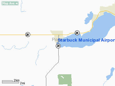
Starbuck Municipal Airport |
Location & QuickFacts
| FAA Information Effective: | 2008-09-25 |
| Airport Identifier: | D32 |
| Airport Status: | Operational |
| Longitude/Latitude: | 095-32-01.1440W/45-35-59.8580N
-95.533651/45.599961 (Estimated) |
| Elevation: | 1141 ft / 347.78 m (Estimated) |
| Land: | 29 acres |
| From nearest city: | 1 nautical miles S of Starbuck, MN |
| Location: | Pope County, MN |
| Magnetic Variation: | 05E (1985) |
Owner & Manager
| Ownership: | Publicly owned |
| Owner: | City Of Starbuck |
| Address: | 307 Fifth St., Box 606
Starbuck, MN 56381 |
| Phone number: | 320-239-2525 |
| Manager: | Gary Koos |
| Address: | 307 Fifth St., Box 606
Starbuck, MN 56381 |
| Phone number: | 500-730-6934 |
Airport Operations and Facilities
| Airport Use: | Open to public |
| Wind indicator: | Yes |
| Segmented Circle: | No |
| Control Tower: | No |
| Lighting Schedule: | DUSK-DAWN |
| Beacon Color: | Clear-Green (lighted land airport) |
| Landing fee charge: | No |
| Sectional chart: | Twin Cities |
| Region: | AGL - Great Lakes |
| Boundary ARTCC: | ZMP - Minneapolis |
| Tie-in FSS: | PNM - Princeton |
| FSS on Airport: | No |
| FSS Toll Free: | 1-800-WX-BRIEF |
| NOTAMs Facility: | PNM (NOTAM-d service avaliable) |
Airport Communications
Airport Services
| Airframe Repair: | NONE |
| Power Plant Repair: | NONE |
| Bottled Oxygen: | NONE |
| Bulk Oxygen: | NONE |
Runway Information
Runway 15/33
| Dimension: | 2512 x 198 ft / 765.7 x 60.4 m |
| Surface: | TURF, Fair Condition |
| Edge Lights: | Non-standard lighting system
NSTD LIRL; NSTD SPACING. |
| |
Runway 15 |
Runway 33 |
| Longitude: | 095-32-17.1300W | 095-32-12.9700W |
| Latitude: | 45-36-07.7500N | 45-35-43.1300N |
| Elevation: | 1141.00 ft | 1141.00 ft |
| Alignment: | 127 | 127 |
| Traffic Pattern: | Left | Left |
| Runway End Identifier: | No | No |
| Centerline Lights: | No | No |
| Touchdown Lights: | No | No |
| Obstruction: | 110 ft tree, 1835.0 ft from runway, 225 ft left of centerline, 16:1 slope to clear
TREE +12 FT, 230 FT FM END, 100 L, 19:1 | 90 ft trees, 1800.0 ft from runway, 270 ft left of centerline, 20:1 slope to clear |
|
Radio Navigation Aids
| ID |
Type |
Name |
Ch |
Freq |
Var |
Dist |
| GHW | NDB | Glenwood | | 346.00 | 03E | 9.4 nm |
| EE | NDB | Tamie | | 374.00 | 04E | 15.0 nm |
| BBB | NDB | Benson | | 239.00 | 05E | 17.1 nm |
| AQP | NDB | Appleton | | 356.00 | 05E | 30.0 nm |
| VVV | NDB | Ortonville | | 332.00 | 05E | 41.5 nm |
| ETH | NDB | Wheaton | | 326.00 | 05E | 43.9 nm |
| DXX | NDB | Dawson/madison | | 341.00 | 06E | 46.0 nm |
| MOX | VOR/DME | Morris | 033X | 109.60 | 05E | 18.4 nm |
| AXN | VOR/DME | Alexandria | 075X | 112.80 | 07E | 25.0 nm |
| BDH | VOR/DME | Willmar | 84X | 113.70 | 04E | 33.7 nm |
| ILL | VOR/DME | Willmar | 084X | 113.70 | 04E | 34.5 nm |
| MVE | VOR/DME | Montevideo | 053X | 111.60 | 05E | 38.4 nm |
| FFM | VOR/DME | Fergus Falls | 041X | 110.40 | 05E | 48.9 nm |
Remarks
- ULTRALIGHT ACFT ON & INVOF AIRPORT.
Images and information placed above are from
http://www.airport-data.com/airport/D32/
We thank them for the data!
| General Info
|
| Country |
United States
|
| State |
MINNESOTA
|
| FAA ID |
D32
|
| Latitude |
45-35-59.858N
|
| Longitude |
095-32-01.144W
|
| Elevation |
1141 feet
|
| Near City |
STARBUCK
|
We don't guarantee the information is fresh and accurate. The data may
be wrong or outdated.
For more up-to-date information please refer to other sources.
|
|


