 |
|
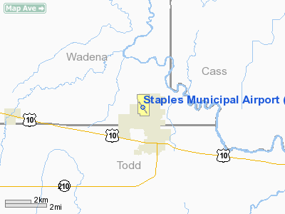
Staples Municipal Airport |
Location & QuickFacts
| FAA Information Effective: | 2008-09-25 |
| Airport Identifier: | SAZ |
| Airport Status: | Operational |
| Longitude/Latitude: | 094-48-23.7660W/46-22-51.1660N
-94.806602/46.380879 (Estimated) |
| Elevation: | 1287 ft / 392.28 m (Surveyed) |
| Land: | 172 acres |
| From nearest city: | 2 nautical miles NW of Staples, MN |
| Location: | Wadena County, MN |
| Magnetic Variation: | 04E (1995) |
Owner & Manager
| Ownership: | Publicly owned |
| Owner: | City Of Staples |
| Address: | 611 Iowa Ave Ne
Staples, MN 56479 |
| Phone number: | 218-894-2550 |
| Manager: | Gerald Brever |
| Address: | 611 Iowa Ave Ne
Staples, MN 56479 |
| Phone number: | 218-894-2550 |
Airport Operations and Facilities
| Airport Use: | Open to public |
| Wind indicator: | Yes |
| Segmented Circle: | No |
| Control Tower: | No |
| Lighting Schedule: | DUSK-DAWN
ACTVT MIRL RY 14/32, PAPI RYS 14 & 32, AND REIL RYS 14 & 32 - CTAF. |
| Beacon Color: | Clear-Green (lighted land airport) |
| Landing fee charge: | No |
| Sectional chart: | Twin Cities |
| Region: | AGL - Great Lakes |
| Boundary ARTCC: | ZMP - Minneapolis |
| Tie-in FSS: | PNM - Princeton |
| FSS on Airport: | No |
| FSS Toll Free: | 1-800-WX-BRIEF |
| NOTAMs Facility: | SAZ (NOTAM-d service avaliable) |
| Federal Agreements: | N |
Airport Communications
Airport Services
| Fuel available: | 100LL
SELF SERVE FUEL AVAIL 24 HRS WITH CREDIT CARD. |
Runway Information
Runway 14/32
| Dimension: | 3304 x 75 ft / 1007.1 x 22.9 m |
| Surface: | ASPH, Good Condition |
| Edge Lights: | Medium |
| |
Runway 14 |
Runway 32 |
| Longitude: | 094-48-37.3170W | 094-48-10.1210W |
| Latitude: | 46-23-04.4980N | 46-22-37.8630N |
| Elevation: | 1286.00 ft | 1284.00 ft |
| Alignment: | 127 | 127 |
| Traffic Pattern: | Left | Left |
| Markings: | Non-precision instrument, Fair Condition | Non-precision instrument, Fair Condition |
| Crossing Height: | 27.00 ft | 27.00 ft |
| VASI: | 4-light PAPI on left side | 4-light PAPI on left side |
| Visual Glide Angle: | 3.00° | 3.00° |
| Runway End Identifier: | Yes | Yes |
| Centerline Lights: | No | No |
| Touchdown Lights: | No | No |
| Obstruction: | 15 ft road, 210.0 ft from runway
ROAD +15, 0-200 FT FM RWY END, 100 FT L/R. | 11 ft road, 450.0 ft from runway, 250 ft right of centerline, 22:1 slope to clear |
|
Radio Navigation Aids
| ID |
Type |
Name |
Ch |
Freq |
Var |
Dist |
| SAZ | NDB | Staples | | 257.00 | 04E | 0.1 nm |
| XCR | NDB | Ripley | | 404.00 | 03E | 26.5 nm |
| PWC | NDB | Pine River | | 330.00 | 03E | 27.2 nm |
| PK | NDB | Spida | | 269.00 | 04E | 28.1 nm |
| LXL | NDB | Little Falls | | 359.00 | 03E | 32.3 nm |
| EE | NDB | Tamie | | 374.00 | 04E | 41.1 nm |
| XVG | NDB | Longville | | 392.00 | 04E | 44.4 nm |
| AIT | NDB | Aitkin | | 397.00 | 03E | 47.9 nm |
| GHW | NDB | Glenwood | | 346.00 | 03E | 49.2 nm |
| RYM | TACAN | Camp Ripley | 048X | | 03E | 25.6 nm |
| AXN | VOR/DME | Alexandria | 075X | 112.80 | 07E | 31.0 nm |
| PKD | VOR/DME | Park Rapids | 043X | 110.60 | 04E | 32.9 nm |
| BRD | VORTAC | Brainerd | 116X | 116.90 | 03E | 32.4 nm |
Remarks
- OCCASIONAL HOP HOSPITAL HELIPAD .89 NM ESE RY 14/32.
- GCO AVBL ON FREQ 121.725 THRU MINNEAPOLIS ARTCC & FLT SVCS.
Images and information placed above are from
http://www.airport-data.com/airport/SAZ/
We thank them for the data!
| General Info
|
| Country |
United States
|
| State |
MINNESOTA
|
| FAA ID |
SAZ
|
| Latitude |
46-22-51.166N
|
| Longitude |
094-48-23.766W
|
| Elevation |
1287 feet
|
| Near City |
STAPLES
|
We don't guarantee the information is fresh and accurate. The data may
be wrong or outdated.
For more up-to-date information please refer to other sources.
|
|


