|
|
St Paul Downtown Holman Fld Airport |
Coordinates: 44°56′04″N 093°03′36″W / 44.93444°N 93.06°W / 44.93444; -93.06
St. Paul Downtown Airport
Holman Field |
 |
| IATA: STP – ICAO: KSTP – FAA LID: STP |
| Summary |
| Airport type |
Public |
| Owner |
Metropolitan Airports Commission |
| Serves |
St. Paul, Minnesota |
| Location |
St. Paul, Minnesota, USA |
| Elevation AMSL |
705 ft / 215 m |
| Runways |
| Direction |
Length |
Surface |
| ft |
m |
| 14/32 |
6,491 |
1,978 |
Asphalt |
| 13/31 |
4,004 |
1,220 |
Asphalt |
| 9/27 |
3,642 |
1,110 |
Asphalt |
| Statistics (2006) |
| Aircraft operations |
158,783 |
| Based aircraft |
122 |
| Source: Federal Aviation Administration |
St. Paul Downtown Airport (IATA: STP, ICAO: KSTP, FAA LID: STP), also known as Holman Field, is an airport just across the Mississippi River from downtown Saint Paul, Minnesota. It is one of several reliever airports in the Twin Cities operated by the Metropolitan Airports Commission. The airport has three runways and serves aircraft operated by corporations in the local area, a flight training school and the Minnesota Army National Guard aviation unit, as well as transient general aviation aircraft.
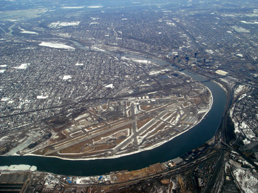 | |
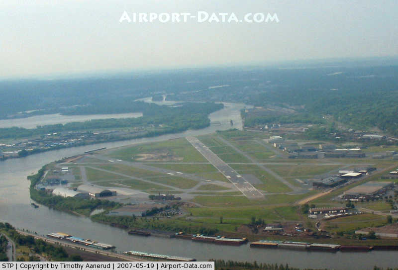
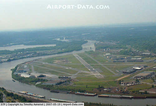
Aerial photo of St. Paul Downtown Airport, with downtown St. Paul to the upper right, Mississippi River and MSP to the top left |
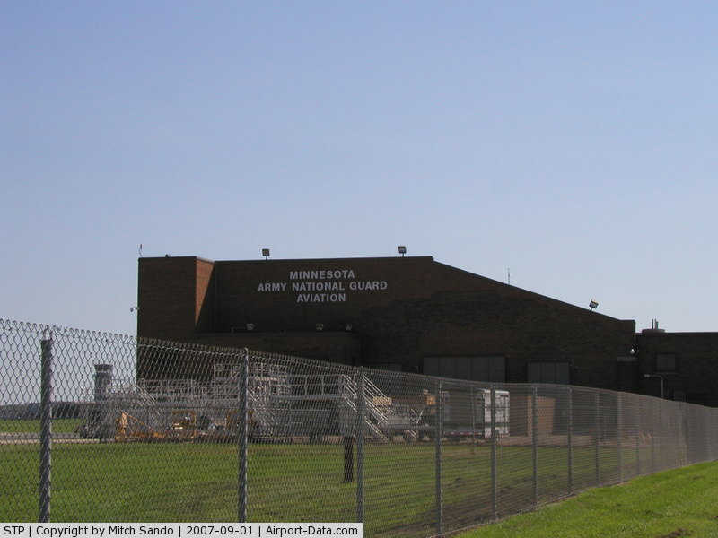
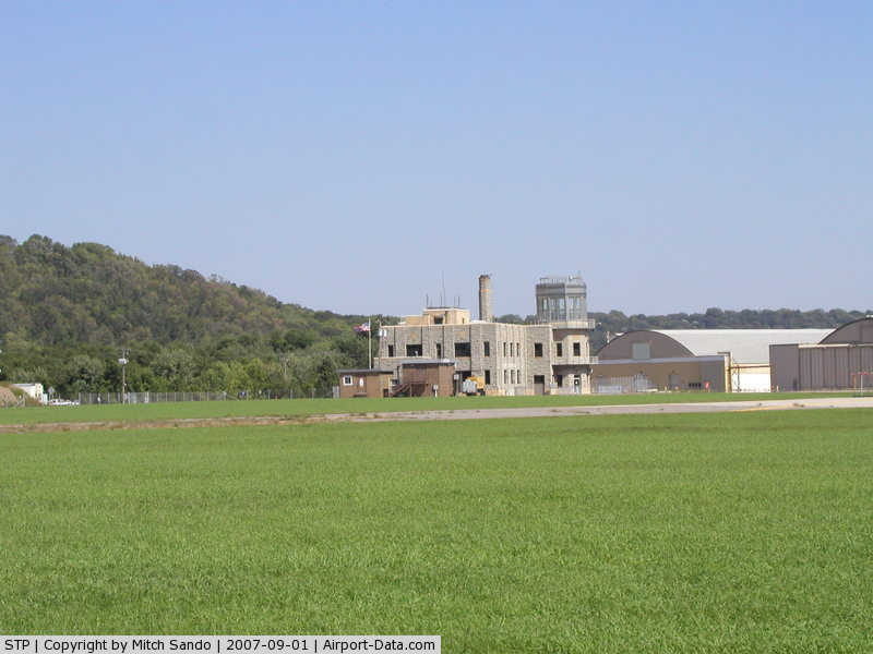
The airport is home to an installation of the Minnesota Army National Guard. The Holman Field Administration Building was added to the National Register of Historic Places in 1991. History
Holman Field was named for Charles W. "Speed" Holman (born in 1898), who was a stunt pilot, barnstormer, wing walker, parachutist, airmail pilot, aviation record holder and airline pilot. Born in Bloomington, he was the first pilot hired by Northwest Airways in 1926. In 1928, Holman set a world's record of 1,433 consecutive loops in an airplane in five hours over the St. Paul Airport. He died in an accident during an air show in Omaha in 1931 at the age of 32.
During World War II, Northwest Airlines employed up to 5,000 people at the site, modifying new B-24 Liberator bombers, some of which received the highly classified H2X radar, which proved to be an invaluable tool in the European theater.
The terminal was used as a backdrop for scenes in the 1972 film Slaughterhouse-Five.
During the 1970s and early 1980s, commuter airline Lake State Airways offered scheduled airline service between the St. Paul Downtown Airport and Minneapolis-St. Paul International Airport in Minnesota. It cost $5USD for a one-way ticket between the two airports, and $10 round-trip. Conquest Airlines (5C) flew MDW-STP with a Swearingen Metroliner in summer and fall 1995.
Facilities and aircraft
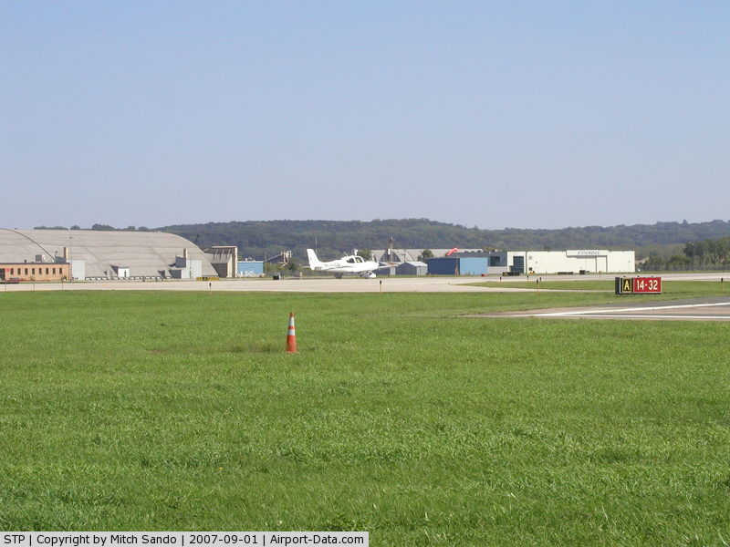
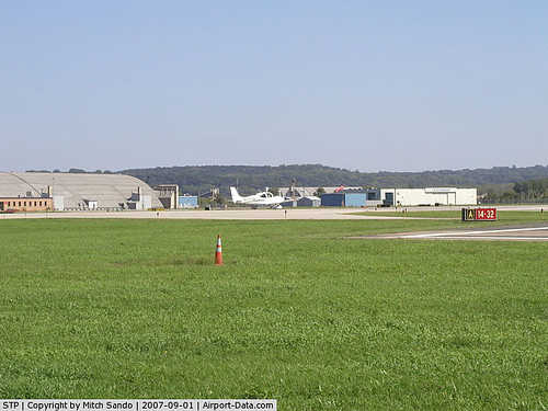
St. Paul Downtown Holman Field covers an area of 540 acres (219 ha) which contains three asphalt paved runways: 14/32 measuring 6,491 x 150 ft (1,978 x 46 m), 13/31 measuring 4,004 x 150 ft (1,220 x 46 m) and 9/27 measuring 3,642 x 100 ft (1,110 x 30 m).
For the 12-month period ending August 31, 2006, the airport had 158,783 aircraft operations, an average of 435 per day:92% general aviation, 5% military and 3% air taxi. There are 122 aircraft based at this airport: 29% military, 28% jet, 26% single-engine, 12% multi-engine and 5% helicopter.
Controversy
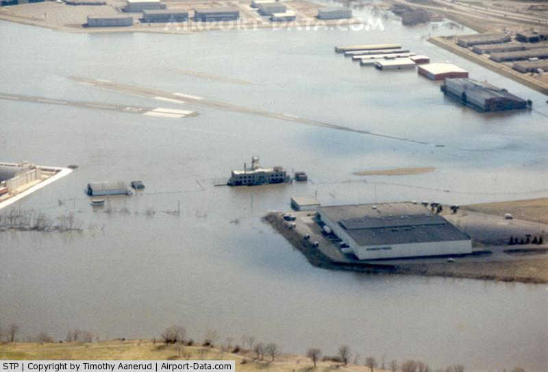
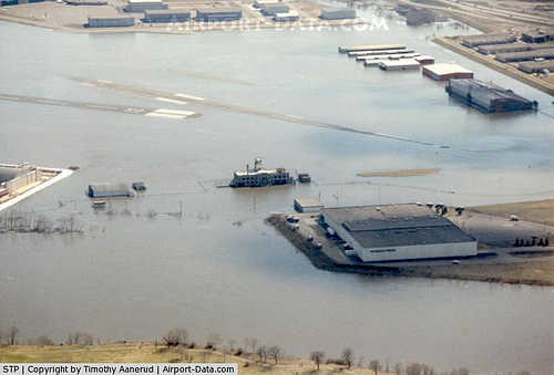
Recently local debate has ensued over plans to build a floodwall around the airport. Three times in the last thirteen years the airport has been flooded due to its proximity to the Mississippi River. Supporters do not want to deal with the future inconvenience of having to deal with the flood again, while critics say that the proposed wall would ruin views and make the airport "ugly".
A dike to protect the airport from the nearby river is under consideration and the National Guard has stated that they may leave if the dike is not constructed in a timely manner.
Gallery
The above content comes from Wikipedia and is published under free licenses – click here to read more.
|
 |
(Click on the photo to enlarge) |
|
 |
(Click on the photo to enlarge) |
|
 |
(Click on the photo to enlarge) |
|
 |
(Click on the photo to enlarge) |
|
 |
(Click on the photo to enlarge) |
Location & QuickFacts
| FAA Information Effective: | 2008-09-25 |
| Airport Identifier: | STP |
| Airport Status: | Operational |
| Longitude/Latitude: | 093-03-37.2328W/44-56-04.6410N
-93.060342/44.934623 (Estimated) |
| Elevation: | 705 ft / 214.88 m (Estimated) |
| Land: | 540 acres |
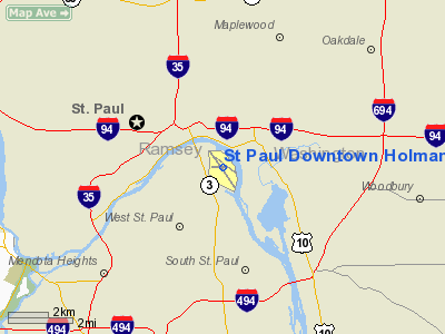
| From nearest city: | 1 nautical miles S of St Paul, MN |
| Location: | Ramsey County, MN |
| Magnetic Variation: | 03E (1985) |
Owner & Manager
| Ownership: | Publicly owned |
| Owner: | Metro Arpt Commsn |
| Address: | 6040 28th Ave, So
Minneapolis, MN 55450 |
| Phone number: | 651-726-8100 |
| Manager: | Greg Fries |
| Address: | 644 Bayfield
St Paul, MN 55107 |
| Phone number: | 651-224-4306
MGR EMAIL: GFRIES@MSPMAC.ORG |
Airport Operations and Facilities
| Airport Use: | Open to public |
| Wind indicator: | Yes |
| Segmented Circle: | No |
| Control Tower: | Yes |
| Lighting Schedule: | DUSK-DAWN
WHEN ATCT CLSD TO INCR INTST ACTVT HIRL RY 14/32 & MALSR RY 14 - CTAF. PAPI RYS 27 & 31 OPERATES 24 HRS. |
| Beacon Color: | Clear-Green (lighted land airport)
OTS INDEFLY. |
| Landing fee charge: | No |
| Sectional chart: | Twin Cities |
| Region: | AGL - Great Lakes |
| Traffic Pattern Alt: | 1200 ft |
| Boundary ARTCC: | ZMP - Minneapolis |
| Tie-in FSS: | PNM - Princeton |
| FSS on Airport: | No |
| FSS Toll Free: | 1-800-WX-BRIEF |
| NOTAMs Facility: | STP (NOTAM-d service avaliable) |
| Federal Agreements: | NGPY |
Airport Communications
| CTAF: | 119.100 |
| Unicom: | 122.950 |
Airport Services
| Fuel available: | 100LLA |
| Airframe Repair: | MAJOR |
| Power Plant Repair: | MAJOR |
| Bottled Oxygen: | NONE |
| Bulk Oxygen: | HIGH |
Runway Information
Runway 09/27
| Dimension: | 3642 x 100 ft / 1110.1 x 30.5 m |
| Surface: | ASPH, Good Condition |
| Weight Limit: | Single wheel: 90000 lbs.
Dual wheel: 160000 lbs.
Dual tandem wheel: 300000 lbs. |
| Edge Lights: | Medium |
| |
Runway 09 |
Runway 27 |
| Longitude: | 093-04-05.2380W | 093-03-14.6140W |
| Latitude: | 44-56-05.5050N | 44-56-05.0700N |
| Elevation: | 700.00 ft | 701.00 ft |
| Alignment: | 91 | 127 |
| Traffic Pattern: | Left | Right |
| Markings: | Non-precision instrument, Good Condition | Non-precision instrument, Good Condition |
| VASI: | | 4-light PAPI on right side |
| Obstruction: | 50 ft trees, 765.0 ft from runway, 120 ft left of centerline, 11:1 slope to clear | 54 ft trees, 1200.0 ft from runway, 225 ft left of centerline, 18:1 slope to clear |
|
Runway 13/31
| Dimension: | 4004 x 150 ft / 1220.4 x 45.7 m |
| Surface: | ASPH, Good Condition |
| Weight Limit: | Single wheel: 90000 lbs.
Dual wheel: 160000 lbs.
Dual tandem wheel: 300000 lbs. |
| Edge Lights: | High |
| |
Runway 13 |
Runway 31 |
| Longitude: | 093-03-54.2330W | 093-03-10.2180W |
| Latitude: | 44-56-21.0660N | 44-55-56.8700N |
| Elevation: | 704.00 ft | 701.00 ft |
| Alignment: | 127 | 127 |
| Traffic Pattern: | Left | Left |
| Markings: | Non-precision instrument, Good Condition | Non-precision instrument, Good Condition |
| Crossing Height: | 57.00 ft | 0.00 ft |
| VASI: | 4-box on left side | 4-light PAPI on left side |
| Visual Glide Angle: | 3.25° | 0.00° |
| Runway End Identifier: | | Yes |
| Obstruction: | 39 ft tree, 1770.0 ft from runway, 175 ft left of centerline, 40:1 slope to clear | 74 ft stack, 1850.0 ft from runway, 50 ft right of centerline, 22:1 slope to clear
TREES +10, 10 TO 200 FM RWY END, 200R TO 50R. |
|
Runway 14/32
| Dimension: | 6491 x 150 ft / 1978.5 x 45.7 m |
| Surface: | ASPH, Good Condition |
| Surface Treatment: | Saw-cut or plastic Grooved |
| Weight Limit: | Single wheel: 45000 lbs.
Dual wheel: 60000 lbs.
Dual tandem wheel: 140000 lbs. |
| Edge Lights: | High |
| |
Runway 14 |
Runway 32 |
| Longitude: | 093-04-04.0970W | 093-03-13.7000W |
| Latitude: | 44-56-28.1120N | 44-55-34.9570N |
| Elevation: | 704.00 ft | 704.00 ft |
| Alignment: | 127 | 127 |
| ILS Type: | ILS/DME
| ILS/DME
|
| Traffic Pattern: | Left | Left |
| Markings: | Precision instrument, Good Condition | Precision instrument, Good Condition |
| Crossing Height: | 42.00 ft | 44.00 ft |
| Displaced threshold: | 343.00 ft | 382.00 ft |
| VASI: | 4-light PAPI on right side | 4-light PAPI on left side |
| Visual Glide Angle: | 3.00° | 3.00° |
| RVR Equipment: | touchdown, rollout | touchdown, rollout |
| Approach lights: | MALSR | |
| Runway End Identifier: | No | Yes |
| Obstruction: | 67 ft tree, 1340.0 ft from runway, 425 ft left of centerline, 17:1 slope to clear
APCH RATIO 8:1 TO DSPLCD THLD. HANGAR +30, 450 FM DSPLCD, 745R. | 70 ft trees, 950.0 ft from runway, 550 ft right of centerline, 10:1 slope to clear
APCH RATIO 17:1 TO DSPLCD THLD. |
|
Radio Navigation Aids
| ID |
Type |
Name |
Ch |
Freq |
Var |
Dist |
| PPI | NDB | Hopey | | 400.00 | 03E | 6.2 nm |
| MS | NDB | Narco | | 266.00 | 02E | 6.7 nm |
| RNH | NDB | New Richmond | | 257.00 | 02E | 25.8 nm |
| OEO | NDB | Osceola | | 233.00 | 01E | 27.6 nm |
| AHH | NDB | Ameron | | 278.00 | 01E | 35.9 nm |
| CBG | NDB | Cambridge | | 350.00 | 03E | 38.4 nm |
| PNM | NDB | Princeton | | 368.00 | 03E | 44.4 nm |
| GYL | NDB | Glencoe | | 407.00 | 03E | 44.9 nm |
| ROS | NDB | Rush City | | 282.00 | 02E | 46.0 nm |
| MSP | VOR/DME | Minneapolis | 100X | 115.30 | 02E | 7.8 nm |
| FCM | VOR/DME | Flying Cloud | 055X | 111.80 | 06E | 18.1 nm |
| FOW | VOR/DME | Halfway | 049X | 111.20 | 02E | 45.9 nm |
| GEP | VORTAC | Gopher | 120X | 117.30 | 06E | 18.4 nm |
| FGT | VORTAC | Farmington | 104X | 115.70 | 06E | 19.0 nm |
| STP | VOT | St Paul | | 114.40 | | 0.4 nm |
| MSP | VOT | Minneapolis St Paul | | 111.00 | | 7.3 nm |
Remarks
- BIRD ROOSTING & FEEDING AREAS ALONG RIVER BANKS.
- FOR NOISE ABATEMENT PROCEDURES CALL 612-725-6327. AIRCRAFT PLEASE FOLLOW VOLUNTARY NOISE ABATEMENT PROCEDURES AS PUBLISHED.
- WHEN USING RYS 27 OR 31 HAZARDOUS RIVER TFC MAY EXIST.
- DEER AND BIRDS ON & INVOF ARPT.
- SE ARR & DEP AVOID TFC PATTERN OPERATIONS AT SOUTH ST. PAUL ARPT 164 DEG 5 NM AT & BLO 1720 MSL.
- ARPT CLSD TO ACFT OVER 100,000 LBS.
- COMPLEX AIRPORT GEOMETRY. VERIFY CORRECT COMPASS HEADING PRIOR TO DEPARTURE.
- SPB ESTABLISHED PRIOR TO 1959.
Images and information placed above are from
http://www.airport-data.com/airport/STP/
We thank them for the data!
| General Info
|
| Country |
United States
|
| State |
MINNESOTA
|
| FAA ID |
STP
|
| Latitude |
44-56-04.101N
|
| Longitude |
093-03-35.995W
|
| Elevation |
705 feet
|
| Near City |
ST PAUL
|
We don't guarantee the information is fresh and accurate. The data may
be wrong or outdated.
For more up-to-date information please refer to other sources.
|
|