|
|
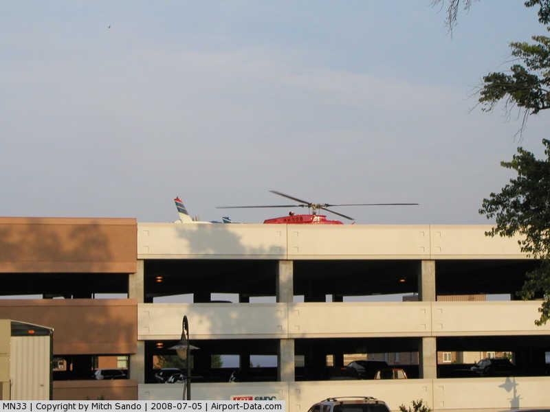
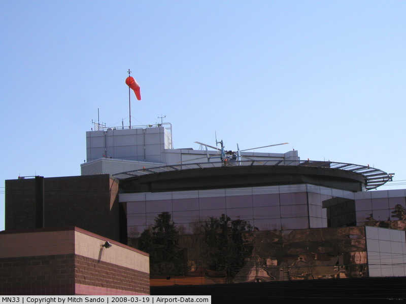
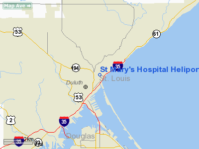
St Mary's Hospital Heliport (MN33) |
|
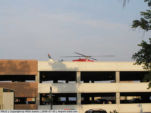 |
(Click on the photo to enlarge) |
|
 |
(Click on the photo to enlarge) |
Location & QuickFacts
| FAA Information Effective: | 2008-09-25 |
| Airport Identifier: | MN33 |
| Airport Status: | Operational |
| Longitude/Latitude: | 092-05-51.9100W/46-47-37.8600N
-92.097753/46.793850 (Estimated) |
| Elevation: | 860 ft / 262.13 m (Surveyed) |
| Land: | 0 acres |
| From nearest city: | 0 nautical miles N of Duluth, MN |
| Location: | St Louis County, MN |
| Magnetic Variation: | 02E (1985) |
Owner & Manager
| Ownership: | Privately owned |
| Owner: | St Mary's Medical Center |
| Address: | 407 East Third St
Duluth, MN 55805 |
| Phone number: | 218-726-4000 |
| Manager: | Lewis Vondy |
| Address: | 407 East Third St
Duluth, MN 55805 |
| Phone number: | 218-786-2494 |
Airport Operations and Facilities
| Airport Use: | Private
MEDICAL. |
| Wind indicator: | Yes |
| Segmented Circle: | No |
| Control Tower: | No |
| Lighting Schedule: | PHONE REQ
FOR HELIPORT BCN CALL 218-720-2392. ACTVT OBSTN & FLOOD LGTS - 123.05. |
| Beacon Color: | Clear-Green-Yellow (heliport) |
| Sectional chart: | Green Bay |
| Region: | AGL - Great Lakes |
| Boundary ARTCC: | ZMP - Minneapolis |
| Tie-in FSS: | PNM - Princeton |
| FSS Toll Free: | 1-800-WX-BRIEF |
Airport Communications
Airport Services
Runway Information
Helipad H1
| Dimension: | 125 x 125 ft / 38.1 x 38.1 m |
| Surface: | CONC, |
| |
Runway H1 |
Runway |
| Traffic Pattern: | Left | Left |
|
Radio Navigation Aids
| ID |
Type |
Name |
Ch |
Freq |
Var |
Dist |
| SUW | NDB | Bong | | 260.00 | 01E | 6.2 nm |
| DL | NDB | Pykla | | 379.00 | 02E | 11.0 nm |
| COQ | NDB | Cloquet | | 335.00 | 03E | 17.7 nm |
| TWM | NDB | Two Harbors | | 243.00 | 01E | 21.2 nm |
| OLG | NDB | Solon Springs | | 388.00 | 01E | 31.0 nm |
| MZH | NDB | Moose Lake | | 362.00 | 02E | 37.0 nm |
| BFW | NDB | Silver Bay | | 350.00 | 00E | 39.2 nm |
| LKI | TACAN | Lakeside | 011X | | 05E | 4.7 nm |
| HIB | VOR/DME | Hibbing | 045X | 110.80 | 02E | 39.3 nm |
| EVM | VOR/DME | Eveleth | 019X | 108.20 | 01E | 41.2 nm |
| DLH | VORTAC | Duluth | 073X | 112.60 | 05E | 4.4 nm |
Remarks
- PRVDD APP/DEP 180-360; TFOF/LNDG AREA IS MKD; WIND INDICATOR IS MAINTAINED.
Images and information placed above are from
http://www.airport-data.com/airport/MN33/
We thank them for the data!
We don't guarantee the information is fresh and accurate. The data may
be wrong or outdated.
For more up-to-date information please refer to other sources.
|
|