|
|
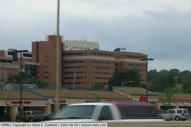
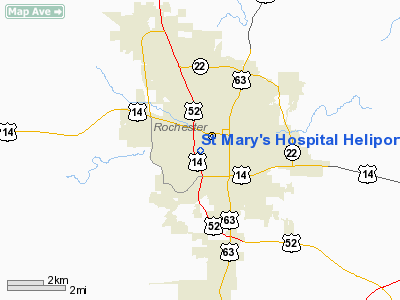
St Mary's Hospital Heliport (99MN) |
|
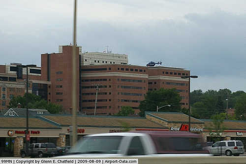 |
(Click on the photo to enlarge) |
Location & QuickFacts
| FAA Information Effective: | 2008-09-25 |
| Airport Identifier: | 99MN |
| Airport Status: | Operational |
| Longitude/Latitude: | 092-28-59.0160W/44-01-11.1250N
-92.483060/44.019757 (Estimated) |
| Elevation: | 1166 ft / 355.40 m (Estimated) |
| Land: | 0 acres |
| From nearest city: | 0 nautical miles N of Rochester, MN |
| Location: | Olmsted County, MN |
| Magnetic Variation: | 02E (1995) |
Owner & Manager
| Ownership: | Privately owned |
| Owner: | Saint Mary's Hospital |
| Address: | 1216 Sw 2nd St
Rochester, MN 55902 |
| Phone number: | 507-255-5591 |
| Manager: | Steve Gudgell |
| Address: | 1216 Sw 2nd St
Rochester, MN 55902 |
| Phone number: | 507-255-2977 |
Airport Operations and Facilities
| Airport Use: | Private
MEDICAL USE. |
| Wind indicator: | Yes |
| Segmented Circle: | No |
| Control Tower: | No |
| Lighting Schedule: | PHONE REQ
FOR PERIMETER LGTS CALL 507-255-5591 OR USE FREQ 155.385 TONE 141.3 OR 155.340 TONE 210.7. |
| Beacon Color: | Clear-Green-Yellow (heliport)
FOR HELI BCN USE FREQ 123.05 KEY MIKE 5 TIMES. |
| Sectional chart: | Chicago |
| Region: | AGL - Great Lakes |
| Boundary ARTCC: | ZMP - Minneapolis |
| Tie-in FSS: | PNM - Princeton |
| FSS on Airport: | No |
| FSS Toll Free: | 1-800-WX-BRIEF |
Airport Communications
Airport Services
Runway Information
Helipad H1
| Dimension: | 91 x 51 ft / 27.7 x 15.5 m |
| Surface: | CONC, |
| |
Runway H1 |
Runway |
| Traffic Pattern: | Left | Left |
|
Radio Navigation Aids
| ID |
Type |
Name |
Ch |
Freq |
Var |
Dist |
| CJJ | NDB | Cresco | | 293.00 | 02E | 42.2 nm |
| ACQ | NDB | Waseca | | 371.00 | 02E | 46.3 nm |
| RST | VOR/DME | Rochester | 057X | 112.00 | 05E | 15.1 nm |
| JAY | VOR/DME | Austin | 019X | 108.20 | 03E | 32.7 nm |
| ONA | VOR/DME | Winona | 051X | 111.40 | 01E | 33.8 nm |
| FOW | VOR/DME | Halfway | 049X | 111.20 | 02E | 39.9 nm |
| AEL | VOR/DME | Albert Lea | 035X | 109.80 | 05E | 43.5 nm |
| ODI | VORTAC | Nodine | 126X | 117.90 | 01E | 44.4 nm |
| FGT | VORTAC | Farmington | 104X | 115.70 | 06E | 47.5 nm |
Remarks
- ALL OPNS TO BE CONDD IN AN AREA 170-330 CLKWS, AREA APROP MKD, WIND INDCR MAINTD.
Images and information placed above are from
http://www.airport-data.com/airport/99MN/
We thank them for the data!
| General Info
|
| Country |
United States
|
| State |
MINNESOTA
|
| FAA ID |
99MN
|
| Latitude |
44-01-11.125N
|
| Longitude |
092-28-59.016W
|
| Elevation |
1166 feet
|
| Near City |
ROCHESTER
|
We don't guarantee the information is fresh and accurate. The data may
be wrong or outdated.
For more up-to-date information please refer to other sources.
|
|