 |
|
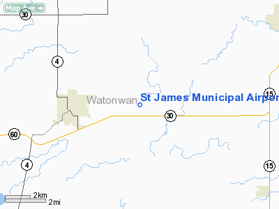
St James Municipal Airport |
|
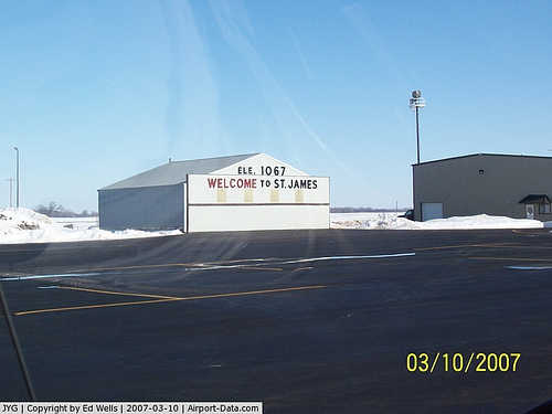 |
(Click on the photo to enlarge) |
|
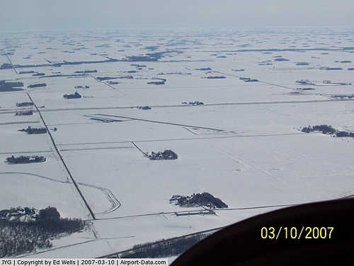 |
(Click on the photo to enlarge) |
Location & QuickFacts
| FAA Information Effective: | 2008-09-25 |
| Airport Identifier: | JYG |
| Airport Status: | Operational |
| Longitude/Latitude: | 094-33-28.5740W/43-59-10.7460N
-94.557937/43.986318 (Estimated) |
| Elevation: | 1067 ft / 325.22 m (Surveyed) |
| Land: | 0 acres |
| From nearest city: | 3 nautical miles E of St James, MN |
| Location: | Watonwan County, MN |
| Magnetic Variation: | 04E (1995) |
Owner & Manager
| Ownership: | Publicly owned |
| Owner: | City Of St James |
| Address: | 124 Armstrong Blvd S, Box 70
St James, MN 56081 |
| Phone number: | 507-375-3241 |
| Manager: | Dewayne Malmgren |
| Address: | 124 Armstrong Blvd S
St James, MN 56081 |
| Phone number: | 507-375-4976 |
Airport Operations and Facilities
| Airport Use: | Open to public |
| Wind indicator: | Yes |
| Segmented Circle: | Yes |
| Control Tower: | No |
| Lighting Schedule: | DUSK-DAWN
ACTVT MIRL RY 15/33; REIL RYS 15 & 33; VASI RYS 15 & 33 - CTAF. |
| Beacon Color: | Clear-Green (lighted land airport) |
| Sectional chart: | Omaha |
| Region: | AGL - Great Lakes |
| Boundary ARTCC: | ZMP - Minneapolis |
| Tie-in FSS: | PNM - Princeton |
| FSS on Airport: | No |
| FSS Toll Free: | 1-800-WX-BRIEF |
| NOTAMs Facility: | JYG (NOTAM-d service avaliable) |
| Federal Agreements: | NY1 |
Airport Communications
Airport Services
| Fuel available: | 100LLMOGAS |
Runway Information
Runway 15/33
| Dimension: | 4000 x 75 ft / 1219.2 x 22.9 m |
| Surface: | ASPH, Good Condition |
| Edge Lights: | Medium |
| |
Runway 15 |
Runway 33 |
| Longitude: | 094-33-42.5780W | 094-33-14.5700W |
| Latitude: | 43-59-27.7130N | 43-58-53.7800N |
| Elevation: | 1061.00 ft | 1065.00 ft |
| Alignment: | 127 | 127 |
| Traffic Pattern: | Left | Left |
| Markings: | Non-precision instrument, Good Condition | Basic, Good Condition |
| Crossing Height: | 24.00 ft | 24.00 ft |
| VASI: | 2-box on left side | 2-box on left side |
| Visual Glide Angle: | 3.00° | 3.00° |
| Runway End Identifier: | Yes | Yes |
| Obstruction: | 15 ft road, 825.0 ft from runway, 317 ft left of centerline, 41:1 slope to clear | 79 ft trees, 2900.0 ft from runway, 34:1 slope to clear |
|
Radio Navigation Aids
| ID |
Type |
Name |
Ch |
Freq |
Var |
Dist |
| JYG | NDB | St James | | 260.00 | 04E | 0.3 nm |
| MWM | NDB | Windom | | 203.00 | 03E | 24.3 nm |
| MJQ | NDB | Jackson | | 353.00 | 04E | 27.6 nm |
| SBU | NDB | Blue Earth | | 332.00 | 04E | 30.8 nm |
| PUF | NDB | Puff | | 345.00 | 04E | 38.9 nm |
| ACQ | NDB | Waseca | | 371.00 | 02E | 43.7 nm |
| ULM | NDB/DME | New Ulm | 050X | 272.00 | 04E | 20.1 nm |
| EST | VOR | Estherville | | 110.40 | 07E | 35.6 nm |
| FRM | VOR/DME | Fairmont | 039X | 110.20 | 07E | 21.3 nm |
| MKT | VOR/DME | Mankato | 045X | 110.80 | 07E | 31.2 nm |
| RWF | VOR/DME | Redwood Falls | 080X | 113.30 | 07E | 37.9 nm |
| OTG | VOR/DME | Worthington | 043X | 110.60 | 08E | 48.9 nm |
Remarks
- ULTRALIGHT TRAFFIC ON & INVOF AIRPORT.
- GCO AVBL ON FREQ 121.725 THRU MINNEAPOLIS ARTCC & FLT SVCS.
Images and information placed above are from
http://www.airport-data.com/airport/JYG/
We thank them for the data!
| General Info
|
| Country |
United States
|
| State |
MINNESOTA
|
| FAA ID |
JYG
|
| Latitude |
43-59-10.746N
|
| Longitude |
094-33-28.574W
|
| Elevation |
1067 feet
|
| Near City |
ST JAMES
|
We don't guarantee the information is fresh and accurate. The data may
be wrong or outdated.
For more up-to-date information please refer to other sources.
|
|


