 |
|
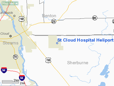
St Cloud Hospital Heliport |
Location & QuickFacts
| FAA Information Effective: | 2008-09-25 |
| Airport Identifier: | MY87 |
| Airport Status: | Operational |
| Longitude/Latitude: | 094-03-26.9470W/45-32-44.8760N
-94.057485/45.545799 (Estimated) |
| Elevation: | 1024 ft / 312.12 m (Estimated) |
| Land: | 0 acres |
| From nearest city: | 0 nautical miles S of St Cloud, MN |
| Location: | Stearns County, MN |
| Magnetic Variation: | 04E (1985) |
Owner & Manager
| Ownership: | Privately owned |
| Owner: | St Cloud Hospital, Inc. |
| Address: | 1406 6th Ave N
St Cloud, MN 56303 |
| Phone number: | 612-251-2700 |
| Manager: | Bill Becker |
| Address: | 1406 6th Ave N
St Cloud, MN 56303 |
| Phone number: | 320-255-5682 |
Airport Operations and Facilities
| Airport Use: | Private
MEDICAL USE. |
| Wind indicator: | Yes |
| Segmented Circle: | No |
| Control Tower: | No |
| Lighting Schedule: | DUSK-DAWN |
| Beacon Color: | Clear-Green-Yellow (heliport) |
| Sectional chart: | Twin Cities |
| Region: | AGL - Great Lakes |
| Boundary ARTCC: | ZMP - Minneapolis |
| Tie-in FSS: | PNM - Princeton |
| FSS Toll Free: | 1-800-WX-BRIEF |
Runway Information
Helipad H1
| Dimension: | 60 x 60 ft / 18.3 x 18.3 m |
| Surface: | ASPH, |
| |
Runway H1 |
Runway |
| Traffic Pattern: | Left | Left |
|
Radio Navigation Aids
| ID |
Type |
Name |
Ch |
Freq |
Var |
Dist |
| PNM | NDB | Princeton | | 368.00 | 03E | 19.0 nm |
| LXL | NDB | Little Falls | | 359.00 | 03E | 27.1 nm |
| CBG | NDB | Cambridge | | 350.00 | 03E | 33.5 nm |
| XCR | NDB | Ripley | | 404.00 | 03E | 34.2 nm |
| JMR | NDB | Mora | | 327.00 | 03E | 39.1 nm |
| HCD | NDB | Hutchinson | | 209.00 | 04E | 43.6 nm |
| GYL | NDB | Glencoe | | 407.00 | 03E | 47.2 nm |
| ROS | NDB | Rush City | | 282.00 | 02E | 47.2 nm |
| RYM | TACAN | Camp Ripley | 048X | | 03E | 35.1 nm |
| STC | VOR/DME | St Cloud | 058X | 112.10 | 03E | 0.2 nm |
| DWN | VORTAC | Darwin | 027X | 109.00 | 07E | 32.2 nm |
| GEP | VORTAC | Gopher | 120X | 117.30 | 06E | 37.6 nm |
| BRD | VORTAC | Brainerd | 116X | 116.90 | 03E | 48.3 nm |
Remarks
- APCH/DEP OPERATIONSARE CONDUCTED IN AN AREA FROM 260-280 & FROM 080-100; AREA IS MARKED; WIND INDICATOR IS MAINTAINED.
Images and information placed above are from
http://www.airport-data.com/airport/MY87/
We thank them for the data!
| General Info
|
| Country |
United States
|
| State |
MINNESOTA
|
| FAA ID |
MY87
|
| Latitude |
45-32-44.876N
|
| Longitude |
094-03-26.947W
|
| Elevation |
1024 feet
|
| Near City |
ST CLOUD
|
We don't guarantee the information is fresh and accurate. The data may
be wrong or outdated.
For more up-to-date information please refer to other sources.
|
|


