 |
|
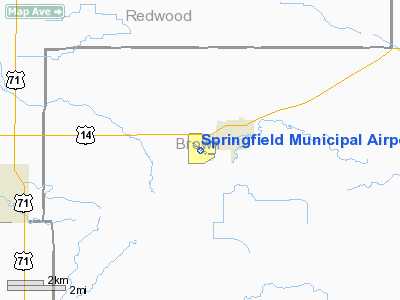
Springfield Municipal Airport |
Location & QuickFacts
| FAA Information Effective: | 2008-09-25 |
| Airport Identifier: | D42 |
| Airport Status: | Operational |
| Longitude/Latitude: | 094-59-56.1640W/44-13-51.8520N
-94.998934/44.231070 (Estimated) |
| Elevation: | 1072 ft / 326.75 m (Surveyed) |
| Land: | 118 acres |
| From nearest city: | 1 nautical miles SW of Springfield, MN |
| Location: | Brown County, MN |
| Magnetic Variation: | 06E (1980) |
Owner & Manager
| Ownership: | Publicly owned |
| Owner: | City Of Springfield |
| Address: | 2 E Central
Springfield, MN 56087 |
| Phone number: | 507-723-3500 |
| Manager: | Sylvester Vogel |
| Address: | 38956 Cty Rd. 24
Springfield, MN 56087 |
| Phone number: | 507-723-3512 |
Airport Operations and Facilities
| Airport Use: | Open to public |
| Wind indicator: | Yes |
| Segmented Circle: | No |
| Control Tower: | No |
| Lighting Schedule: | DUSK-DAWN
MIRL RY 13/31 PRESET ON LOW INTST; TO INCR INTST - CTAF. PAPI RYS 13 & 31 ON CONTINUOUSLY. REIL RYS 13 & 31 5 CLICKS MED & 7 CLICKS HIGH; 3 CLICKS OFF. |
| Beacon Color: | Clear-Green (lighted land airport) |
| Landing fee charge: | No |
| Sectional chart: | Omaha |
| Region: | AGL - Great Lakes |
| Boundary ARTCC: | ZMP - Minneapolis |
| Tie-in FSS: | PNM - Princeton |
| FSS on Airport: | No |
| FSS Toll Free: | 1-800-WX-BRIEF |
| NOTAMs Facility: | PNM (NOTAM-d service avaliable) |
| Federal Agreements: | NGY |
Airport Communications
| CTAF: | 122.800 |
| Unicom: | 122.800 |
Airport Services
Runway Information
Runway 13/31
| Dimension: | 3400 x 75 ft / 1036.3 x 22.9 m |
| Surface: | ASPH, Good Condition |
| Weight Limit: | Single wheel: 12000 lbs. |
| Edge Lights: | Medium |
| |
Runway 13 |
Runway 31 |
| Longitude: | 095-00-13.5070W | 094-59-38.7670W |
| Latitude: | 44-14-03.0320N | 44-13-40.5970N |
| Elevation: | 1070.00 ft | 1067.00 ft |
| Alignment: | 127 | 127 |
| Traffic Pattern: | Right | Left |
| Markings: | Non-precision instrument, Good Condition | Non-precision instrument, Good Condition |
| Crossing Height: | 20.00 ft | 20.00 ft |
| VASI: | 2-light PAPI on left side | 2-light PAPI on left side |
| Visual Glide Angle: | 3.00° | 3.00° |
| Runway End Identifier: | Yes | Yes |
| Obstruction: | 20 ft road, 1065.0 ft from runway, 43:1 slope to clear | , 50:1 slope to clear |
|
Radio Navigation Aids
| ID |
Type |
Name |
Ch |
Freq |
Var |
Dist |
| MWM | NDB | Windom | | 203.00 | 03E | 19.9 nm |
| JYG | NDB | St James | | 260.00 | 04E | 24.3 nm |
| MJQ | NDB | Jackson | | 353.00 | 04E | 35.1 nm |
| HCD | NDB | Hutchinson | | 209.00 | 04E | 45.9 nm |
| ULM | NDB/DME | New Ulm | 050X | 272.00 | 04E | 22.2 nm |
| RWF | VOR/DME | Redwood Falls | 080X | 113.30 | 07E | 15.2 nm |
| MML | VOR/DME | Marshall | 047X | 111.00 | 05E | 37.8 nm |
| FRM | VOR/DME | Fairmont | 039X | 110.20 | 07E | 43.1 nm |
| OTG | VOR/DME | Worthington | 043X | 110.60 | 08E | 43.2 nm |
| MKT | VOR/DME | Mankato | 045X | 110.80 | 07E | 46.8 nm |
Remarks
- ULTRALIGHT TRAFFIC ON & INVOF ARPT.
Images and information placed above are from
http://www.airport-data.com/airport/D42/
We thank them for the data!
| General Info
|
| Country |
United States
|
| State |
MINNESOTA
|
| FAA ID |
D42
|
| Latitude |
44-13-51.852N
|
| Longitude |
094-59-56.164W
|
| Elevation |
1072 feet
|
| Near City |
SPRINGFIELD
|
We don't guarantee the information is fresh and accurate. The data may
be wrong or outdated.
For more up-to-date information please refer to other sources.
|
|


