 |
|
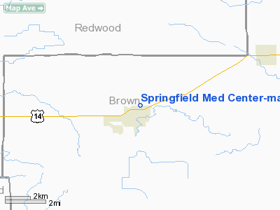
Springfield Med Center - Mayo Health System Heliport |
Location & QuickFacts
| FAA Information Effective: | 2008-09-25 |
| Airport Identifier: | MN70 |
| Airport Status: | Operational |
| Longitude/Latitude: | 094-58-17.9620W/44-14-47.8530N
-94.971656/44.246626 (Estimated) |
| Elevation: | 1075 ft / 327.66 m (Estimated) |
| Land: | 0 acres |
| From nearest city: | 0 nautical miles N of Springfield, MN |
| Location: | Brown County, MN |
| Magnetic Variation: | 05E (1990) |
Owner & Manager
| Ownership: | Publicly owned |
| Owner: | Springfield Hospital |
| Address: | 625 N. Jackson
Springfield, MN 56087 |
| Phone number: | 507-723-6201 |
| Manager: | Greg Smith, Dir Of Env. Services |
| Address: | 625 N Jackson
Springfield, MN 56087 |
| Phone number: | 507-723-7725 |
Airport Operations and Facilities
| Airport Use: | Private
MEDICAL USE. |
| Wind indicator: | Yes |
| Segmented Circle: | No |
| Control Tower: | No |
| Lighting Schedule: | PHONE REQ
FOR ARPT BCN CALL 507-723-6201. |
| Beacon Color: | Clear-Green-Yellow (heliport) |
| Sectional chart: | Twin Cities |
| Region: | AGL - Great Lakes |
| Boundary ARTCC: | ZMP - Minneapolis |
| Tie-in FSS: | PNM - Princeton |
| FSS Toll Free: | 1-800-WX-BRIEF |
Runway Information
Helipad H1
| Dimension: | 50 x 50 ft / 15.2 x 15.2 m |
| Surface: | CONC, Good Condition |
| |
Runway H1 |
Runway |
| Traffic Pattern: | Left | Left |
|
Radio Navigation Aids
| ID |
Type |
Name |
Ch |
Freq |
Var |
Dist |
| MWM | NDB | Windom | | 203.00 | 03E | 21.1 nm |
| JYG | NDB | St James | | 260.00 | 04E | 24.0 nm |
| MJQ | NDB | Jackson | | 353.00 | 04E | 36.0 nm |
| HCD | NDB | Hutchinson | | 209.00 | 04E | 44.5 nm |
| GYL | NDB | Glencoe | | 407.00 | 03E | 49.0 nm |
| ULM | NDB/DME | New Ulm | 050X | 272.00 | 04E | 20.8 nm |
| RWF | VOR/DME | Redwood Falls | 080X | 113.30 | 07E | 14.9 nm |
| MML | VOR/DME | Marshall | 047X | 111.00 | 05E | 38.6 nm |
| FRM | VOR/DME | Fairmont | 039X | 110.20 | 07E | 43.2 nm |
| OTG | VOR/DME | Worthington | 043X | 110.60 | 08E | 44.7 nm |
| MKT | VOR/DME | Mankato | 045X | 110.80 | 07E | 45.6 nm |
Remarks
- PRVDD APCH/DEP RTE OPS FM 360 TO 060 & FM 170 TO 360; ARR/DEP ARE CONDUCTED TO AVOID OPS AT SPRINGFIELD MUNI ARPT WITH TFC PATTERNS N OF HY 14 DURG ARR/DEP; TKOF/LDG AREA MKD; WIND INDICATOR MAINTAINED; & TWO-WAY RADIO COMM ARE ESTABLISHED BTWN HOSP & ACFT PRIOR TO LDG.
Images and information placed above are from
http://www.airport-data.com/airport/MN70/
We thank them for the data!
| General Info
|
| Country |
United States
|
| State |
MINNESOTA
|
| FAA ID |
MN70
|
| Latitude |
44-14-47.853N
|
| Longitude |
094-58-17.962W
|
| Elevation |
1075 feet
|
| Near City |
SPRINGFIELD
|
We don't guarantee the information is fresh and accurate. The data may
be wrong or outdated.
For more up-to-date information please refer to other sources.
|
|


