 |
|
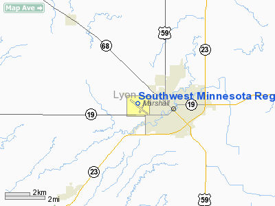
Southwest Minnesota Regional Marshall / Ryan Fld Airport |
| Southwest Minnesota Regional Airport |
| IATA: MML – ICAO: KMML |
| Summary |
| Airport type |
Public |
| Location |
Marshall, Minnesota |
| Elevation AMSL |
1,180 ft / 359.7 m |
| Coordinates |
44°27′01.9190″N 095°49′18.7″W / 44.45053306°N 95.821861°W / 44.45053306; -95.821861Coordinates: 44°27′01.9190″N 095°49′18.7″W / 44.45053306°N 95.821861°W / 44.45053306; -95.821861 |
| Runways |
| Direction |
Length |
Surface |
| ft |
m |
| 12/30 |
7,220 |
2,201 |
Asphalt |
Southwest Minnesota Regional Airport (IATA: MML, ICAO: KMML) is a general aviation airport located 1 mile west of the central business district (CBD) of Marshall, Minnesota, US. It is primarily a general aviation facility, though passenger air service did once exist on Midwest Aviation, also known as Lake State Airways.
The above content comes from Wikipedia and is published under free licenses – click here to read more.
Location & QuickFacts
| FAA Information Effective: | 2008-09-25 |
| Airport Identifier: | MML |
| Airport Status: | Operational |
| Longitude/Latitude: | 095-49-27.9119W/44-27-06.2277N
-95.824420/44.451730 (Estimated) |
| Elevation: | 1183 ft / 360.58 m (Surveyed) |
| Land: | 390 acres |
| From nearest city: | 1 nautical miles W of Marshall, MN |
| Location: | Lyon County, MN |
| Magnetic Variation: | 05E (1995) |
Owner & Manager
| Ownership: | Publicly owned |
| Owner: | City Of Marshall |
| Address: | 344 West Main St
Marshall, MN 56258 |
| Phone number: | 507-537-6760 |
| Manager: | Glenn Olson |
| Address: | 344 W Main Street
Marshall, MN 56258 |
| Phone number: | 507-537-6773 |
Airport Operations and Facilities
| Airport Use: | Open to public |
| Wind indicator: | Yes |
| Segmented Circle: | No |
| Control Tower: | No |
| Lighting Schedule: | DUSK-DAWN
ACTVT MIRL RY 02/20; HIRL RY 12/30; PAPI RYS 02; 20; 12 & 30; REIL RYS 02; 20 & 30; MALSR RY 12 - CTAF. |
| Beacon Color: | Clear-Green (lighted land airport) |
| Landing fee charge: | No |
| Sectional chart: | Omaha |
| Region: | AGL - Great Lakes |
| Boundary ARTCC: | ZMP - Minneapolis |
| Tie-in FSS: | PNM - Princeton |
| FSS on Airport: | No |
| FSS Toll Free: | 1-800-WX-BRIEF |
| NOTAMs Facility: | MML (NOTAM-d service avaliable) |
| Federal Agreements: | NGY |
Airport Communications
| CTAF: | 122.800 |
| Unicom: | 122.800 |
Airport Services
| Fuel available: | 100LLA |
| Airframe Repair: | MAJOR |
| Power Plant Repair: | MAJOR |
| Bottled Oxygen: | NONE |
| Bulk Oxygen: | NONE |
Runway Information
Runway 02/20
| Dimension: | 4000 x 75 ft / 1219.2 x 22.9 m |
| Surface: | ASPH, Good Condition |
| Edge Lights: | Medium |
| |
Runway 02 |
Runway 20 |
| Longitude: | 095-49-20.9332W | 095-48-55.0468W |
| Latitude: | 44-26-45.7312N | 44-27-20.5939N |
| Elevation: | 1180.00 ft | 1172.00 ft |
| Alignment: | 28 | 127 |
| Traffic Pattern: | Left | Left |
| Markings: | Non-precision instrument, Good Condition | Non-precision instrument, Good Condition |
| Crossing Height: | 32.00 ft | 32.00 ft |
| VASI: | 4-light PAPI on left side | 4-light PAPI on left side |
| Visual Glide Angle: | 3.00° | 3.00° |
| Runway End Identifier: | Yes | Yes |
| Centerline Lights: | No | No |
| Touchdown Lights: | No | No |
| Obstruction: | , 50:1 slope to clear | 15 ft road, 650.0 ft from runway, 290 ft right of centerline, 30:1 slope to clear |
|
Runway 12/30
| Dimension: | 7220 x 100 ft / 2200.7 x 30.5 m |
| Surface: | ASPH, Good Condition |
| Weight Limit: | Single wheel: 30000 lbs.
Dual wheel: 45000 lbs. |
| Edge Lights: | High |
| |
Runway 12 |
Runway 30 |
| Longitude: | 095-50-17.1525W | 095-49-00.7963W |
| Latitude: | 44-27-30.8030N | 44-26-45.0600N |
| Elevation: | 1183.00 ft | 1179.00 ft |
| Alignment: | 127 | 127 |
| ILS Type: | ILS
| |
| Traffic Pattern: | Left | Left |
| Markings: | Precision instrument, Good Condition | Precision instrument, Good Condition |
| Crossing Height: | 50.00 ft | 32.00 ft |
| VASI: | 4-light PAPI on left side | 4-light PAPI on left side |
| Visual Glide Angle: | 3.00° | 3.00° |
| Approach lights: | MALSR
MALSR OTS INDEFLY. | |
| Runway End Identifier: | No | Yes |
| Centerline Lights: | No | No |
| Touchdown Lights: | No | No |
| Obstruction: | , 50:1 slope to clear | 52 ft pole, 1520.0 ft from runway, 435 ft right of centerline, 25:1 slope to clear |
|
Radio Navigation Aids
| ID |
Type |
Name |
Ch |
Freq |
Var |
Dist |
| DXX | NDB | Dawson/madison | | 341.00 | 06E | 35.4 nm |
| MWM | NDB | Windom | | 203.00 | 03E | 44.9 nm |
| AQP | NDB | Appleton | | 356.00 | 05E | 47.3 nm |
| PQN | NDB/DME | Pipestone | 028X | 284.00 | 06E | 34.6 nm |
| MML | VOR/DME | Marshall | 047X | 111.00 | 05E | 0.2 nm |
| RWF | VOR/DME | Redwood Falls | 080X | 113.30 | 07E | 29.9 nm |
| MVE | VOR/DME | Montevideo | 053X | 111.60 | 05E | 31.7 nm |
| BKX | VOR/DME | Brookings | 025X | 108.80 | 06E | 43.5 nm |
| OTG | VOR/DME | Worthington | 043X | 110.60 | 08E | 49.5 nm |
| BDH | VOR/DME | Willmar | 84X | 113.70 | 04E | 49.9 nm |
Remarks
- GCO AVBL ON FREQ 121.725 THRU MINNEAPOLIS ARTCC & FLT SVCS.
Images and information placed above are from
http://www.airport-data.com/airport/MML/
We thank them for the data!
| General Info
|
| Country |
United States
|
| State |
MINNESOTA
|
| FAA ID |
MML
|
| Time |
UTC-6(-5DT)
|
| Latitude |
44.450533
44° 27' 01.92" N
|
| Longitude |
-95.821861
095° 49' 18.70" W
|
| Elevation |
1180 feet
360 meters
|
| Type |
Civil
|
| Magnetic Variation |
003° E (02/06)
|
| Beacon |
Yes
|
| Operating Agency |
U.S.CIVIL AIRPORT WHEREIN PERMIT COVERS USE BY TRANSIT MILITARY AIRCRAFT
|
| Near City |
Marshall
|
| Operating Hours |
SEE REMARKS FOR OPERATING HOURS OR COMMUNICATIONS FOR POSSIBLE HOURS
|
| Daylight Saving Time |
Second Sunday in March at 0200 to first Sunday in November at 0200 local time (Exception Arizona and that portion of Indiana in the Eastern Time Zone)
|
We don't guarantee the information is fresh and accurate. The data may
be wrong or outdated.
For more up-to-date information please refer to other sources.
|
|


