 |
|
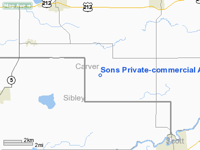
Sons Private-commercial Airport |
Location & QuickFacts
| FAA Information Effective: | 2008-09-25 |
| Airport Identifier: | 47MN |
| Airport Status: | Operational |
| Longitude/Latitude: | 093-52-00.8770W/44-41-59.8650N
-93.866910/44.699962 (Estimated) |
| Elevation: | 1000 ft / 304.80 m (Estimated) |
| Land: | 10 acres |
| From nearest city: | 5 nautical miles SE of Norwood, MN |
| Location: | Carver County, MN |
| Magnetic Variation: | 04E (1985) |
Owner & Manager
| Ownership: | Privately owned |
| Owner: | Thomas Sons |
| Address: |
Norwood, MN 55368 |
| Phone number: | 952-466-5563 |
| Manager: | Thomas Sons |
| Address: |
Norwood, MN 55368 |
| Phone number: | 952-466-5563 |
Airport Operations and Facilities
| Airport Use: | Private |
| Wind indicator: | Yes |
| Segmented Circle: | No |
| Control Tower: | No |
| Landing fee charge: | No |
| Sectional chart: | Twin Cities |
| Region: | AGL - Great Lakes |
| Boundary ARTCC: | ZMP - Minneapolis |
| Tie-in FSS: | PNM - Princeton |
| FSS on Airport: | No |
| FSS Toll Free: | 1-800-WX-BRIEF |
Airport Services
| Airframe Repair: | NONE |
| Power Plant Repair: | NONE |
| Bottled Oxygen: | NONE |
| Bulk Oxygen: | NONE |
Runway Information
Runway 09/27
| Dimension: | 2100 x 115 ft / 640.1 x 35.1 m |
| Surface: | TURF, Good Condition |
| |
Runway 09 |
Runway 27 |
| Traffic Pattern: | Left | Left |
| Runway End Identifier: | No | No |
| Centerline Lights: | No | No |
| Touchdown Lights: | No | No |
| Obstruction: | 70 ft trees, 180.0 ft from runway, 105 ft left of centerline, 2:1 slope to clear
+70' TREES 105' LEFT OF CNTRLN. | 15 ft , 300.0 ft from runway, 20:1 slope to clear
+15' PLINE ON CNTRLN. |
|
Radio Navigation Aids
| ID |
Type |
Name |
Ch |
Freq |
Var |
Dist |
| GYL | NDB | Glencoe | | 407.00 | 03E | 10.0 nm |
| HCD | NDB | Hutchinson | | 209.00 | 04E | 24.0 nm |
| MS | NDB | Narco | | 266.00 | 02E | 34.0 nm |
| ACQ | NDB | Waseca | | 371.00 | 02E | 40.2 nm |
| PPI | NDB | Hopey | | 400.00 | 03E | 40.8 nm |
| ULM | NDB/DME | New Ulm | 050X | 272.00 | 04E | 35.5 nm |
| FCM | VOR/DME | Flying Cloud | 055X | 111.80 | 06E | 19.1 nm |
| MKT | VOR/DME | Mankato | 045X | 110.80 | 07E | 28.9 nm |
| MSP | VOR/DME | Minneapolis | 100X | 115.30 | 02E | 29.4 nm |
| FOW | VOR/DME | Halfway | 049X | 111.20 | 02E | 36.6 nm |
| FGT | VORTAC | Farmington | 104X | 115.70 | 06E | 29.6 nm |
| GEP | VORTAC | Gopher | 120X | 117.30 | 06E | 34.0 nm |
| DWN | VORTAC | Darwin | 027X | 109.00 | 07E | 34.2 nm |
| MSP | VOT | Minneapolis St Paul | | 111.00 | | 29.9 nm |
| STP | VOT | St Paul | | 114.40 | | 37.3 nm |
Remarks
- NO EDGE OR END MARKERS ON RWY 09/27.
Images and information placed above are from
http://www.airport-data.com/airport/47MN/
We thank them for the data!
| General Info
|
| Country |
United States
|
| State |
MINNESOTA
|
| FAA ID |
47MN
|
| Latitude |
44-41-59.865N
|
| Longitude |
093-52-00.877W
|
| Elevation |
1000 feet
|
| Near City |
NORWOOD
|
We don't guarantee the information is fresh and accurate. The data may
be wrong or outdated.
For more up-to-date information please refer to other sources.
|
|


