 |
|
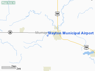
Slayton Municipal Airport |
Location & QuickFacts
| FAA Information Effective: | 2008-09-25 |
| Airport Identifier: | DVP |
| Airport Status: | Operational |
| Longitude/Latitude: | 095-46-57.4000W/43-59-12.4500N
-95.782611/43.986792 (Estimated) |
| Elevation: | 1623 ft / 494.69 m (Estimated) |
| Land: | 54 acres |
| From nearest city: | 1 nautical miles W of Slayton, MN |
| Location: | Murray County, MN |
| Magnetic Variation: | 04E (2000) |
Owner & Manager
| Ownership: | Publicly owned |
| Owner: | City Of Slayton |
| Address: | 2424 26th St
Slayton, MN 56172 |
| Phone number: | 507-836-8534 |
| Manager: | Mike Gillette |
| Address: | 2424 26th St
Slayton, MN 56172 |
| Phone number: | 507-836-8534 |
Airport Operations and Facilities
| Airport Use: | Open to public |
| Wind indicator: | Yes |
| Segmented Circle: | No |
| Control Tower: | No |
| Lighting Schedule: | DUSK-DAWN
ACTVT LIRL RY 17/35, SAVASI RYS 17 & 35, REIL RYS 17 & 35 - CTAF. |
| Beacon Color: | Clear-Green (lighted land airport) |
| Landing fee charge: | No |
| Sectional chart: | Omaha |
| Region: | AGL - Great Lakes |
| Traffic Pattern Alt: | 800 ft |
| Boundary ARTCC: | ZMP - Minneapolis |
| Tie-in FSS: | PNM - Princeton |
| FSS on Airport: | No |
| FSS Toll Free: | 1-800-WX-BRIEF |
| NOTAMs Facility: | DVP (NOTAM-d service avaliable) |
Airport Communications
Airport Services
| Fuel available: | 100LL |
| Bottled Oxygen: | NONE |
| Bulk Oxygen: | NONE |
Runway Information
Runway 17/35
| Dimension: | 3005 x 60 ft / 915.9 x 18.3 m |
| Surface: | ASPH, Good Condition |
| Edge Lights: | Non-standard lighting system
LIRL NSTD SPACING. |
| |
Runway 17 |
Runway 35 |
| Longitude: | 095-46-57.3970W | 095-46-57.3970W |
| Latitude: | 43-59-27.3180N | 43-58-57.6430N |
| Elevation: | 1615.00 ft | 1623.00 ft |
| Alignment: | 127 | 0 |
| Traffic Pattern: | Left | Left |
| Markings: | Non-precision instrument, Good Condition | Non-precision instrument, Good Condition |
| Crossing Height: | 21.00 ft | 21.00 ft |
| VASI: | 2-box SAVASI on left side | 2-box SAVASI on left side |
| Visual Glide Angle: | 3.00° | 3.00° |
| Runway End Identifier: | Yes | Yes |
| Obstruction: | 15 ft road, 201.0 ft from runway, 235 ft right of centerline
+22 FT TREES 770 FT FM RY END L/R 40:1.
RY 17/35 +15 FT ROAD 0-200 FT FM RY END 235 FT L/R. | 15 ft road, 201.0 ft from runway, 235 ft left of centerline
+30 FT POWERLINE 1400 FT FM RY END L/R 40:1. |
|
Radio Navigation Aids
| ID |
Type |
Name |
Ch |
Freq |
Var |
Dist |
| MWM | NDB | Windom | | 203.00 | 03E | 29.5 nm |
| ISB | NDB | Sibley | | 269.00 | 05E | 37.2 nm |
| MJQ | NDB | Jackson | | 353.00 | 04E | 40.1 nm |
| SHL | NDB | Sheldon | | 338.00 | 05E | 46.5 nm |
| PQN | NDB/DME | Pipestone | 028X | 284.00 | 06E | 22.2 nm |
| OTG | VOR/DME | Worthington | 043X | 110.60 | 08E | 22.2 nm |
| MML | VOR/DME | Marshall | 047X | 111.00 | 05E | 27.8 nm |
| RWF | VOR/DME | Redwood Falls | 080X | 113.30 | 07E | 40.4 nm |
| DDL | VOR/DME | Sheldon | 023X | 108.60 | 05E | 46.6 nm |
| BKX | VOR/DME | Brookings | 025X | 108.80 | 06E | 48.4 nm |
| FSD | VORTAC | Sioux Falls | 097X | 115.00 | 09E | 47.8 nm |
Images and information placed above are from
http://www.airport-data.com/airport/DVP/
We thank them for the data!
| General Info
|
| Country |
United States
|
| State |
MINNESOTA
|
| FAA ID |
DVP
|
| Latitude |
43-59-12.450N
|
| Longitude |
095-46-57.400W
|
| Elevation |
1623 feet
|
| Near City |
SLAYTON
|
We don't guarantee the information is fresh and accurate. The data may
be wrong or outdated.
For more up-to-date information please refer to other sources.
|
|


