 |
|
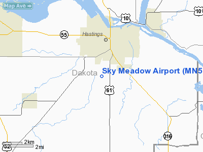
Location & QuickFacts
| FAA Information Effective: | 2008-09-25 |
| Airport Identifier: | MN58 |
| Airport Status: | Operational |
| Longitude/Latitude: | 092-51-50.7390W/44-41-51.8820N
-92.864094/44.697745 (Estimated) |
| Elevation: | 820 ft / 249.94 m (Surveyed) |
| Land: | 0 acres |
| From nearest city: | 3 nautical miles S of Hastings, MN |
| Location: | Dakota County, MN |
| Magnetic Variation: | 03E (1985) |
Owner & Manager
| Ownership: | Privately owned |
| Owner: | Robert W. Weber |
| Address: | 17238 Knox Path E
Hastings, MN 55033 |
| Phone number: | 612-437-5769 |
| Address: |
|
Airport Operations and Facilities
| Airport Use: | Private |
| Wind indicator: | Yes |
| Segmented Circle: | No |
| Control Tower: | No |
| Lighting Schedule: | DUSK-2400 |
| Landing fee charge: | No |
| Sectional chart: | Green Bay |
| Region: | AGL - Great Lakes |
| Boundary ARTCC: | ZMP - Minneapolis |
| Tie-in FSS: | PNM - Princeton |
| FSS on Airport: | No |
| FSS Toll Free: | 1-800-WX-BRIEF |
Airport Services
| Airframe Repair: | NONE |
| Power Plant Repair: | NONE |
Runway Information
Runway 18/36
| Dimension: | 2300 x 125 ft / 701.0 x 38.1 m |
| Surface: | TURF, |
| Edge Lights: | Low |
| |
Runway 18 |
Runway 36 |
| Traffic Pattern: | Left | Left |
|
Radio Navigation Aids
| ID |
Type |
Name |
Ch |
Freq |
Var |
Dist |
| PPI | NDB | Hopey | | 400.00 | 03E | 11.1 nm |
| MS | NDB | Narco | | 266.00 | 02E | 12.4 nm |
| RNH | NDB | New Richmond | | 257.00 | 02E | 30.5 nm |
| OEO | NDB | Osceola | | 233.00 | 01E | 37.6 nm |
| AHH | NDB | Ameron | | 278.00 | 01E | 40.9 nm |
| ACQ | NDB | Waseca | | 371.00 | 02E | 47.9 nm |
| MSP | VOR/DME | Minneapolis | 100X | 115.30 | 02E | 19.9 nm |
| FCM | VOR/DME | Flying Cloud | 055X | 111.80 | 06E | 26.4 nm |
| FOW | VOR/DME | Halfway | 049X | 111.20 | 02E | 36.8 nm |
| FGT | VORTAC | Farmington | 104X | 115.70 | 06E | 14.2 nm |
| GEP | VORTAC | Gopher | 120X | 117.30 | 06E | 34.6 nm |
| STP | VOT | St Paul | | 114.40 | | 16.8 nm |
| MSP | VOT | Minneapolis St Paul | | 111.00 | | 18.7 nm |
Images and information placed above are from
http://www.airport-data.com/airport/MN58/
We thank them for the data!
| General Info
|
| Country |
United States
|
| State |
MINNESOTA
|
| FAA ID |
MN58
|
| Latitude |
44-41-51.882N
|
| Longitude |
092-51-50.739W
|
| Elevation |
820 feet
|
| Near City |
HASTINGS
|
We don't guarantee the information is fresh and accurate. The data may
be wrong or outdated.
For more up-to-date information please refer to other sources.
|
|


