 |
|
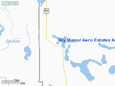
Sky Manor Aero Estates Airport |
Location & QuickFacts
| FAA Information Effective: | 2008-09-25 |
| Airport Identifier: | MN86 |
| Airport Status: | Operational |
| Longitude/Latitude: | 095-07-21.0750W/47-02-44.8520N
-95.122521/47.045792 (Estimated) |
| Elevation: | 1492 ft / 454.76 m (Surveyed) |
| Land: | 0 acres |
| From nearest city: | 8 nautical miles NW of Park Rapids, MN |
| Location: | Hubbard County, MN |
| Magnetic Variation: | 04E (1985) |
Owner & Manager
| Ownership: | Privately owned |
| Owner: | Sky Manor Aero Estates Inc |
| Address: | 26720 Island Air Drive
Park Rapids, MN 56470 |
| Phone number: | 952-432-4195
THIS IS THE AMGR PHONE DURING THE WINTER MONTHS NOVEMBER TO MARCH. |
| Manager: | Sanford B. Berg |
| Address: | 26720 Island Air Drive
Park Rapids, MN 56470 |
| Phone number: | 218-732-1941
THIS IS THE AMGR PHONE DURING THE SUMMER MONTHS APRIL TO OCTOBER. |
Airport Operations and Facilities
| Airport Use: | Private |
| Wind indicator: | Yes |
| Segmented Circle: | No |
| Control Tower: | No |
| Landing fee charge: | No |
| Sectional chart: | Twin Cities |
| Region: | AGL - Great Lakes |
| Boundary ARTCC: | ZMP - Minneapolis |
| Tie-in FSS: | PNM - Princeton |
| FSS on Airport: | No |
| FSS Toll Free: | 1-800-WX-BRIEF |
Airport Services
| Airframe Repair: | NONE |
| Power Plant Repair: | NONE |
Runway Information
Runway 01/19
| Dimension: | 2775 x 150 ft / 845.8 x 45.7 m |
| Surface: | TURF, |
| |
Runway 01 |
Runway 19 |
| Traffic Pattern: | Left | Left |
|
Runway 13/31
| Dimension: | 3200 x 200 ft / 975.4 x 61.0 m |
| Surface: | TURF, |
| |
Runway 13 |
Runway 31 |
| Traffic Pattern: | Left | Left |
|
Radio Navigation Aids
| ID |
Type |
Name |
Ch |
Freq |
Var |
Dist |
| PK | NDB | Spida | | 269.00 | 04E | 14.1 nm |
| PWC | NDB | Pine River | | 330.00 | 03E | 35.9 nm |
| XVG | NDB | Longville | | 392.00 | 04E | 37.7 nm |
| SAZ | NDB | Staples | | 257.00 | 04E | 42.0 nm |
| FSE | NDB | Fosston | | 224.00 | 05E | 42.0 nm |
| PKD | VOR/DME | Park Rapids | 043X | 110.60 | 04E | 9.1 nm |
| DTL | VOR/DME | Detroit Lakes | 049X | 111.20 | 05E | 34.1 nm |
| BJI | VORTAC | Bemidji | 023X | 108.60 | 04E | 32.1 nm |
Remarks
- NOT FOR GEN USE. IS MAINT FOR USE OF SKY MANOR HOMESITE OWNERS AND THEIR GUESTS.
Images and information placed above are from
http://www.airport-data.com/airport/MN86/
We thank them for the data!
| General Info
|
| Country |
United States
|
| State |
MINNESOTA
|
| FAA ID |
MN86
|
| Latitude |
47-02-44.852N
|
| Longitude |
095-07-21.075W
|
| Elevation |
1492 feet
|
| Near City |
PARK RAPIDS
|
We don't guarantee the information is fresh and accurate. The data may
be wrong or outdated.
For more up-to-date information please refer to other sources.
|
|


