|
|
|
 |
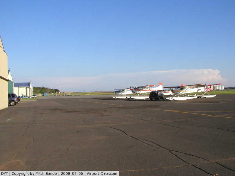
(Click on the photo to enlarge) |
|
 |
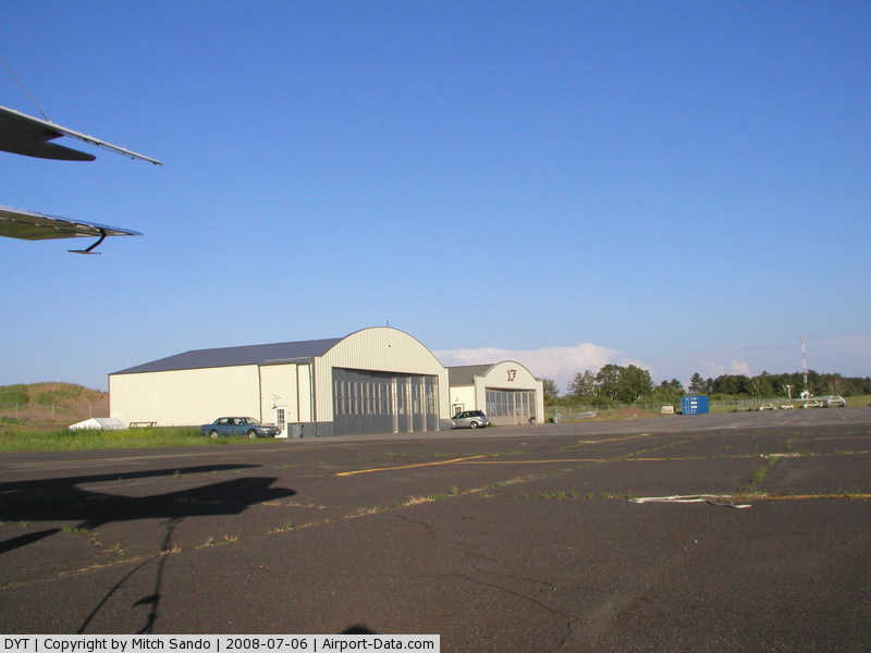
(Click on the photo to enlarge) |
|
 |
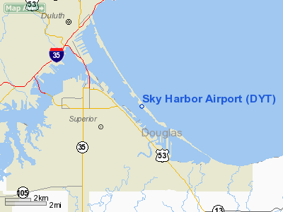
(Click on the photo to enlarge) |
|
 |
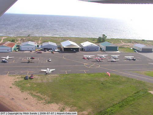
(Click on the photo to enlarge) |
|
 |
(Click on the photo to enlarge) |
|
 |
(Click on the photo to enlarge) |
|
 |
(Click on the photo to enlarge) |
|
 |
(Click on the photo to enlarge) |
|
 |
(Click on the photo to enlarge) |
Location & QuickFacts
| FAA Information Effective: | 2008-09-25 |
| Airport Identifier: | DYT |
| Airport Status: | Operational |
| Longitude/Latitude: | 092-02-36.3800W/46-43-18.6990N
-92.043439/46.721861 (Estimated) |
| Elevation: | 610 ft / 185.93 m (Surveyed) |
| Land: | 70 acres |
| From nearest city: | 6 nautical miles SE of Duluth, MN |
| Location: | St Louis County, MN |
| Magnetic Variation: | 01E (1995) |
Owner & Manager
| Ownership: | Publicly owned |
| Owner: | Duluth Arpt Authority |
| Address: | Duluth Intl Arpt, 4701 Grinden Drive
Duluth, MN 55811 |
| Phone number: | 218-727-2968 |
| Manager: | Brian Grefe |
| Address: | Duluth Arpt Authority, 4701 Airport Drive
Duluth, MN 55811 |
| Phone number: | 218-727-2968 |
Airport Operations and Facilities
| Airport Use: | Open to public |
| Wind indicator: | Yes |
| Segmented Circle: | No |
| Control Tower: | No |
| Lighting Schedule: | DUSK-DAWN
ACTVT MIRL RY 14/32 PAPI RYS 14 & 32 & REIL RYS 14 & 32 - CTAF |
| Beacon Color: | Clear-Green (lighted land airport) |
| Landing fee charge: | No |
| Sectional chart: | Green Bay |
| Region: | AGL - Great Lakes |
| Boundary ARTCC: | ZMP - Minneapolis |
| Tie-in FSS: | PNM - Princeton |
| FSS on Airport: | No |
| FSS Toll Free: | 1-800-WX-BRIEF |
| NOTAMs Facility: | DYT (NOTAM-d service avaliable) |
| Federal Agreements: | NGY |
Airport Communications
| CTAF: | 122.700 |
| Unicom: | 122.700 |
Airport Services
| Fuel available: | 100LL
FUEL AVAIL 24 HRS WITH CREDIT CARD. |
| Airframe Repair: | MAJOR |
| Power Plant Repair: | MAJOR |
| Bottled Oxygen: | NONE |
| Bulk Oxygen: | NONE |
Runway Information
Runway 09W/27W
| Dimension: | 5000 x 1500 ft / 1524.0 x 457.2 m |
| Surface: | WATER, |
| |
Runway 09W |
Runway 27W |
| Traffic Pattern: | Left | Left |
|
Runway 13W/31W
| Dimension: | 10000 x 2000 ft / 3048.0 x 609.6 m |
| Surface: | WATER, |
| |
Runway 13W |
Runway 31W |
| Traffic Pattern: | Left | Left |
|
Runway 14/32
| Dimension: | 3050 x 75 ft / 929.6 x 22.9 m |
| Surface: | ASPH, Good Condition |
| Edge Lights: | Medium |
| |
Runway 14 |
Runway 32 |
| Longitude: | 092-02-50.9463W | 092-02-21.8122W |
| Latitude: | 46-43-29.9298N | 46-43-07.4764N |
| Elevation: | 605.00 ft | 607.00 ft |
| Alignment: | 127 | 127 |
| Traffic Pattern: | Left | Left |
| Markings: | Non-precision instrument, Good Condition | Non-precision instrument, Good Condition |
| Crossing Height: | 24.00 ft | 25.00 ft |
| VASI: | 4-light PAPI on left side | 4-light PAPI on left side |
| Visual Glide Angle: | 4.00° | 4.00° |
| Runway End Identifier: | Yes | Yes |
| Centerline Lights: | No | No |
| Touchdown Lights: | No | No |
| Obstruction: | 55 ft trees, 1850.0 ft from runway, 30:1 slope to clear | 15 ft trees, 220.0 ft from runway, 200 ft right of centerline, 1:1 slope to clear
TREES +57, 950 FM END, 250R LIGHTED.
TREES +30, 75 TO 100 FM RWY END, 200R. |
|
Radio Navigation Aids
| ID |
Type |
Name |
Ch |
Freq |
Var |
Dist |
| SUW | NDB | Bong | | 260.00 | 01E | 3.1 nm |
| DL | NDB | Pykla | | 379.00 | 02E | 14.8 nm |
| COQ | NDB | Cloquet | | 335.00 | 03E | 19.0 nm |
| TWM | NDB | Two Harbors | | 243.00 | 01E | 23.3 nm |
| OLG | NDB | Solon Springs | | 388.00 | 01E | 26.1 nm |
| MZH | NDB | Moose Lake | | 362.00 | 02E | 36.4 nm |
| BFW | NDB | Silver Bay | | 350.00 | 00E | 40.9 nm |
| SLY | NDB | Seeley | | 344.00 | 01E | 45.7 nm |
| ENY | NDB | Kennedy | | 254.00 | 02E | 47.7 nm |
| LKI | TACAN | Lakeside | 011X | | 05E | 9.4 nm |
| HIB | VOR/DME | Hibbing | 045X | 110.80 | 02E | 44.1 nm |
| EVM | VOR/DME | Eveleth | 019X | 108.20 | 01E | 46.0 nm |
| ASX | VOR/DME | Ashland | 039X | 110.20 | 02E | 47.6 nm |
| HYR | VOR/DME | Hayward | 081X | 113.40 | 03E | 49.0 nm |
| DLH | VORTAC | Duluth | 073X | 112.60 | 05E | 8.1 nm |
Remarks
- FOR SEA PLANE OPS BE ALERT FOR EXTSV WATER SPORT ACTIVITIES IN LAKE SUPERIOR BAY.
- TREES OBSCURING AER 32.
- RY 12 TREE +90 FT, 2200 FT FM AER 12.
- BE ALERT: EXTENSIVE ACFT ACTIVITY INVOF RICHARD I. BONG ARPT 2 MI SW.
- RY 32 TREES +57 FT, 950 FT FM END, 180 R, LGTD.
- WIND SURFING ACTIVITY IN VICINITY OF SEALANES MAY THRU SEPT.
- BIRDS ON AND INVOF ARPT.
Images and information placed above are from
http://www.airport-data.com/airport/DYT/
We thank them for the data!
| General Info
|
| Country |
United States
|
| State |
MINNESOTA
|
| FAA ID |
DYT
|
| Latitude |
46.721861
46° 43' 18.70" N
|
| Longitude |
-92.043439
092° 02' 36.38" W
|
| Elevation |
610 feet
186 meters
|
| Magnetic Variation |
000° W (01/06)
|
| Beacon |
Yes
|
| Operating Agency |
U.S.CIVIL AIRPORT WHEREIN PERMIT COVERS USE BY TRANSIT MILITARY AIRCRAFT
|
| Daylight Saving Time |
Second Sunday in March at 0200 to first Sunday in November at 0200 local time (Exception Arizona and that portion of Indiana in the Eastern Time Zone)
|
We don't guarantee the information is fresh and accurate. The data may
be wrong or outdated.
For more up-to-date information please refer to other sources.
|
|