 |
|
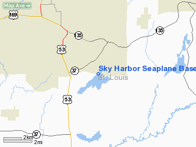
Sky Harbor Seaplane Base (9Y5) |
Location & QuickFacts
| FAA Information Effective: | 2008-09-25 |
| Airport Identifier: | 9Y5 |
| Airport Status: | Operational |
| Longitude/Latitude: | 092-28-35.6620W/47-27-34.7380N
-92.476573/47.459649 (Estimated) |
| Elevation: | 1376 ft / 419.40 m (Estimated) |
| Land: | 25 acres |
| From nearest city: | 2 nautical miles SE of Eveleth, MN |
| Location: | St Louis County, MN |
| Magnetic Variation: | 02E (1985) |
Owner & Manager
| Ownership: | Privately owned |
| Owner: | Peter J. Johnson-jim Rhude |
| Address: | Rr 1, Box 267
Britt, MN 55701
JIM RHUDE'S ADDRESS: 2200 E 41ST ST; HIBBING MN 55746. |
| Phone number: | 218-741-3280 |
| Manager: | Dave Serena |
| Address: | 3503 Ely Lake Drive
Eveleth, MN 55734 |
| Phone number: | 218-744-4104 |
Airport Operations and Facilities
| Airport Use: | Open to public |
| Wind indicator: | Yes |
| Segmented Circle: | No |
| Control Tower: | No |
| Landing fee charge: | No |
| Sectional chart: | Green Bay |
| Region: | AGL - Great Lakes |
| Boundary ARTCC: | ZMP - Minneapolis |
| Tie-in FSS: | PNM - Princeton |
| FSS on Airport: | No |
| FSS Toll Free: | 1-800-WX-BRIEF |
| NOTAMs Facility: | PNM (NOTAM-d service avaliable) |
Airport Communications
Airport Services
| Fuel available: | 100LL |
| Airframe Repair: | MAJOR |
| Power Plant Repair: | MAJOR |
| Bottled Oxygen: | NONE |
| Bulk Oxygen: | NONE |
Runway Information
Runway 03/21
| Dimension: | 6500 x 1000 ft / 1981.2 x 304.8 m |
| Surface: | WATER, |
| |
Runway 03 |
Runway 21 |
| Traffic Pattern: | Left | Left |
|
Runway 07/25
| Dimension: | 6500 x 1000 ft / 1981.2 x 304.8 m |
| Surface: | WATER, |
| |
Runway 07 |
Runway 25 |
| Traffic Pattern: | Left | Left |
|
Runway 14/32
| Dimension: | 4500 x 1000 ft / 1371.6 x 304.8 m |
| Surface: | WATER, |
| |
Runway 14 |
Runway 32 |
| Traffic Pattern: | Left | Left |
|
Radio Navigation Aids
| ID |
Type |
Name |
Ch |
Freq |
Var |
Dist |
| CQM | NDB | Cook | | 233.00 | 01E | 23.4 nm |
| ORB | NDB | Orr | | 341.00 | 02E | 37.0 nm |
| DL | NDB | Pykla | | 379.00 | 02E | 37.2 nm |
| TWM | NDB | Two Harbors | | 243.00 | 01E | 38.6 nm |
| BFW | NDB | Silver Bay | | 350.00 | 00E | 45.1 nm |
| COQ | NDB | Cloquet | | 335.00 | 03E | 45.8 nm |
| SCG | NDB | Scott | | 385.00 | 02E | 48.1 nm |
| SUW | NDB | Bong | | 260.00 | 01E | 48.6 nm |
| LKI | TACAN | Lakeside | 011X | | 05E | 38.8 nm |
| EVM | VOR/DME | Eveleth | 019X | 108.20 | 01E | 2.4 nm |
| HIB | VOR/DME | Hibbing | 045X | 110.80 | 02E | 13.3 nm |
| ELO | VOR/DME | Ely | 033X | 109.60 | 00E | 34.0 nm |
| GPZ | VOR/DME | Grand Rapids | 051X | 111.40 | 06E | 44.9 nm |
| DLH | VORTAC | Duluth | 073X | 112.60 | 05E | 41.1 nm |
Remarks
- A ROCK REEF LAYS FROM THE SOUTHWEST TIP OF ISLAND IN CENTER OF THE LAKE WESTWARD TO SHORELINE.
Images and information placed above are from
http://www.airport-data.com/airport/9Y5/
We thank them for the data!
| General Info
|
| Country |
United States
|
| State |
MINNESOTA
|
| FAA ID |
9Y5
|
| Latitude |
47-27-34.738N
|
| Longitude |
092-28-35.662W
|
| Elevation |
1376 feet
|
| Near City |
EVELETH
|
We don't guarantee the information is fresh and accurate. The data may
be wrong or outdated.
For more up-to-date information please refer to other sources.
|
|


