 |
|
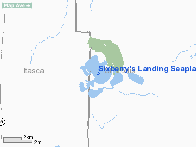
Sixberry's Landing Seaplane Base |
Location & QuickFacts
| FAA Information Effective: | 2008-09-25 |
| Airport Identifier: | 11MN |
| Airport Status: | Operational |
| Longitude/Latitude: | 093-02-53.6610W/47-40-39.7450N
-93.048239/47.677707 (Estimated) |
| Elevation: | 1372 ft / 418.19 m (Estimated) |
| Land: | 0 acres |
| From nearest city: | 15 nautical miles N of Chisholm, MN |
| Location: | Itasca County, MN |
| Magnetic Variation: | 02E (1990) |
Owner & Manager
| Ownership: | Privately owned |
| Owner: | Edward E. Sixberry |
| Address: | Po Box 123
Side Lake, MN 55781 |
| Phone number: | 218-254-5309 |
| Manager: | Edward E. Sixberry |
| Address: | Po Box 123
Side Lake, MN 55781 |
| Phone number: | 218-254-5309 |
Airport Operations and Facilities
| Airport Use: | Private |
| Wind indicator: | Yes |
| Segmented Circle: | No |
| Control Tower: | No |
| Sectional chart: | Twin Cities |
| Region: | AGL - Great Lakes |
| Boundary ARTCC: | ZMP - Minneapolis |
| Tie-in FSS: | PNM - Princeton |
| FSS on Airport: | No |
| FSS Toll Free: | 1-800-WX-BRIEF |
Runway Information
Runway 06/24
| Dimension: | 10560 x 600 ft / 3218.7 x 182.9 m |
| Surface: | WATER, |
| |
Runway 06 |
Runway 24 |
| Traffic Pattern: | Left | Left |
|
Runway 15/33
| Dimension: | 11616 x 600 ft / 3540.6 x 182.9 m |
| Surface: | WATER, |
| |
Runway 15 |
Runway 33 |
| Traffic Pattern: | Left | Left |
|
Radio Navigation Aids
| ID |
Type |
Name |
Ch |
Freq |
Var |
Dist |
| CQM | NDB | Cook | | 233.00 | 01E | 16.8 nm |
| ORB | NDB | Orr | | 341.00 | 02E | 21.8 nm |
| FOZ | NDB | Bigfork | | 345.00 | 02E | 25.3 nm |
| SCG | NDB | Scott | | 385.00 | 02E | 41.9 nm |
| IN | NDB | Raize | | 353.00 | 06E | 49.2 nm |
| HIB | VOR/DME | Hibbing | 045X | 110.80 | 02E | 26.6 nm |
| EVM | VOR/DME | Eveleth | 019X | 108.20 | 01E | 27.1 nm |
| GPZ | VOR/DME | Grand Rapids | 051X | 111.40 | 06E | 35.7 nm |
| ELO | VOR/DME | Ely | 033X | 109.60 | 00E | 50.0 nm |
Remarks
- A MINIMUM 20:1 APCH CLEARANCE OVER OBSTRUCTION MUST BE PROVIDED; REFERENCE FAR 91.115.
Images and information placed above are from
http://www.airport-data.com/airport/11MN/
We thank them for the data!
| General Info
|
| Country |
United States
|
| State |
MINNESOTA
|
| FAA ID |
11MN
|
| Latitude |
47-40-39.745N
|
| Longitude |
093-02-53.661W
|
| Elevation |
1372 feet
|
| Near City |
CHISHOLM
|
We don't guarantee the information is fresh and accurate. The data may
be wrong or outdated.
For more up-to-date information please refer to other sources.
|
|


