 |
|
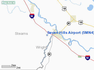
Location & QuickFacts
| FAA Information Effective: | 2008-09-25 |
| Airport Identifier: | 5MN4 |
| Airport Status: | Operational |
| Longitude/Latitude: | 094-04-35.9420W/45-24-45.0750N
-94.076651/45.412521 (Estimated) |
| Elevation: | 1010 ft / 307.85 m (Estimated) |
| Land: | 8 acres |
| From nearest city: | 2 nautical miles W of Clearwater, MN |
| Location: | Stevens County, MN |
| Magnetic Variation: | 03E (1995) |
Owner & Manager
| Ownership: | Privately owned |
| Owner: | Dennis Nemeth |
| Address: | 1702 200th St East
Clearwater, MN 55320 |
| Phone number: | 320-558-2278 |
| Manager: | Dennis Nemeth |
| Address: | 1702 200th St East
Clearwater, MN 55320 |
| Phone number: | 320-558-2278 |
Airport Operations and Facilities
| Airport Use: | Private |
| Wind indicator: | Yes |
| Segmented Circle: | No |
| Control Tower: | No |
| Sectional chart: | Twin Cities |
| Region: | AGL - Great Lakes |
| Boundary ARTCC: | ZMP - Minneapolis |
| Tie-in FSS: | PNM - Princeton |
| FSS Toll Free: | 1-800-WX-BRIEF |
Runway Information
Runway 09/27
| Dimension: | 2100 x 25 ft / 640.1 x 7.6 m |
| Surface: | TURF, |
| |
Runway 09 |
Runway 27 |
| Traffic Pattern: | Left | Left |
|
Radio Navigation Aids
| ID |
Type |
Name |
Ch |
Freq |
Var |
Dist |
| PNM | NDB | Princeton | | 368.00 | 03E | 21.8 nm |
| LXL | NDB | Little Falls | | 359.00 | 03E | 34.2 nm |
| CBG | NDB | Cambridge | | 350.00 | 03E | 35.4 nm |
| HCD | NDB | Hutchinson | | 209.00 | 04E | 35.8 nm |
| GYL | NDB | Glencoe | | 407.00 | 03E | 39.2 nm |
| XCR | NDB | Ripley | | 404.00 | 03E | 41.6 nm |
| JMR | NDB | Mora | | 327.00 | 03E | 44.5 nm |
| RYM | TACAN | Camp Ripley | 048X | | 03E | 42.4 nm |
| STC | VOR/DME | St Cloud | 058X | 112.10 | 03E | 8.3 nm |
| FCM | VOR/DME | Flying Cloud | 055X | 111.80 | 06E | 44.0 nm |
| ILL | VOR/DME | Willmar | 084X | 113.70 | 04E | 46.4 nm |
| MSP | VOR/DME | Minneapolis | 100X | 115.30 | 02E | 47.2 nm |
| BDH | VOR/DME | Willmar | 84X | 113.70 | 04E | 47.8 nm |
| DWN | VORTAC | Darwin | 027X | 109.00 | 07E | 25.2 nm |
| GEP | VORTAC | Gopher | 120X | 117.30 | 06E | 33.8 nm |
| MSP | VOT | Minneapolis St Paul | | 111.00 | | 48.4 nm |
Remarks
- PRVDD CLEAR 20:1 APCHS, CLEAR WY SAFETY AREA & CLEAR OBSTACLE FREE ZONE.
Images and information placed above are from
http://www.airport-data.com/airport/5MN4/
We thank them for the data!
| General Info
|
| Country |
United States
|
| State |
MINNESOTA
|
| FAA ID |
5MN4
|
| Latitude |
45-24-45.075N
|
| Longitude |
094-04-35.942W
|
| Elevation |
1010 feet
|
| Near City |
CLEARWATER
|
We don't guarantee the information is fresh and accurate. The data may
be wrong or outdated.
For more up-to-date information please refer to other sources.
|
|


