 |
|
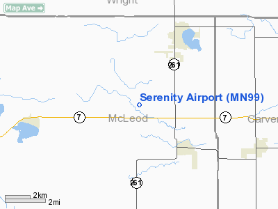
Location & QuickFacts
| FAA Information Effective: | 2008-09-25 |
| Airport Identifier: | MN99 |
| Airport Status: | Operational |
| Longitude/Latitude: | 094-05-20.0000W/44-54-56.0000N
-94.088889/44.915556 (Estimated) |
| Elevation: | 1050 ft / 320.04 m (Estimated) |
| Land: | 0 acres |
| From nearest city: | 3 nautical miles NW of Lester Prairie, MN |
| Location: | Mc Leod County, MN |
| Magnetic Variation: | 03E (2000) |
Owner & Manager
| Ownership: | Privately owned |
| Owner: | Camon E. Simon |
| Address: | 20714 Dairy Ave
Lester Prairie, MN 55354 |
| Phone number: | 320-395-5443 |
| Manager: | Camon E. Simon |
| Address: | 20714 Dairy Ave.
Lester Prairie, MN 55354 |
| Phone number: | 320-395-5443 |
Airport Operations and Facilities
| Airport Use: | Private |
| Wind indicator: | Yes |
| Segmented Circle: | No |
| Control Tower: | No |
| Sectional chart: | Twin Cities |
| Region: | AGL - Great Lakes |
| Boundary ARTCC: | ZMP - Minneapolis |
| Tie-in FSS: | PNM - Princeton |
| FSS Toll Free: | 1-800-WX-BRIEF |
Runway Information
Runway 09/27
| Dimension: | 2046 x 75 ft / 623.6 x 22.9 m |
| Surface: | TURF, |
| |
Runway 09 |
Runway 27 |
| Traffic Pattern: | Left | Left |
| Obstruction: | 15 ft pline, 330.0 ft from runway | |
|
Radio Navigation Aids
| ID |
Type |
Name |
Ch |
Freq |
Var |
Dist |
| GYL | NDB | Glencoe | | 407.00 | 03E | 9.3 nm |
| HCD | NDB | Hutchinson | | 209.00 | 04E | 13.0 nm |
| MS | NDB | Narco | | 266.00 | 02E | 42.8 nm |
| PNM | NDB | Princeton | | 368.00 | 03E | 44.0 nm |
| PPI | NDB | Hopey | | 400.00 | 03E | 48.9 nm |
| ULM | NDB/DME | New Ulm | 050X | 272.00 | 04E | 40.0 nm |
| FCM | VOR/DME | Flying Cloud | 055X | 111.80 | 06E | 27.5 nm |
| MSP | VOR/DME | Minneapolis | 100X | 115.30 | 02E | 36.3 nm |
| STC | VOR/DME | St Cloud | 058X | 112.10 | 03E | 38.1 nm |
| MKT | VOR/DME | Mankato | 045X | 110.80 | 07E | 42.5 nm |
| ILL | VOR/DME | Willmar | 084X | 113.70 | 04E | 44.3 nm |
| BDH | VOR/DME | Willmar | 84X | 113.70 | 04E | 45.8 nm |
| DWN | VORTAC | Darwin | 027X | 109.00 | 07E | 18.6 nm |
| GEP | VORTAC | Gopher | 120X | 117.30 | 06E | 33.4 nm |
| FGT | VORTAC | Farmington | 104X | 115.70 | 06E | 42.3 nm |
| MSP | VOT | Minneapolis St Paul | | 111.00 | | 37.3 nm |
| STP | VOT | St Paul | | 114.40 | | 43.8 nm |
Remarks
- 500 FT RADIO ANTENNA 6 MILES WEST OF ARPT.
- PROVIDED CLEAR 20:1 APPROACHES, CLEAR OBSTACLE FREE ZONE, AND CLEAR RUNWAY SAFETY AREA.
Images and information placed above are from
http://www.airport-data.com/airport/MN99/
We thank them for the data!
| General Info
|
| Country |
United States
|
| State |
MINNESOTA
|
| FAA ID |
MN99
|
| Latitude |
44-54-56.000N
|
| Longitude |
094-05-20.000W
|
| Elevation |
1050 feet
|
| Near City |
LESTER PRAIRIE
|
We don't guarantee the information is fresh and accurate. The data may
be wrong or outdated.
For more up-to-date information please refer to other sources.
|
|


