 |
|
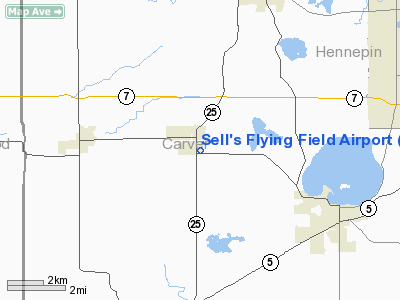
Sell's Flying Field Airport |
Location & QuickFacts
| FAA Information Effective: | 2008-09-25 |
| Airport Identifier: | 54MN |
| Airport Status: | Operational |
| Longitude/Latitude: | 093-53-07.8820W/44-52-44.8650N
-93.885523/44.879129 (Estimated) |
| Elevation: | 980 ft / 298.70 m (Estimated) |
| Land: | 0 acres |
| From nearest city: | 0 nautical miles S of Mayer, MN |
| Location: | Carver County, MN |
| Magnetic Variation: | 04E (1985) |
Owner & Manager
| Ownership: | Privately owned |
| Owner: | Charles A. Sell |
| Address: | 45 Woodhill Road
St Cloud, MN 56301 |
| Phone number: | 612-252-4819 |
| Manager: | Charles A. Sell |
| Address: | 45 Woodhill Road
St Cloud, MN 56301 |
| Phone number: | 612-252-4819 |
Airport Operations and Facilities
| Airport Use: | Private |
| Segmented Circle: | No |
| Control Tower: | No |
| Sectional chart: | Twin Cities |
| Region: | AGL - Great Lakes |
| Boundary ARTCC: | ZMP - Minneapolis |
| Tie-in FSS: | PNM - Princeton |
| FSS on Airport: | No |
| FSS Toll Free: | 1-800-WX-BRIEF |
Runway Information
Runway N/S
| Dimension: | 1200 x 50 ft / 365.8 x 15.2 m |
| Surface: | TURF, |
| |
Runway N |
Runway S |
| Traffic Pattern: | Left | Left |
|
Radio Navigation Aids
| ID |
Type |
Name |
Ch |
Freq |
Var |
Dist |
| GYL | NDB | Glencoe | | 407.00 | 03E | 11.1 nm |
| HCD | NDB | Hutchinson | | 209.00 | 04E | 21.2 nm |
| MS | NDB | Narco | | 266.00 | 02E | 34.0 nm |
| PPI | NDB | Hopey | | 400.00 | 03E | 40.2 nm |
| PNM | NDB | Princeton | | 368.00 | 03E | 42.9 nm |
| CBG | NDB | Cambridge | | 350.00 | 03E | 48.6 nm |
| ULM | NDB/DME | New Ulm | 050X | 272.00 | 04E | 42.7 nm |
| FCM | VOR/DME | Flying Cloud | 055X | 111.80 | 06E | 18.6 nm |
| MSP | VOR/DME | Minneapolis | 100X | 115.30 | 02E | 27.7 nm |
| MKT | VOR/DME | Mankato | 045X | 110.80 | 07E | 39.6 nm |
| STC | VOR/DME | St Cloud | 058X | 112.10 | 03E | 40.9 nm |
| FOW | VOR/DME | Halfway | 049X | 111.20 | 02E | 46.2 nm |
| GEP | VORTAC | Gopher | 120X | 117.30 | 06E | 27.0 nm |
| DWN | VORTAC | Darwin | 027X | 109.00 | 07E | 27.2 nm |
| FGT | VORTAC | Farmington | 104X | 115.70 | 06E | 33.5 nm |
| MSP | VOT | Minneapolis St Paul | | 111.00 | | 28.6 nm |
| STP | VOT | St Paul | | 114.40 | | 35.4 nm |
Remarks
- FILED FOR RECORD PURPOSES ONLY.
Images and information placed above are from
http://www.airport-data.com/airport/54MN/
We thank them for the data!
| General Info
|
| Country |
United States
|
| State |
MINNESOTA
|
| FAA ID |
54MN
|
| Latitude |
44-52-44.865N
|
| Longitude |
093-53-07.882W
|
| Elevation |
980 feet
|
| Near City |
MAYER
|
We don't guarantee the information is fresh and accurate. The data may
be wrong or outdated.
For more up-to-date information please refer to other sources.
|
|


