 |
|
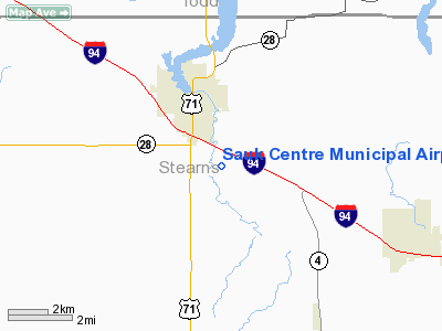
Sauk Centre Municipal Airport |
Location & QuickFacts
| FAA Information Effective: | 2008-09-25 |
| Airport Identifier: | D39 |
| Airport Status: | Operational |
| Longitude/Latitude: | 094-56-00.2310W/45-42-23.6240N
-94.933398/45.706562 (Estimated) |
| Elevation: | 1244 ft / 379.17 m (Surveyed) |
| Land: | 160 acres |
| From nearest city: | 2 nautical miles SE of Sauk Centre, MN |
| Location: | Stearns County, MN |
| Magnetic Variation: | 03E (2000) |
Owner & Manager
| Ownership: | Publicly owned |
| Owner: | City Of Sauk Centre |
| Address: | 320 Oak St. S
Sauk Centre, MN 56378 |
| Phone number: | 320-352-2205 |
| Manager: | Butch Wessel |
| Address: | 320 Oak St. S
Sauk Centre, MN 56378 |
| Phone number: | 320-352-2203 |
Airport Operations and Facilities
| Airport Use: | Open to public |
| Wind indicator: | Yes |
| Segmented Circle: | No |
| Control Tower: | No |
| Lighting Schedule: | DUSK-DAWN |
| Beacon Color: | Clear-Green (lighted land airport) |
| Landing fee charge: | No |
| Sectional chart: | Twin Cities |
| Region: | AGL - Great Lakes |
| Traffic Pattern Alt: | 800 ft |
| Boundary ARTCC: | ZMP - Minneapolis |
| Tie-in FSS: | PNM - Princeton |
| FSS on Airport: | No |
| FSS Toll Free: | 1-800-WX-BRIEF |
| NOTAMs Facility: | PNM (NOTAM-d service avaliable) |
Airport Communications
Airport Services
| Fuel available: | 100LL
FUEL AVBL 24 HRS WITH CREDIT CARD. |
| Airframe Repair: | MAJOR |
| Power Plant Repair: | MINOR |
Runway Information
Runway 08/26
| Dimension: | 2270 x 140 ft / 691.9 x 42.7 m |
| Surface: | TURF, Fair Condition |
| |
Runway 08 |
Runway 26 |
| Longitude: | 094-56-16.9760W | 094-55-44.9920W |
| Latitude: | 45-42-31.6370N | 45-42-31.3170N |
| Elevation: | 1244.00 ft | 1244.00 ft |
| Alignment: | 91 | 127 |
| Traffic Pattern: | Left | Left |
| Obstruction: | , 50:1 slope to clear | 42 ft trees, 925.0 ft from runway, 80 ft left of centerline, 22:1 slope to clear |
|
Runway 14/32
| Dimension: | 3300 x 60 ft / 1005.8 x 18.3 m |
| Surface: | ASPH, Fair Condition |
| Edge Lights: | Low
RY 32 VISUAL LIGHTING ON NPI RY. |
| |
Runway 14 |
Runway 32 |
| Longitude: | 094-56-11.0410W | 094-55-48.3860W |
| Latitude: | 45-42-32.4330N | 45-42-04.0110N |
| Elevation: | 1234.00 ft | 1234.00 ft |
| Alignment: | 127 | 127 |
| Traffic Pattern: | Left | Left |
| Markings: | Non-precision instrument, Good Condition | Non-precision instrument, Good Condition |
| Obstruction: | 15 ft trees, 890.0 ft from runway, 225 ft right of centerline, 45:1 slope to clear | , 50:1 slope to clear |
|
Radio Navigation Aids
| ID |
Type |
Name |
Ch |
Freq |
Var |
Dist |
| EE | NDB | Tamie | | 374.00 | 04E | 16.4 nm |
| GHW | NDB | Glenwood | | 346.00 | 03E | 16.6 nm |
| LXL | NDB | Little Falls | | 359.00 | 03E | 28.8 nm |
| XCR | NDB | Ripley | | 404.00 | 03E | 33.3 nm |
| BBB | NDB | Benson | | 239.00 | 05E | 37.8 nm |
| SAZ | NDB | Staples | | 257.00 | 04E | 41.0 nm |
| RYM | TACAN | Camp Ripley | 048X | | 03E | 33.5 nm |
| AXN | VOR/DME | Alexandria | 075X | 112.80 | 07E | 19.6 nm |
| ILL | VOR/DME | Willmar | 084X | 113.70 | 04E | 36.0 nm |
| BDH | VOR/DME | Willmar | 84X | 113.70 | 04E | 36.3 nm |
| STC | VOR/DME | St Cloud | 058X | 112.10 | 03E | 38.0 nm |
| MOX | VOR/DME | Morris | 033X | 109.60 | 05E | 44.3 nm |
| DWN | VORTAC | Darwin | 027X | 109.00 | 07E | 42.4 nm |
Remarks
- ULTRALIGHT TRAFFIC ON & INVOF ARPT.
Images and information placed above are from
http://www.airport-data.com/airport/D39/
We thank them for the data!
| General Info
|
| Country |
United States
|
| State |
MINNESOTA
|
| FAA ID |
D39
|
| Latitude |
45-42-23.624N
|
| Longitude |
094-56-00.231W
|
| Elevation |
1244 feet
|
| Near City |
SAUK CENTRE
|
We don't guarantee the information is fresh and accurate. The data may
be wrong or outdated.
For more up-to-date information please refer to other sources.
|
|


