 |
|
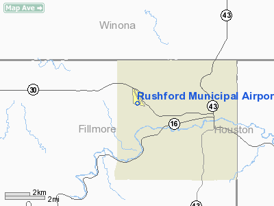
Rushford Municipal Airport |
Location & QuickFacts
| FAA Information Effective: | 2008-09-25 |
| Airport Identifier: | 55Y |
| Airport Status: | Operational |
| Longitude/Latitude: | 091-49-48.3420W/43-48-56.9700N
-91.830095/43.815825 (Estimated) |
| Elevation: | 1211 ft / 369.11 m (Surveyed) |
| Land: | 105 acres |
| From nearest city: | 3 nautical miles W of Rushford, MN |
| Location: | Fillmore County, MN |
| Magnetic Variation: | 01E (1995) |
Owner & Manager
| Ownership: | Publicly owned |
| Owner: | City Of Rushford |
| Address: | 101 N Mill St, Po Box 430
Rushford, MN 55971 |
| Phone number: | 507-864-2444 |
| Manager: | Mike Thern |
| Address: | 750 West Burns Valley Road
Winona, MN 55987 |
| Phone number: | 507-864-2705 |
Airport Operations and Facilities
| Airport Use: | Open to public |
| Wind indicator: | Yes |
| Segmented Circle: | No |
| Control Tower: | No |
| Lighting Schedule: | DUSK-DAWN
ACTVT MIRL RY 16/34 - CTAF |
| Beacon Color: | Clear-Green (lighted land airport) |
| Landing fee charge: | No |
| Sectional chart: | Chicago |
| Region: | AGL - Great Lakes |
| Traffic Pattern Alt: | 1000 ft |
| Boundary ARTCC: | ZMP - Minneapolis |
| Tie-in FSS: | PNM - Princeton |
| FSS on Airport: | No |
| FSS Toll Free: | 1-800-WX-BRIEF |
| NOTAMs Facility: | PNM (NOTAM-d service avaliable) |
Airport Communications
Airport Services
| Fuel available: | 100LL
SELF SERVICE FUEL AVBL WITH CREDIT CARD. |
| Airframe Repair: | NONE |
| Power Plant Repair: | NONE |
| Bottled Oxygen: | NONE |
| Bulk Oxygen: | NONE |
Runway Information
Runway 16/34
| Dimension: | 3200 x 60 ft / 975.4 x 18.3 m |
| Surface: | ASPH, Good Condition |
| Edge Lights: | Medium |
| |
Runway 16 |
Runway 34 |
| Longitude: | 091-49-55.2730W | 091-49-41.4850W |
| Latitude: | 43-49-11.9730N | 43-48-41.9930N |
| Elevation: | 1211.00 ft | 1183.00 ft |
| Alignment: | 127 | 127 |
| Traffic Pattern: | Left | Left |
| Markings: | Non-precision instrument, Good Condition | Non-precision instrument, Good Condition |
| Obstruction: | 78 ft trees, 2800.0 ft from runway, 50 ft left of centerline, 33:1 slope to clear | 53 ft trees, 900.0 ft from runway, 150 ft left of centerline, 13:1 slope to clear |
|
Radio Navigation Aids
| ID |
Type |
Name |
Ch |
Freq |
Var |
Dist |
| CHU | NDB | Caledonia | | 209.00 | 03E | 20.2 nm |
| CJJ | NDB | Cresco | | 293.00 | 02E | 30.0 nm |
| DEH | NDB | Decorah | | 236.00 | 01E | 32.7 nm |
| BCK | NDB | Black River Falls | | 362.00 | 00E | 49.9 nm |
| ONA | VOR/DME | Winona | 051X | 111.40 | 01E | 16.6 nm |
| LSE | VOR/DME | La Crosse | 021X | 108.40 | 02E | 25.1 nm |
| RST | VOR/DME | Rochester | 057X | 112.00 | 05E | 33.3 nm |
| JAY | VOR/DME | Austin | 019X | 108.20 | 03E | 49.5 nm |
| ODI | VORTAC | Nodine | 126X | 117.90 | 01E | 16.7 nm |
| UKN | VORTAC | Waukon | 113X | 116.60 | 05E | 34.6 nm |
Remarks
- CAUTION DEER ON & INVOF AIRPORT.
Images and information placed above are from
http://www.airport-data.com/airport/55Y/
We thank them for the data!
| General Info
|
| Country |
United States
|
| State |
MINNESOTA
|
| FAA ID |
55Y
|
| Latitude |
43-48-56.970N
|
| Longitude |
091-49-48.342W
|
| Elevation |
1211 feet
|
| Near City |
RUSHFORD
|
We don't guarantee the information is fresh and accurate. The data may
be wrong or outdated.
For more up-to-date information please refer to other sources.
|
|


