 |
|
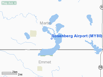
Location & QuickFacts
| FAA Information Effective: | 2008-09-25 |
| Airport Identifier: | MY80 |
| Airport Status: | Operational |
| Longitude/Latitude: | 094-34-56.9210W/43-31-19.8410N
-94.582478/43.522178 (Estimated) |
| Elevation: | 1255 ft / 382.52 m (Estimated) |
| Land: | 0 acres |
| From nearest city: | 3 nautical miles SE of Ceylon, MN |
| Location: | Martin County, MN |
| Magnetic Variation: | 05E (1985) |
Owner & Manager
| Ownership: | Privately owned |
| Owner: | Gerald A. Rosenberg |
| Address: | Rr 1
Ceylon, MN 56121 |
| Phone number: | 507-632-4246 |
| Address: |
|
Airport Operations and Facilities
| Airport Use: | Private |
| Wind indicator: | Yes |
| Segmented Circle: | No |
| Control Tower: | No |
| Sectional chart: | Omaha |
| Region: | AGL - Great Lakes |
| Boundary ARTCC: | ZMP - Minneapolis |
| Tie-in FSS: | FOD - Fort Dodge |
| FSS Toll Free: | 1-800-WX-BRIEF |
Runway Information
Runway 10/28
| Dimension: | 2500 x 90 ft / 762.0 x 27.4 m |
| Surface: | TURF, |
| |
Runway 10 |
Runway 28 |
| Traffic Pattern: | Left | Left |
| Displaced threshold: | 500.00 ft | 0.00 ft |
| Obstruction: | 30 ft trees, 500.0 ft from runway | |
|
Radio Navigation Aids
| ID |
Type |
Name |
Ch |
Freq |
Var |
Dist |
| PUF | NDB | Puff | | 345.00 | 04E | 12.3 nm |
| MJQ | NDB | Jackson | | 353.00 | 04E | 19.1 nm |
| SBU | NDB | Blue Earth | | 332.00 | 04E | 21.6 nm |
| EGQ | NDB | Emmetsburg | | 410.00 | 04E | 25.9 nm |
| JYG | NDB | St James | | 260.00 | 04E | 27.9 nm |
| AXA | NDB | Algona | | 403.00 | 03E | 29.8 nm |
| MWM | NDB | Windom | | 203.00 | 03E | 32.6 nm |
| LTU | NDB | Little Sioux | | 326.00 | 05E | 33.8 nm |
| FXY | NDB | Forest City | | 359.00 | 05E | 45.4 nm |
| POH | NDB | Pocahontas | | 428.00 | 06E | 46.7 nm |
| ULM | NDB/DME | New Ulm | 050X | 272.00 | 04E | 48.0 nm |
| EST | VOR | Estherville | | 110.40 | 07E | 9.8 nm |
| FRM | VOR/DME | Fairmont | 039X | 110.20 | 07E | 10.2 nm |
| SPW | VOR/DME | Spencer | 037X | 110.00 | 05E | 34.6 nm |
| OTG | VOR/DME | Worthington | 043X | 110.60 | 08E | 44.2 nm |
Remarks
Images and information placed above are from
http://www.airport-data.com/airport/MY80/
We thank them for the data!
| General Info
|
| Country |
United States
|
| State |
MINNESOTA
|
| FAA ID |
MY80
|
| Latitude |
43-31-19.841N
|
| Longitude |
094-34-56.921W
|
| Elevation |
1255 feet
|
| Near City |
CEYLON
|
We don't guarantee the information is fresh and accurate. The data may
be wrong or outdated.
For more up-to-date information please refer to other sources.
|
|


