 |
|
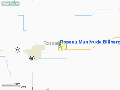
Roseau Muni/rudy Billberg Field Airport |
Location & QuickFacts
| FAA Information Effective: | 2008-09-25 |
| Airport Identifier: | ROX |
| Airport Status: | Operational |
| Longitude/Latitude: | 095-41-49.5000W/48-51-21.6000N
-95.697083/48.856000 (Estimated) |
| Elevation: | 1060 ft / 323.09 m (Surveyed) |
| Land: | 260 acres |
| From nearest city: | 3 nautical miles E of Roseau, MN |
| Location: | Roseau County, MN |
| Magnetic Variation: | 05E (1985) |
Owner & Manager
| Ownership: | Publicly owned |
| Owner: | City Of Roseau |
| Address: | 100-2nd Ave, Ne, P O Box 307
Roseau, MN 56751 |
| Phone number: | 218-463-1542 |
| Manager: | Arlan Sandland |
| Address: | 31072 420 Ave
Roseau, MN 56751 |
| Phone number: | 218-463-3906 |
Airport Operations and Facilities
| Airport Use: | Open to public |
| Wind indicator: | Yes |
| Segmented Circle: | Yes |
| Control Tower: | No |
| Lighting Schedule: | DUSK-DAWN
MIRL RY 16/34 PRESET LOW INTST; TO INCR INTST & ACTVT REIL RYS 16 & 34 - CTAF. |
| Beacon Color: | Clear-Green (lighted land airport) |
| Landing fee charge: | No |
| Sectional chart: | Twin Cities |
| Region: | AGL - Great Lakes |
| Boundary ARTCC: | ZMP - Minneapolis |
| Tie-in FSS: | PNM - Princeton |
| FSS on Airport: | No |
| FSS Toll Free: | 1-800-WX-BRIEF |
| NOTAMs Facility: | ROX (NOTAM-d service avaliable) |
| Federal Agreements: | NGY |
Airport Communications
| CTAF: | 122.800 |
| Unicom: | 122.800 |
Airport Services
| Fuel available: | 100LLA |
| Airframe Repair: | MAJOR |
| Power Plant Repair: | MAJOR |
| Bottled Oxygen: | NONE |
| Bulk Oxygen: | NONE |
Runway Information
Runway 06/24
| Dimension: | 2505 x 250 ft / 763.5 x 76.2 m |
| Surface: | TURF, Good Condition |
| |
Runway 06 |
Runway 24 |
| Longitude: | 095-42-00.2385W | 095-41-25.4340W |
| Latitude: | 48-51-06.9591N | 48-51-16.0801N |
| Elevation: | 1057.00 ft | 1056.00 ft |
| Alignment: | 69 | 127 |
| Traffic Pattern: | Left | Left |
| Markings: | None,
06/24 MKD WITH YELLOW CONES. | None, |
| Runway End Identifier: | No | No |
| Centerline Lights: | No | No |
| Touchdown Lights: | No | No |
| Obstruction: | 28 ft trees, 700.0 ft from runway, 100 ft right of centerline, 25:1 slope to clear | 50 ft trees, 1250.0 ft from runway, 125 ft left of centerline, 25:1 slope to clear |
|
Runway 16/34
| Dimension: | 4401 x 75 ft / 1341.4 x 22.9 m |
| Surface: | ASPH, Fair Condition |
| Weight Limit: | Single wheel: 30000 lbs.
Dual wheel: 40000 lbs. |
| Edge Lights: | Medium |
| |
Runway 16 |
Runway 34 |
| Longitude: | 095-42-00.8637W | 095-41-45.6493W |
| Latitude: | 48-51-48.5274N | 48-51-06.2806N |
| Elevation: | 1046.00 ft | 1060.00 ft |
| Alignment: | 127 | 127 |
| Traffic Pattern: | Left | Left |
| Markings: | Non-precision instrument, Good Condition | Non-precision instrument, Good Condition |
| Crossing Height: | 26.00 ft | 25.00 ft |
| VASI: | 2-box on left side | 2-box on left side |
| Visual Glide Angle: | 3.00° | 3.00° |
| Runway End Identifier: | Yes | Yes |
| Centerline Lights: | No | No |
| Touchdown Lights: | No | No |
|
Radio Navigation Aids
| ID |
Type |
Name |
Ch |
Freq |
Var |
Dist |
| PFT | NDB | Piney Pinecreek | | 342.00 | 05E | 13.8 nm |
| ROX | VOR/DME | Roseau | 025X | 108.80 | 05E | 0.1 nm |
| BDE | VOR/DME | Baudette | 053X | 111.60 | 04E | 43.9 nm |
Remarks
- RY 06/24 CLSD WINTER MONTHS.
Images and information placed above are from
http://www.airport-data.com/airport/ROX/
We thank them for the data!
| General Info
|
| Country |
United States
|
| State |
MINNESOTA
|
| FAA ID |
ROX
|
| Latitude |
48-51-21.610N
|
| Longitude |
095-41-49.320W
|
| Elevation |
1059 feet
|
| Near City |
ROSEAU
|
We don't guarantee the information is fresh and accurate. The data may
be wrong or outdated.
For more up-to-date information please refer to other sources.
|
|


