 |
|
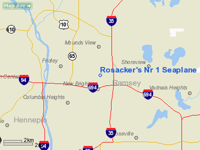
Rosacker's Nr 1 Seaplane Base |
Location & QuickFacts
| FAA Information Effective: | 2008-09-25 |
| Airport Identifier: | MY33 |
| Airport Status: | Operational |
| Longitude/Latitude: | 093-12-15.8070W/45-04-36.8760N
-93.204391/45.076910 (Estimated) |
| Elevation: | 865 ft / 263.65 m (Estimated) |
| Land: | 0 acres |
| From nearest city: | 1 nautical miles N of New Brighton, MN |
| Location: | Ramsey County, MN |
| Magnetic Variation: | 03E (1985) |
Owner & Manager
| Ownership: | Privately owned |
| Owner: | Hans D. Rosacker |
| Address: | 1639 14ave Nw
New Brighton, MN 55112 |
| Phone number: | 651-633-1751 |
| Address: |
|
Airport Operations and Facilities
| Airport Use: | Private
PERSONAL USE. |
| Segmented Circle: | No |
| Control Tower: | No |
| Sectional chart: | Twin Cities |
| Region: | AGL - Great Lakes |
| Boundary ARTCC: | ZMP - Minneapolis |
| Tie-in FSS: | PNM - Princeton |
| FSS on Airport: | No |
| FSS Toll Free: | 1-800-WX-BRIEF |
Runway Information
Runway 14/32
| Dimension: | 3500 x 200 ft / 1066.8 x 61.0 m |
| Surface: | WATER, |
| |
Runway 14 |
Runway 32 |
| Traffic Pattern: | Left | Left |
|
Runway 17/35
| Dimension: | 3500 x 200 ft / 1066.8 x 61.0 m |
| Surface: | WATER, |
| |
Runway 17 |
Runway 35 |
| Traffic Pattern: | Left | Left |
|
Radio Navigation Aids
| ID |
Type |
Name |
Ch |
Freq |
Var |
Dist |
| MS | NDB | Narco | | 266.00 | 02E | 15.8 nm |
| PPI | NDB | Hopey | | 400.00 | 03E | 16.6 nm |
| OEO | NDB | Osceola | | 233.00 | 01E | 26.0 nm |
| RNH | NDB | New Richmond | | 257.00 | 02E | 28.8 nm |
| CBG | NDB | Cambridge | | 350.00 | 03E | 29.0 nm |
| PNM | NDB | Princeton | | 368.00 | 03E | 33.9 nm |
| AHH | NDB | Ameron | | 278.00 | 01E | 37.4 nm |
| ROS | NDB | Rush City | | 282.00 | 02E | 38.7 nm |
| GYL | NDB | Glencoe | | 407.00 | 03E | 42.1 nm |
| JMR | NDB | Mora | | 327.00 | 03E | 49.0 nm |
| MSP | VOR/DME | Minneapolis | 100X | 115.30 | 02E | 10.9 nm |
| FCM | VOR/DME | Flying Cloud | 055X | 111.80 | 06E | 18.5 nm |
| STC | VOR/DME | St Cloud | 058X | 112.10 | 03E | 45.9 nm |
| GEP | VORTAC | Gopher | 120X | 117.30 | 06E | 8.3 nm |
| FGT | VORTAC | Farmington | 104X | 115.70 | 06E | 26.8 nm |
| STP | VOT | St Paul | | 114.40 | | 10.2 nm |
| MSP | VOT | Minneapolis St Paul | | 111.00 | | 11.6 nm |
Images and information placed above are from
http://www.airport-data.com/airport/MY33/
We thank them for the data!
| General Info
|
| Country |
United States
|
| State |
MINNESOTA
|
| FAA ID |
MY33
|
| Latitude |
45-04-36.876N
|
| Longitude |
093-12-15.807W
|
| Elevation |
865 feet
|
| Near City |
NEW BRIGHTON
|
We don't guarantee the information is fresh and accurate. The data may
be wrong or outdated.
For more up-to-date information please refer to other sources.
|
|


