 |
|
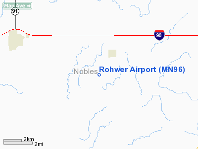
Location & QuickFacts
| FAA Information Effective: | 2008-09-25 |
| Airport Identifier: | MN96 |
| Airport Status: | Operational |
| Longitude/Latitude: | 095-49-01.0590W/43-35-53.8750N
-95.816961/43.598299 (Estimated) |
| Elevation: | 1640 ft / 499.87 m (Estimated) |
| Land: | 0 acres |
| From nearest city: | 2 nautical miles SW of Rushmore, MN |
| Location: | Nobles County, MN |
| Magnetic Variation: | 05E (1985) |
Owner & Manager
| Ownership: | Privately owned |
| Owner: | Warren C. Rohwer |
| Address: | 21795 270 St
Rushmore, MN 56168 |
| Phone number: | 507-478-4309 |
| Manager: | Warren C. Rohwer |
| Address: | 21795 270 St.
Rushmore, MN 56168 |
| Phone number: | 507-478-4309 |
Airport Operations and Facilities
| Airport Use: | Private |
| Wind indicator: | Yes |
| Segmented Circle: | No |
| Control Tower: | No |
| Landing fee charge: | No |
| Sectional chart: | Omaha |
| Region: | AGL - Great Lakes |
| Boundary ARTCC: | ZMP - Minneapolis |
| Tie-in FSS: | PNM - Princeton |
| FSS on Airport: | No |
| FSS Toll Free: | 1-800-WX-BRIEF |
Airport Services
| Airframe Repair: | NONE |
| Power Plant Repair: | NONE |
Runway Information
Runway N/S
| Dimension: | 2500 x 75 ft / 762.0 x 22.9 m |
| Surface: | TURF, |
| |
Runway N |
Runway S |
| Traffic Pattern: | Left | Left |
|
Radio Navigation Aids
| ID |
Type |
Name |
Ch |
Freq |
Var |
Dist |
| ISB | NDB | Sibley | | 269.00 | 05E | 14.1 nm |
| SHL | NDB | Sheldon | | 338.00 | 05E | 23.1 nm |
| SOY | NDB | Sioux Center | | 368.00 | 06E | 32.4 nm |
| MWM | NDB | Windom | | 203.00 | 03E | 36.0 nm |
| MJQ | NDB | Jackson | | 353.00 | 04E | 36.3 nm |
| ORC | NDB | Orange City | | 521.00 | 05E | 38.0 nm |
| LTU | NDB | Little Sioux | | 326.00 | 05E | 41.2 nm |
| FS | NDB | Rokky | | 245.00 | 06E | 44.5 nm |
| PUF | NDB | Puff | | 345.00 | 04E | 49.4 nm |
| PQN | NDB/DME | Pipestone | 028X | 284.00 | 06E | 31.2 nm |
| EST | VOR | Estherville | | 110.40 | 07E | 48.1 nm |
| OTG | VOR/DME | Worthington | 043X | 110.60 | 08E | 10.6 nm |
| DDL | VOR/DME | Sheldon | 023X | 108.60 | 05E | 23.2 nm |
| SPW | VOR/DME | Spencer | 037X | 110.00 | 05E | 37.6 nm |
| FSD | VORTAC | Sioux Falls | 097X | 115.00 | 09E | 42.1 nm |
Remarks
- OPEN SKI USE ONLY/DEC-APR.
- BLDGS OFF NW CORNER; LOW FENCE S END OF RWY.
Images and information placed above are from
http://www.airport-data.com/airport/MN96/
We thank them for the data!
| General Info
|
| Country |
United States
|
| State |
MINNESOTA
|
| FAA ID |
MN96
|
| Latitude |
43-35-53.875N
|
| Longitude |
095-49-01.059W
|
| Elevation |
1640 feet
|
| Near City |
RUSHMORE
|
We don't guarantee the information is fresh and accurate. The data may
be wrong or outdated.
For more up-to-date information please refer to other sources.
|
|


