 |
|
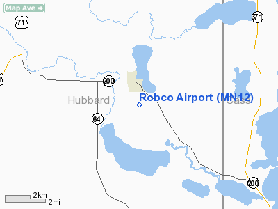
Location & QuickFacts
| FAA Information Effective: | 2008-09-25 |
| Airport Identifier: | MN12 |
| Airport Status: | Operational |
| Longitude/Latitude: | 094-45-08.0000W/47-11-56.0000N
-94.752222/47.198889 (Estimated) |
| Elevation: | 1380 ft / 420.62 m (Estimated) |
| Land: | 160 acres |
| From nearest city: | 1 nautical miles S of Laporte, MN |
| Location: | Hubbard County, MN |
| Magnetic Variation: | 04E (1990) |
Owner & Manager
| Ownership: | Privately owned |
| Owner: | Harold Cotant |
| Address: | 37358 County 39
Laporte, MN 56461 |
| Phone number: | 218-224-2585 |
| Manager: | Harold Cotant |
| Address: | 37358 County 39
Laporte, MN 56461 |
| Phone number: | 218-224-2585 |
Airport Operations and Facilities
| Airport Use: | Private |
| Wind indicator: | Yes |
| Segmented Circle: | Yes |
| Control Tower: | No |
| Sectional chart: | Twin Cities |
| Region: | AGL - Great Lakes |
| Boundary ARTCC: | ZMP - Minneapolis |
| Tie-in FSS: | PNM - Princeton |
| FSS on Airport: | No |
| FSS Toll Free: | 1-800-WX-BRIEF |
Runway Information
Runway 07/25
| Dimension: | 2600 x 80 ft / 792.5 x 24.4 m |
| Surface: | TURF, |
| |
Runway 07 |
Runway 25 |
| Traffic Pattern: | Left | Left |
|
Runway 15/33
| Dimension: | 3000 x 80 ft / 914.4 x 24.4 m |
| Surface: | TURF, |
| |
Runway 15 |
Runway 33 |
| Traffic Pattern: | Right | Left |
|
Radio Navigation Aids
| ID |
Type |
Name |
Ch |
Freq |
Var |
Dist |
| PK | NDB | Spida | | 269.00 | 04E | 23.8 nm |
| XVG | NDB | Longville | | 392.00 | 04E | 25.5 nm |
| PWC | NDB | Pine River | | 330.00 | 03E | 32.1 nm |
| FSE | NDB | Fosston | | 224.00 | 05E | 47.6 nm |
| SAZ | NDB | Staples | | 257.00 | 04E | 49.1 nm |
| PKD | VOR/DME | Park Rapids | 043X | 110.60 | 04E | 22.3 nm |
| BJI | VORTAC | Bemidji | 023X | 108.60 | 04E | 25.2 nm |
Remarks
- PRVDD ANY OBSTN IN THE RY APCH SLOPE SFC BE LOWERED OR REMOVED. OTHERWISE THE RY THR SHOULD BE DSPLCD & CLEARLY MARKED SO AS TO PROVIDE A MINIMUM 20:1 APCH CLNC OVER ALL OBSTNS. THE AREA 125 FT EITHER SIDE OF THE RY CTRLN & 300 FT FROM EITHER END OF THE RY END BE CLEAR OF ANY OBSTNS.
Images and information placed above are from
http://www.airport-data.com/airport/MN12/
We thank them for the data!
| General Info
|
| Country |
United States
|
| State |
MINNESOTA
|
| FAA ID |
MN12
|
| Latitude |
47-11-56.000N
|
| Longitude |
094-45-08.000W
|
| Elevation |
1380 feet
|
| Near City |
LAPORTE
|
We don't guarantee the information is fresh and accurate. The data may
be wrong or outdated.
For more up-to-date information please refer to other sources.
|
|


