|
|
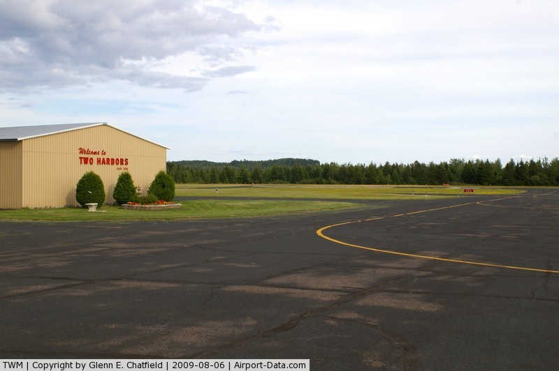
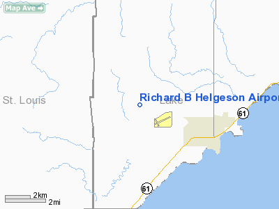
Richard B Helgeson Airport |
|
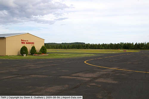 |
(Click on the photo to enlarge) |
Location & QuickFacts
| FAA Information Effective: | 2008-09-25 |
| Airport Identifier: | TWM |
| Airport Status: | Operational |
| Longitude/Latitude: | 091-44-42.5100W/47-02-57.2100N
-91.745142/47.049225 (Estimated) |
| Elevation: | 1080 ft / 329.18 m (Estimated) |
| Land: | 360 acres |
| From nearest city: | 4 nautical miles NW of Two Harbors, MN |
| Location: | Lake County, MN |
| Magnetic Variation: | 01E (1990) |
Owner & Manager
| Ownership: | Publicly owned |
| Owner: | City Of Two Harbors |
| Address: | City Hall, 522 First Ave.
Two Harbors, MN 55616 |
| Phone number: | 218-834-5631 |
| Manager: | Richard B. Helgeson |
| Address: | 522 First Ave
Two Harbors, MN 55616 |
| Phone number: | 218-834-2162 |
Airport Operations and Facilities
| Airport Use: | Open to public |
| Wind indicator: | Yes |
| Segmented Circle: | Yes |
| Control Tower: | No |
| Lighting Schedule: | DUSK-DAWN
ACTVT MIRL RY 06/24; VASI & REIL RYS 06 & 24 -CTAF. |
| Beacon Color: | Clear-Green (lighted land airport) |
| Landing fee charge: | No |
| Sectional chart: | Green Bay |
| Region: | AGL - Great Lakes |
| Traffic Pattern Alt: | 800 ft |
| Boundary ARTCC: | ZMP - Minneapolis |
| Tie-in FSS: | PNM - Princeton |
| FSS on Airport: | No |
| FSS Toll Free: | 1-800-WX-BRIEF |
| NOTAMs Facility: | TWM (NOTAM-d service avaliable) |
| Federal Agreements: | NGY |
Airport Communications
Airport Services
| Fuel available: | 100LLA MOGAS
100LL & MOGAS AVAIL 24 HRS WITH CREDIT CARD. |
| Airframe Repair: | NONE |
| Power Plant Repair: | NONE |
| Bottled Oxygen: | NONE |
| Bulk Oxygen: | NONE |
Runway Information
Runway 06/24
| Dimension: | 4400 x 75 ft / 1341.1 x 22.9 m |
| Surface: | ASPH, Good Condition |
| Edge Lights: | Medium |
| |
Runway 06 |
Runway 24 |
| Longitude: | 091-45-11.1500W | 091-44-14.9300W |
| Latitude: | 47-02-50.2900N | 47-03-10.5300N |
| Elevation: | 1073.00 ft | 1070.00 ft |
| Alignment: | 62 | 127 |
| Traffic Pattern: | Left | Left |
| Markings: | Non-precision instrument, Good Condition | Non-precision instrument, Good Condition |
| Crossing Height: | 27.00 ft | 27.00 ft |
| VASI: | 2-box on left side | 2-box on left side |
| Visual Glide Angle: | 3.00° | 3.00° |
| Runway End Identifier: | Yes | Yes |
| Obstruction: | 49 ft trees, 1100.0 ft from runway, 100 ft left of centerline, 18:1 slope to clear | 30 ft trees, 220.0 ft from runway, 250 ft left of centerline |
|
Runway 15/33
| Dimension: | 2550 x 150 ft / 777.2 x 45.7 m |
| Surface: | TURF, Good Condition |
| |
Runway 15 |
Runway 33 |
| Longitude: | 091-44-53.1900W | 091-44-31.2500W |
| Latitude: | 47-03-02.4500N | 47-02-42.2300N |
| Elevation: | 1075.00 ft | 1040.00 ft |
| Alignment: | 127 | 127 |
| Traffic Pattern: | Left | Left |
| Obstruction: | 35 ft trees, 480.0 ft from runway, 125 ft left of centerline, 13:1 slope to clear | 15 ft trees, 510.0 ft from runway, 34:1 slope to clear |
|
Radio Navigation Aids
| ID |
Type |
Name |
Ch |
Freq |
Var |
Dist |
| TWM | NDB | Two Harbors | | 243.00 | 01E | 0.2 nm |
| BFW | NDB | Silver Bay | | 350.00 | 00E | 18.2 nm |
| SUW | NDB | Bong | | 260.00 | 01E | 26.1 nm |
| DL | NDB | Pykla | | 379.00 | 02E | 27.9 nm |
| COQ | NDB | Cloquet | | 335.00 | 03E | 37.7 nm |
| OLG | NDB | Solon Springs | | 388.00 | 01E | 44.1 nm |
| ENY | NDB | Kennedy | | 254.00 | 02E | 45.4 nm |
| LKI | TACAN | Lakeside | 011X | | 05E | 21.8 nm |
| EVM | VOR/DME | Eveleth | 019X | 108.20 | 01E | 38.1 nm |
| HIB | VOR/DME | Hibbing | 045X | 110.80 | 02E | 42.0 nm |
| ASX | VOR/DME | Ashland | 039X | 110.20 | 02E | 45.4 nm |
| ELO | VOR/DME | Ely | 033X | 109.60 | 00E | 46.6 nm |
| DLH | VORTAC | Duluth | 073X | 112.60 | 05E | 23.9 nm |
Remarks
- GCO AVBL ON FREQ 121.725 (0600-2300) THRU DLH CD & FLT SVCS.
Images and information placed above are from
http://www.airport-data.com/airport/TWM/
We thank them for the data!
| General Info
|
| Country |
United States
|
| State |
MINNESOTA
|
| FAA ID |
TWM
|
| Latitude |
47-02-57.210N
|
| Longitude |
091-44-42.510W
|
| Elevation |
1080 feet
|
| Near City |
TWO HARBORS
|
We don't guarantee the information is fresh and accurate. The data may
be wrong or outdated.
For more up-to-date information please refer to other sources.
|
|