 |
|
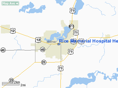
Rice Memorial Hospital Heliport |
Location & QuickFacts
| FAA Information Effective: | 2008-09-25 |
| Airport Identifier: | MY44 |
| Airport Status: | Operational |
| Longitude/Latitude: | 095-02-47.7000W/45-07-12.3000N
-95.046583/45.120083 (Estimated) |
| Elevation: | 1179 ft / 359.36 m (Estimated) |
| Land: | 0 acres |
| From nearest city: | 0 nautical miles N of Willmar, MN |
| Location: | Kandiyohi County, MN |
| Magnetic Variation: | () |
Owner & Manager
| Ownership: | Privately owned |
| Owner: | Rice Memorial Hospital |
| Address: | 301 Becker Ave Sw
Willmar, MN 56201 |
| Phone number: | 320-235-4543 |
| Manager: | Rice Memorial Hospital |
| Address: | 301 Becker Ave Sw
Willmar, MN 56201 |
| Phone number: | 320-235-4543 |
Airport Operations and Facilities
| Airport Use: | Private |
| Wind indicator: | Yes |
| Control Tower: | No |
| Lighting Schedule: | PHONE REQ
FOR ROTG BCN AND PERIMETER LGTS CALL 320-235-4543. |
| Beacon Color: | Clear-Green-Yellow (heliport) |
| Sectional chart: | Twin Cities |
| Region: | AGL - Great Lakes |
| Boundary ARTCC: | ZMP - Minneapolis |
| Tie-in FSS: | PNM - Princeton |
| FSS Toll Free: | 1-800-WX-BRIEF |
Runway Information
Helipad H1
| Dimension: | 45 x 45 ft / 13.7 x 13.7 m |
| Surface: | ALUMINUM, |
| |
Runway H1 |
Runway |
| Traffic Pattern: | Left | Left |
|
Radio Navigation Aids
| ID |
Type |
Name |
Ch |
Freq |
Var |
Dist |
| BBB | NDB | Benson | | 239.00 | 05E | 28.4 nm |
| HCD | NDB | Hutchinson | | 209.00 | 04E | 32.3 nm |
| GHW | NDB | Glenwood | | 346.00 | 03E | 33.5 nm |
| AQP | NDB | Appleton | | 356.00 | 05E | 41.3 nm |
| EE | NDB | Tamie | | 374.00 | 04E | 41.8 nm |
| GYL | NDB | Glencoe | | 407.00 | 03E | 46.2 nm |
| DXX | NDB | Dawson/madison | | 341.00 | 06E | 48.8 nm |
| ILL | VOR/DME | Willmar | 084X | 113.70 | 04E | 1.9 nm |
| BDH | VOR/DME | Willmar | 84X | 113.70 | 04E | 3.4 nm |
| MVE | VOR/DME | Montevideo | 053X | 111.60 | 05E | 29.6 nm |
| RWF | VOR/DME | Redwood Falls | 080X | 113.30 | 07E | 39.4 nm |
| MOX | VOR/DME | Morris | 033X | 109.60 | 05E | 47.3 nm |
| STC | VOR/DME | St Cloud | 058X | 112.10 | 03E | 49.1 nm |
| DWN | VORTAC | Darwin | 027X | 109.00 | 07E | 25.2 nm |
Remarks
- PRVDD APCH/DEP FR 350 TO 360 DEG & 170 T0 180 DEG; AREA IS MARKED; HEL STAY BLO ILL ARPT'S TPA; ALL OPNS MUST COORDINATE WITH ILL ARPT AUTHORITY.
Images and information placed above are from
http://www.airport-data.com/airport/MY44/
We thank them for the data!
We don't guarantee the information is fresh and accurate. The data may
be wrong or outdated.
For more up-to-date information please refer to other sources.
|
|


