 |
|
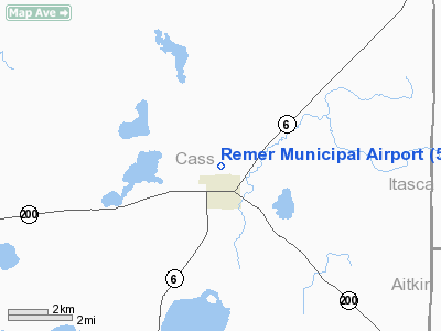
Location & QuickFacts
| FAA Information Effective: | 2008-09-25 |
| Airport Identifier: | 52Y |
| Airport Status: | Operational |
| Longitude/Latitude: | 093-54-50.8450W/47-04-04.8330N
-93.914124/47.068009 (Estimated) |
| Elevation: | 1350 ft / 411.48 m (Estimated) |
| Land: | 64 acres |
| From nearest city: | 1 nautical miles N of Remer, MN |
| Location: | Cass County, MN |
| Magnetic Variation: | 03E (1985) |
Owner & Manager
| Ownership: | Publicly owned |
| Owner: | City Of Remer |
| Address: | Po Box 54
Remer, MN 56672 |
| Phone number: | 218-566-4156 |
| Manager: | Mark Madden |
| Address: | 506 Atlas Ave Se
Remer, MN 56672 |
| Phone number: | 218-566-3436 |
Airport Operations and Facilities
| Airport Use: | Open to public |
| Wind indicator: | Yes |
| Segmented Circle: | No |
| Control Tower: | No |
| Landing fee charge: | No |
| Sectional chart: | Twin Cities |
| Region: | AGL - Great Lakes |
| Boundary ARTCC: | ZMP - Minneapolis |
| Tie-in FSS: | PNM - Princeton |
| FSS on Airport: | No |
| FSS Toll Free: | 1-800-WX-BRIEF |
| NOTAMs Facility: | PNM (NOTAM-d service avaliable) |
Airport Communications
Airport Services
| Airframe Repair: | NONE |
| Power Plant Repair: | NONE |
| Bottled Oxygen: | NONE |
| Bulk Oxygen: | NONE |
Runway Information
Runway 13/31
| Dimension: | 2765 x 154 ft / 842.8 x 46.9 m |
| Surface: | TURF, Good Condition |
| |
Runway 13 |
Runway 31 |
| Longitude: | 093-55-00.8400W | 093-54-30.8400W |
| Latitude: | 47-04-13.8300N | 47-03-55.8300N |
| Elevation: | 1350.00 ft | 1350.00 ft |
| Traffic Pattern: | Left | Left |
| Runway End Identifier: | No | No |
| Touchdown Lights: | No | No |
| Obstruction: | 57 ft trees, 520.0 ft from runway, 125 ft left of centerline, 9:1 slope to clear
TREES +45, 640 FROM RWY END, 50L, 14:1. | 17 ft trees, 75.0 ft from runway, 125 ft right of centerline, 4:1 slope to clear |
|
Radio Navigation Aids
| ID |
Type |
Name |
Ch |
Freq |
Var |
Dist |
| XVG | NDB | Longville | | 392.00 | 04E | 12.8 nm |
| PWC | NDB | Pine River | | 330.00 | 03E | 28.2 nm |
| AIT | NDB | Aitkin | | 397.00 | 03E | 32.8 nm |
| FOZ | NDB | Bigfork | | 345.00 | 02E | 44.3 nm |
| PK | NDB | Spida | | 269.00 | 04E | 45.8 nm |
| GPZ | VOR/DME | Grand Rapids | 051X | 111.40 | 06E | 18.3 nm |
| PKD | VOR/DME | Park Rapids | 043X | 110.60 | 04E | 48.5 nm |
| BRD | VORTAC | Brainerd | 116X | 116.90 | 03E | 43.5 nm |
Remarks
- ULTRALIGHT TRAFFIC ON & INVOF AIRPORT.
Images and information placed above are from
http://www.airport-data.com/airport/52Y/
We thank them for the data!
| General Info
|
| Country |
United States
|
| State |
MINNESOTA
|
| FAA ID |
52Y
|
| Latitude |
47-04-04.833N
|
| Longitude |
093-54-50.845W
|
| Elevation |
1350 feet
|
| Near City |
REMER
|
We don't guarantee the information is fresh and accurate. The data may
be wrong or outdated.
For more up-to-date information please refer to other sources.
|
|


