 |
|
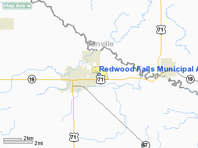
Redwood Falls Municipal Airport |
Location & QuickFacts
| FAA Information Effective: | 2008-09-25 |
| Airport Identifier: | RWF |
| Airport Status: | Operational |
| Longitude/Latitude: | 095-04-55.2000W/44-32-48.8000N
-95.082000/44.546889 (Estimated) |
| Elevation: | 1024 ft / 312.12 m (Surveyed) |
| Land: | 143 acres |
| From nearest city: | 2 nautical miles NE of Redwood Falls, MN |
| Location: | Redwood County, MN |
| Magnetic Variation: | 04E (2000) |
Owner & Manager
| Ownership: | Publicly owned |
| Owner: | City Of Redwood Falls |
| Address: | P O Box 143
Redwood Falls, MN 56283 |
| Phone number: | 507-637-5755 |
| Manager: | David Fuhr |
| Address: | 500 Airport Drive
Redwood Falls, MN 56283 |
| Phone number: | 507-644-3590 |
Airport Operations and Facilities
| Airport Use: | Open to public |
| Wind indicator: | Yes |
| Segmented Circle: | Yes |
| Control Tower: | No |
| Lighting Schedule: | DUSK-DAWN
ACTVT MIRL RY 12/30; REIL & PAPI RYS 12 & 30 - CTAF. |
| Beacon Color: | Clear-Green (lighted land airport) |
| Landing fee charge: | No |
| Sectional chart: | Twin Cities |
| Region: | AGL - Great Lakes |
| Boundary ARTCC: | ZMP - Minneapolis |
| Tie-in FSS: | PNM - Princeton |
| FSS on Airport: | No |
| FSS Toll Free: | 1-800-WX-BRIEF |
| NOTAMs Facility: | RWF (NOTAM-d service avaliable) |
| Federal Agreements: | NGY |
Airport Communications
| CTAF: | 123.000 |
| Unicom: | 123.000 |
Airport Services
| Fuel available: | 100LLA
SELF SERVE FUEL AVAIL 24 HRS WITH CREDIT CARD. |
| Airframe Repair: | MINOR |
| Power Plant Repair: | MINOR |
| Bottled Oxygen: | NONE |
| Bulk Oxygen: | NONE |
Runway Information
Runway 05/23
| Dimension: | 2081 x 200 ft / 634.3 x 61.0 m |
| Surface: | TURF, Good Condition |
| |
Runway 05 |
Runway 23 |
| Longitude: | 095-05-06.6571W | 095-04-43.5537W |
| Latitude: | 44-32-39.2627N | 44-32-51.4487N |
| Elevation: | 1018.00 ft | 1019.00 ft |
| Alignment: | 54 | 127 |
| Traffic Pattern: | Left | Left |
| Markings: | None,
RY 05/23 AND DISPL THLDS MARKED WITH YELLOW CONES. | None, |
| Displaced threshold: | 330.00 ft | 176.00 ft |
| Runway End Identifier: | No | No |
| Centerline Lights: | No | No |
| Touchdown Lights: | No | No |
| Obstruction: | 42 ft pole, 470.0 ft from runway, 75 ft right of centerline, 11:1 slope to clear
RWY 05 APCH RATIO 20:1 TO DSPLCD THLD. | 55 ft trees, 830.0 ft from runway, 95 ft right of centerline, 15:1 slope to clear
RWY 23 TREES +60, 770 FM RWY END, 220L, 15:1 TO DISPLCD THLD. |
|
Runway 12/30
| Dimension: | 4001 x 100 ft / 1219.5 x 30.5 m |
| Surface: | ASPH, Good Condition |
| Weight Limit: | Single wheel: 23000 lbs.
Dual wheel: 42000 lbs. |
| Edge Lights: | Medium |
| |
Runway 12 |
Runway 30 |
| Longitude: | 095-05-17.1614W | 095-04-33.4380W |
| Latitude: | 44-33-02.6121N | 44-32-38.5144N |
| Elevation: | 1018.00 ft | 1023.00 ft |
| Alignment: | 127 | 127 |
| Traffic Pattern: | Left | Left |
| Markings: | Non-precision instrument, Poor Condition
RYS 12 & 30 MKGS FADED. | Non-precision instrument, Poor Condition |
| VASI: | 2-light PAPI on left side | 2-light PAPI on left side |
| Runway End Identifier: | Yes | Yes |
| Centerline Lights: | No | No |
| Touchdown Lights: | No | No |
| Obstruction: | 48 ft trees, 1250.0 ft from runway, 100 ft right of centerline, 21:1 slope to clear | 15 ft hill, 380.0 ft from runway, 260 ft left of centerline, 12:1 slope to clear |
|
Radio Navigation Aids
| ID |
Type |
Name |
Ch |
Freq |
Var |
Dist |
| HCD | NDB | Hutchinson | | 209.00 | 04E | 35.2 nm |
| MWM | NDB | Windom | | 203.00 | 03E | 38.3 nm |
| JYG | NDB | St James | | 260.00 | 04E | 40.7 nm |
| GYL | NDB | Glencoe | | 407.00 | 03E | 44.5 nm |
| ULM | NDB/DME | New Ulm | 050X | 272.00 | 04E | 28.6 nm |
| RWF | VOR/DME | Redwood Falls | 080X | 113.30 | 07E | 5.2 nm |
| MML | VOR/DME | Marshall | 047X | 111.00 | 05E | 32.4 nm |
| ILL | VOR/DME | Willmar | 084X | 113.70 | 04E | 34.3 nm |
| BDH | VOR/DME | Willmar | 84X | 113.70 | 04E | 34.4 nm |
| MVE | VOR/DME | Montevideo | 053X | 111.60 | 05E | 37.1 nm |
| DWN | VORTAC | Darwin | 027X | 109.00 | 07E | 42.1 nm |
Remarks
- RY 12/30 PARALLEL TWY IS TURF.
- ULTRALIGHTS ON & INVOF OF ARPT.
Images and information placed above are from
http://www.airport-data.com/airport/RWF/
We thank them for the data!
| General Info
|
| Country |
United States
|
| State |
MINNESOTA
|
| FAA ID |
RWF
|
| Latitude |
44-32-49.934N
|
| Longitude |
095-04-56.118W
|
| Elevation |
1023 feet
|
| Near City |
REDWOOD FALLS
|
We don't guarantee the information is fresh and accurate. The data may
be wrong or outdated.
For more up-to-date information please refer to other sources.
|
|


