|
|
|
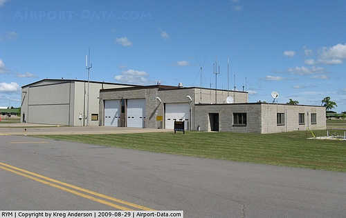 |
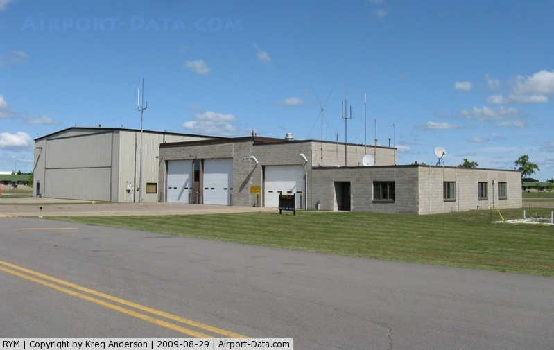
(Click on the photo to enlarge) |
Location & QuickFacts
| FAA Information Effective: | 2008-09-25 |
| Airport Identifier: | RYM |
| Airport Status: | Operational |
| Longitude/Latitude: | 094-21-37.9390W/46-05-28.3310N
-94.360539/46.091203 (Estimated) |
| Elevation: | 1150 ft / 350.52 m (Estimated) |
| Land: | 0 acres |
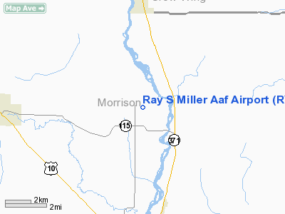
| From nearest city: | 1 nautical miles NW of Camp Ripley, MN |
| Location: | Morrison County, MN |
| Magnetic Variation: | 03E (1995) |
Owner & Manager
| Ownership: | Army owned |
| Owner: | U S Army Atca-aso |
| Address: | Cameron Station
Alexandria, VA 22314 |
| Manager: | Base Operations |
| Address: |
|
| Phone number: | 320-616-2780 |
Airport Operations and Facilities
| Airport Use: | Private |
| Segmented Circle: | No |
| Control Tower: | Yes |
| Lighting Schedule: | RDO-CTL
LGT: HIRL RWY 13-31 OPR LO INTS; TO INCREASE INTS ACTIVATE-126.2. MALSF RWY 31 OPR WHEN HIRL REACH STEP 3. |
| Sectional chart: | Twin Cities |
| Region: | AGL - Great Lakes |
| Boundary ARTCC: | ZMP - Minneapolis |
| Tie-in FSS: | PNM - Princeton |
| FSS on Airport: | No |
| FSS Toll Free: | 1-800-WX-BRIEF |
| NOTAMs Facility: | RYM (NOTAM-d service avaliable) |
Runway Information
Runway 13/31
| Dimension: | 6100 x 100 ft / 1859.3 x 30.5 m |
| Surface: | ASPH, |
| Pavement Class: | 27 /F/A/W/T |
| Edge Lights: | Medium |
| |
Runway 13 |
Runway 31 |
| Longitude: | 094-22-08.3900W | 094-21-07.4800W |
| Latitude: | 46-05-49.7400N | 46-05-06.9200N |
| Elevation: | 1151.00 ft | 1145.00 ft |
| ILS Type: | | ILS/DME
|
| Traffic Pattern: | Left | Left |
| Approach lights: | | MALSF |
|
Runway 132/312
| Dimension: | 3500 x 80 ft / 1066.8 x 24.4 m |
| Surface: | GRAVEL, |
| |
Runway 132 |
Runway 312 |
| Traffic Pattern: | Left | Left |
|
Radio Navigation Aids
| ID |
Type |
Name |
Ch |
Freq |
Var |
Dist |
| XCR | NDB | Ripley | | 404.00 | 03E | 1.0 nm |
| LXL | NDB | Little Falls | | 359.00 | 03E | 8.5 nm |
| SAZ | NDB | Staples | | 257.00 | 04E | 25.4 nm |
| PWC | NDB | Pine River | | 330.00 | 03E | 38.2 nm |
| AIT | NDB | Aitkin | | 397.00 | 03E | 39.5 nm |
| EE | NDB | Tamie | | 374.00 | 04E | 43.4 nm |
| PNM | NDB | Princeton | | 368.00 | 03E | 44.7 nm |
| JMR | NDB | Mora | | 327.00 | 03E | 47.2 nm |
| GHW | NDB | Glenwood | | 346.00 | 03E | 48.3 nm |
| RYM | TACAN | Camp Ripley | 048X | | 03E | 0.2 nm |
| STC | VOR/DME | St Cloud | 058X | 112.10 | 03E | 34.9 nm |
| AXN | VOR/DME | Alexandria | 075X | 112.80 | 07E | 37.3 nm |
| BRD | VORTAC | Brainerd | 116X | 116.90 | 03E | 20.8 nm |
Remarks
- FUEL: J8
- RSTD: PPR. BASE OPS DSN 871-2781/2779/2780, C320-616-2781/2779/2780.
- CAUTION: RWY EDGE LGT POSN 25' FR USABLE RWY SFC.
- NS ABTMT: PRO IN EFF.
- MISC: WINDS ARE EST DUE TO FMQ-13 WIND SENSORS BEING ACCURATE TO WITHIN ONLY +/- 4 KT. ATC/WX WILL NOT INCL/RELAY WIND CORR INTO FCST/PHRASEOLOGY. THEREFORE, AIRCREWS WILL INCORPORATE A +/- 4 KT ACCURACY INTO THEIR DECISION MAKING PROCESS FOR FLYING OPR.
- MISC: PRK AREA CAP DESIGNED FOR 3 C130 ACFT SIMULTANEOUSLY. ASSAULT STRIP MRK CNTR 3500' OF RWY, 750' OVRN BOTH ENDS. CTC BASE OPS FOR ASSAULT STRIP LGT.
- OPR AGENCY ARNG.
Images and information placed above are from
http://www.airport-data.com/airport/RYM/
We thank them for the data!
| General Info
|
| Country |
United States
|
| State |
MINNESOTA
|
| FAA ID |
RYM
|
| Latitude |
46-04-59.877N
|
| Longitude |
094-21-01.008W
|
| Elevation |
1150 feet
|
| Near City |
CAMP RIPLEY
|
We don't guarantee the information is fresh and accurate. The data may
be wrong or outdated.
For more up-to-date information please refer to other sources.
|
|