 |
|
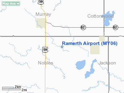
Location & QuickFacts
| FAA Information Effective: | 2008-09-25 |
| Airport Identifier: | MY06 |
| Airport Status: | Operational |
| Longitude/Latitude: | 095-33-19.0230W/43-49-52.8650N
-95.555284/43.831351 (Estimated) |
| Elevation: | 1500 ft / 457.20 m (Estimated) |
| Land: | 0 acres |
| From nearest city: | 3 nautical miles SE of Fulda, MN |
| Location: | Nobles County, MN |
| Magnetic Variation: | 05E (1985) |
Owner & Manager
| Ownership: | Privately owned |
| Owner: | F J Ramerth |
| Address: | Rt 1; Box 164
Dundee, MN 56126 |
| Phone number: | 507-425-2058 |
| Manager: | F J Ramerth |
| Address: | Rt 1; Box 164
Dundee, MN 56126 |
| Phone number: | 507-425-2058 |
Airport Operations and Facilities
| Airport Use: | Private |
| Wind indicator: | Yes |
| Segmented Circle: | No |
| Control Tower: | No |
| Landing fee charge: | No |
| Sectional chart: | Omaha |
| Region: | AGL - Great Lakes |
| Boundary ARTCC: | ZMP - Minneapolis |
| Tie-in FSS: | LAN - Lansing |
| FSS on Airport: | No |
| FSS Toll Free: | 1-800-WX-BRIEF |
Runway Information
Runway 17/35
| Dimension: | 1700 x 85 ft / 518.2 x 25.9 m |
| Surface: | TURF, |
| |
Runway 17 |
Runway 35 |
| Traffic Pattern: | Left | Left |
|
Radio Navigation Aids
| ID |
Type |
Name |
Ch |
Freq |
Var |
Dist |
| MWM | NDB | Windom | | 203.00 | 03E | 19.9 nm |
| MJQ | NDB | Jackson | | 353.00 | 04E | 27.1 nm |
| ISB | NDB | Sibley | | 269.00 | 05E | 29.1 nm |
| SHL | NDB | Sheldon | | 338.00 | 05E | 39.0 nm |
| JYG | NDB | St James | | 260.00 | 04E | 44.4 nm |
| PUF | NDB | Puff | | 345.00 | 04E | 45.8 nm |
| LTU | NDB | Little Sioux | | 326.00 | 05E | 46.2 nm |
| PQN | NDB/DME | Pipestone | 028X | 284.00 | 06E | 33.4 nm |
| EST | VOR | Estherville | | 110.40 | 07E | 43.5 nm |
| OTG | VOR/DME | Worthington | 043X | 110.60 | 08E | 11.1 nm |
| MML | VOR/DME | Marshall | 047X | 111.00 | 05E | 38.9 nm |
| DDL | VOR/DME | Sheldon | 023X | 108.60 | 05E | 39.2 nm |
| RWF | VOR/DME | Redwood Falls | 080X | 113.30 | 07E | 42.4 nm |
| SPW | VOR/DME | Spencer | 037X | 110.00 | 05E | 43.1 nm |
Remarks
- OWNER REQUESTS ARPT NOT CHARTED.
- ARPT OPEN MAY-OCT ONLY.
Images and information placed above are from
http://www.airport-data.com/airport/MY06/
We thank them for the data!
| General Info
|
| Country |
United States
|
| State |
MINNESOTA
|
| FAA ID |
MY06
|
| Latitude |
43-49-52.865N
|
| Longitude |
095-33-19.023W
|
| Elevation |
1500 feet
|
| Near City |
FULDA
|
We don't guarantee the information is fresh and accurate. The data may
be wrong or outdated.
For more up-to-date information please refer to other sources.
|
|


