 |
|
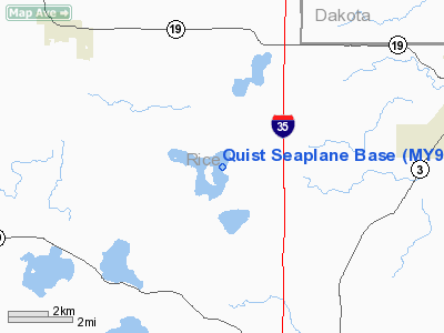
Location & QuickFacts
| FAA Information Effective: | 2008-09-25 |
| Airport Identifier: | MY96 |
| Airport Status: | Operational |
| Longitude/Latitude: | 093-19-51.0000W/44-25-00.0000N
-93.330833/44.416667 (Estimated) |
| Elevation: | 1004 ft / 306.02 m (Estimated) |
| Land: | 0 acres |
| From nearest city: | 8 nautical miles N of Faribault, MN |
| Location: | Rice County, MN |
| Magnetic Variation: | 03E (1990) |
Owner & Manager
| Ownership: | Privately owned |
| Owner: | Dale E. Quist |
| Address: | 3400 120th Ct. West
Faribault, MN 55021 |
| Phone number: | 507-645-8086 |
| Manager: | Dale E. Quist |
| Address: | 3400 120th Ct. West
Faribault, MN 55021 |
| Phone number: | 507-645-8801 |
Airport Operations and Facilities
| Airport Use: | Private |
| Segmented Circle: | No |
| Control Tower: | No |
| Sectional chart: | Omaha |
| Region: | AGL - Great Lakes |
| Boundary ARTCC: | ZMP - Minneapolis |
| Tie-in FSS: | PNM - Princeton |
| FSS on Airport: | No |
| FSS Toll Free: | 1-800-WX-BRIEF |
Runway Information
Runway N/S
| Dimension: | 4000 x 3000 ft / 1219.2 x 914.4 m |
| Surface: | WATER, |
| |
Runway N |
Runway S |
| Traffic Pattern: | Left | Left |
|
Radio Navigation Aids
| ID |
Type |
Name |
Ch |
Freq |
Var |
Dist |
| ACQ | NDB | Waseca | | 371.00 | 02E | 22.9 nm |
| MS | NDB | Narco | | 266.00 | 02E | 26.6 nm |
| PPI | NDB | Hopey | | 400.00 | 03E | 32.1 nm |
| GYL | NDB | Glencoe | | 407.00 | 03E | 38.4 nm |
| FOW | VOR/DME | Halfway | 049X | 111.20 | 02E | 12.9 nm |
| FCM | VOR/DME | Flying Cloud | 055X | 111.80 | 06E | 25.2 nm |
| MKT | VOR/DME | Mankato | 045X | 110.80 | 07E | 27.7 nm |
| MSP | VOR/DME | Minneapolis | 100X | 115.30 | 02E | 29.1 nm |
| AEL | VOR/DME | Albert Lea | 035X | 109.80 | 05E | 44.2 nm |
| RST | VOR/DME | Rochester | 057X | 112.00 | 05E | 49.5 nm |
| FGT | VORTAC | Farmington | 104X | 115.70 | 06E | 14.4 nm |
| GEP | VORTAC | Gopher | 120X | 117.30 | 06E | 43.9 nm |
| MSP | VOT | Minneapolis St Paul | | 111.00 | | 28.5 nm |
| STP | VOT | St Paul | | 114.40 | | 33.6 nm |
Images and information placed above are from
http://www.airport-data.com/airport/MY96/
We thank them for the data!
| General Info
|
| Country |
United States
|
| State |
MINNESOTA
|
| FAA ID |
MY96
|
| Latitude |
44-25-00.000N
|
| Longitude |
093-19-51.000W
|
| Elevation |
1004 feet
|
| Near City |
FARIBAULT
|
We don't guarantee the information is fresh and accurate. The data may
be wrong or outdated.
For more up-to-date information please refer to other sources.
|
|


